
The Budawang Range, commonly called The Budawangs, a rugged mountain range within the Budawang National Park and the Morton National Park, are part of a spur off the Great Dividing Range and are located in the South Coast region of New South Wales, Australia.

Nerriga is a small village in the Southern Tablelands of New South Wales, Australia in Queanbeyan-Palerang Regional Council. It is situated at the edge of Morton National Park, on the Braidwood - Nowra road. The population of Nerriga and the surrounding localities at the 2016 census was 72.

Araluen is a small town near Braidwood in the Southern Tablelands of New South Wales, Australia, in Queanbeyan-Palerang Regional Council. It lies in the valley of Araluen Creek, that joins the Deua River at roughly the midpoint in its course. At the 2021 census, Araluen had a population of 209 people.
Yalwal is the site of a former gold mining town of the same name situated 29 km (18 mi) west of Nowra at the confluence of the Danjera and Yarramunmun Creeks which then forms Yalwal Creek which flows into the Shoalhaven River in New South Wales, Australia.

Sassafras is a locality in the City of Shoalhaven in New South Wales, Australia. It lies on the Braidwood Road, where it passes over the coastal escarpment on the road between Nowra and Nerriga. This road continues southwest to Braidwood, but this involves a section of unsealed road.. The sealed Oallen Ford Road branches off south of Nerriga, which connects via various sealed roads to Canberra and Goulburn. Sassafras is a small community of orchards in an area of extensive national parks. At the 2016 census, it had a population of 31.

Beaumont is a locality in the City of Shoalhaven in New South Wales, Australia. It lies on Cambewarra Range about 18 km north of Nowra on both sides of the Kangaroo Valley–Nowra road. It includes the Cambewarra Mountain lookout, which gives a good view of the lower Shoalhaven valley. At the 2016 census, it had a population of 125.

Cambewarra Village is a locality in the City of Shoalhaven in New South Wales, Australia. It lies on Main Road, which runs west from Cambewarra Road, which forms part of the Kangaroo Valley–Nowra road, about 9 km northwest of Nowra and south of Cambewarra Mountain. At the 2016 census, it had a population of 1,189. Cambewarra Village is largely surrounded by the locality of Cambewarra.

Monga is a locality in the Queanbeyan-Palerang Region, Southern Tablelands, New South Wales, Australia. It lies on the Kings Highway at the top of the Clyde Mountain, about 110 km east of Canberra and 22 km southeast of Braidwood. A large part of the locality forms part of the Monga National Park. At the 2016 census, it had a population of 14.

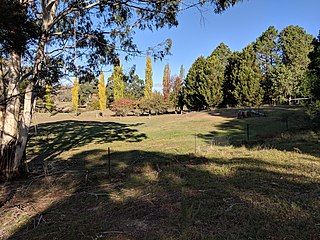
Durran Durra is a locality in the Queanbeyan–Palerang Regional Council, New South Wales, Australia. It is located on the road from Braidwood to Nowra about 15 km north of Braidwood and 100 km east of Canberra. At the 2021 census, it had a population of 114. It consists mainly of grazing country.

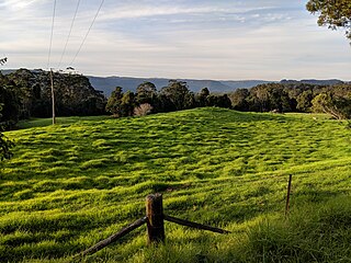
Marlowe is a locality in the Queanbeyan–Palerang Regional Council, New South Wales, Australia. It is bounded by the left bank of the Mongarlowe River and the right bank of the Shoalhaven River. It lies on the road from Braidwood to Nowra about 24 km north of Braidwood and 96 km southwest of Nowra. At the 2021 census, it has a population of eight. It consists mainly of forest and grazing country. Marlowe includes the "rural place" and former village of Charleyong in a loop of the Mongarlowe River at 35°14′57″S149°55′02″E.
Tomboye is a locality in the Queanbeyan–Palerang Regional Council, New South Wales, Australia. It is located on the north side of the Mongarlowe River on the road from Braidwood to Nowra about 28 km north of Braidwood and 93 km southwest of Nowra. At the 2016 census, it had a population of 40. It consists mainly of forest and grazing country.

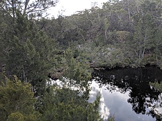
Wog Wog is a locality in the Queanbeyan–Palerang Regional Council, New South Wales, Australia. It is located on the south side of the Corang River and to the east of the road from Braidwood to Nowra about 34 km north of Braidwood and 96 km southwest of Nowra. At the 2021 census, it had a population of 15. It consists mainly of forest, including parts of the Morton National Park. Its eastern boundary runs along the Budawang Range and includes Wog Wog Mountain and Corang Peak.

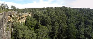
Corang is a locality in the Queanbeyan–Palerang Regional Council, New South Wales, Australia. It is located on the north side of the Corang River and to the east of the road from Braidwood to Nowra about 46 km north of Braidwood and 75 km southwest of Nowra. At the 2016 census, it had a population of 13. It consists mainly of forest and most of it lies in the Morton National Park. Its eastern boundary runs along the Budawang Range and includes Mount Tarn, Sturgiss Mountain and Quiltys Mountain.

Berry Mountain is a locality in the City of Shoalhaven in New South Wales, Australia. It lies west of the Princes Highway on the Kangaroo Valley Road between Berry and Kangaroo Valley. It lies about 23 kilometre north of Nowra and about 160 km south of Sydney. At the 2016 census, it had a population of 28. It lies on a ridge and is partly covered by temperate rain forest and partly by grasslands that were formerly used for dairying, but are now mainly used for rural residences.
Bellawongarah is a locality in the City of Shoalhaven in New South Wales, Australia. It lies west of the Princes Highway on the Kangaroo Valley Road between Berry and Kangaroo Valley. It lies about 23 km north of Nowra and about 160 km south of Sydney. At the 2016 census, it had a population of 127. It lies on a ridge and is partly covered by temperate rain forest and partly by grasslands that were formerly used for dairying, but are now mainly used for rural residences.
Coolumburra is a locality in the City of Shoalhaven in New South Wales, Australia. It lies on the Braidwood Road on the Endrick River between Nowra and Nerriga. This road continues southwest to Braidwood, but this involves a section of unsealed road. The sealed Oallen Ford Road branches off south of Nerriga, which connects via various sealed roads to Canberra and Goulburn. Coolumburra is heavily forested and part lies within the Morton National Park. At the 2016 census, it had a population of none.
Tianjara is a locality in the City of Shoalhaven in New South Wales, Australia. It lies generally south of the Braidwood Road between Nowra and Nerriga. It is about 47 kilometres southwest of Nowra. Tianjara is fairly rugged sandstone country and largely consists of forest. Most of it lies within the Morton National Park or state forests.

Yerriyong is a locality in the City of Shoalhaven in New South Wales, Australia. It lies about 17 km to the southwest of Nowra on the road to Nerriga and Canberra. It is largely made up of eucalyptus forest. At the 2016 census, it had a population of 25.

Bangalee is a suburb of Nowra in the City of Shoalhaven in New South Wales, Australia. It lies north of the Shoalhaven about 7 km to the northwest of Nowra. At the 2016 census, it had a population of 657.
Currowan is a locality in the Eurobodalla Shire, on the South Coast of New South Wales, Australia. At the 2016 census, it had a population of 53.

