
Wallendbeen is a small town in southern New South Wales, Australia, administered by Cootamundra-Gundagai Regional Council. At the 2011 census, Wallendbeen and the surrounding area had a population of 305. The town's name is derived from an aboriginal word for "stony hill".
Manyana is a small town on the South Coast of New South Wales, Australia in the City of Shoalhaven. At the 2016 census, it had a population of 521. Manyana borders with Bendalong and Cunjurong Point.
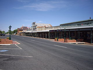
Lockhart is a town in the Riverina Region of New South Wales, Australia. It is the location of the Lockhart Shire Council offices. At the 2016 census, Lockhart had a population of 818 people.

Collingullie is a village 26 kilometres (16 mi) north-west of Wagga Wagga in the Riverina region of New South Wales, Australia. The village is located on the Sturt Highway, between Wagga Wagga and Narrandera, at the crossroads with the road to Lockhart.

Bethungra is a locality in Junee Shire in the South West Slopes region of New South Wales, Australia situated on the Olympic Highway about 13 kilometres northeast of Illabo and 24 kilometres southwest of Cootamundra.

Pleasant Hills is a small village about 26 kilometres west of Henty in the Riverina district of New South Wales, Australia. At the 2006 census, Pleasant Hills had a population of 393 people.

Ganmain is a town in the Riverina region of New South Wales, Australia. Ganmain is located around 55 kilometres (34 mi) north west of Wagga Wagga, and 50 kilometres (31 mi) east of Narrandera. Ganmain is in the Coolamon Shire local government area and had a population at the 2016 census of 779.
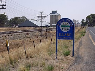
Illabo is a locality in the South West Slopes part of the Riverina in New South Wales, Australia. It is situated about 13 kilometres (8 mi) southwest of Bethungra and 16 kilometres (10 mi) northeast of Junee. At the 2016 census, Illabo had a population of 144.

Wymah is a rural community in the south-east part of the Riverina very close to the border of Victoria, Australia. It is situated by road, about 11 kilometres (7 mi) south of Bowna and 23 kilometres (14 mi) west of Talmalmo. Wymah is situated on the Wymah River Road accessible from Bowna. At the 2016 census, Wymah had a population of 37.

Springdale is a village community in the central north part of the Riverina region of the Australian state of New South Wales. It is situated by road, about 3 kilometres east of Combaning and 23 kilometres north west of Stockinbingal. At the 2016 census, it had a population of 150.

Currawarna is a rural community in the central east part of the Riverina. It is situated by road, about 6 kilometres north west of Millwood and 32 kilometres south of Coolamon. At the 2016 census, Currawarna had a population of 189 people.

Tullimbar is a suburb situated in the Macquarie Valley in the City of Shellharbour, New South Wales, Australia.
Mount Saint Thomas is a suburb of Wollongong in New South Wales, lying east of Figtree and South west of Wollongong. At the 2016 census, it had a population of 1,468.

Monga is a locality in the Queanbeyan-Palerang Region, Southern Tablelands, New South Wales, Australia. It lies on the Kings Highway at the top of the Clyde Mountain, about 110 km east of Canberra and 22 km southeast of Braidwood. A large part of the locality forms part of the Monga National Park. At the 2016 census, it had a population of 14.

Marlowe is a locality in the Queanbeyan–Palerang Regional Council, New South Wales, Australia. It is bounded by the left bank of the Mongarlowe River and the right bank of the Shoalhaven River. It lies on the road from Braidwood to Nowra about 24 km north of Braidwood and 96 km southwest of Nowra. At the 2016 census, The Australian Bureau of Statistics recorded it as having a population of nil, although it does have at least one house. It consists mainly of forest and grazing country. Marlowe includes the "rural place" and former village of Charleyong in a loop of the Mongarlowe River at 35°14′57″S149°55′02″E.

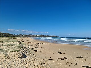
Cunjurong Point is a coastal town in New South Wales, Australia in the City of Shoalhaven. At the 2016 census, it had a population of 74.
Boambolo is a locality in the Yass Valley Council, New South Wales, Australia. It is on the Yass–Wee Jasper road about 15 km south of Yass. At the 2016 census, it had a population of 53.

Berremangra is a locality in the Hilltops Council, New South Wales, Australia. It is on both sides of the Hume Highway about 45 km west of Yass. At the 2016 census, it had a population of 81.

Conjola Park is a beach resort in the City of Shoalhaven, New South Wales, Australia. It lies on the south shore of a lagoon called Conjola Lake, just to the east of the Princes Highway on Lake Conjola Entrance Road, which connects to the resort of Lake Conjola. It lies about 15 km north of Ulladulla and 215 km south of Sydney. At the 2016 census, it had a population of 340.
Currowan is a locality in the Eurobodalla Shire, on the South Coast of New South Wales, Australia. At the 2016 census, it had a population of 53.

