
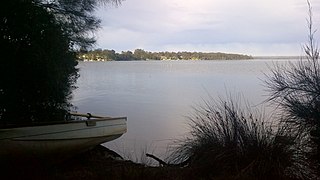
Tea Gardens is a locality in the Mid-Coast Council local government area, located near the southern extremity of the Mid North Coast and the northern extremity of the Hunter Region in New South Wales, Australia.

Huskisson is a town in New South Wales, Australia in the City of Shoalhaven, on the shores of Jervis Bay. It is 24 km south-east of Nowra.
Nelson Bay is a significant township of the Port Stephens local government area in the Hunter Region of New South Wales, Australia. It is located on a bay of the same name on the southern shore of Port Stephens about 60 kilometres (37 mi) by road north-east of Newcastle, its nearest rail link. At the 2016 census, Nelson Bay had a population of 5,820.
Wrights Beach is a town in the City of Shoalhaven in New South Wales, Australia. It is on the shores of St Georges Basin, near the Jervis Bay Territory.

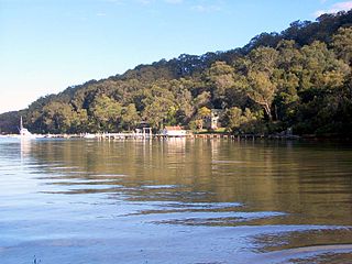
Shoal Bay is the most eastern suburb of the Port Stephens local government area in the Hunter Region of New South Wales, Australia. It is located on the southern shore of Port Stephens, adjacent to the bay of the same name at the entrance to the port. It includes part of Tomaree National Park within its boundaries and, like other suburbs around Port Stephens, is a popular tourist destination, especially in summer months. At the 2016 census the town of Shoal Bay had a population of 1,864 but the population increases significantly during tourist season.
Sanctuary Point is a town in New South Wales, Australia, under the jurisdiction of the City of Shoalhaven, on the shores of St Georges Basin. It is roughly 25 km south of Nowra, and approximately 200 km south of Sydney. At the 2016 census, the population of Sanctuary Point was 7,225.
St Georges Basin is a town in the South Coast region of New South Wales, Australia. St George Basin is located on the shores of St Georges Basin, within the City of Shoalhaven. It is roughly 25 kilometres (16 mi) south of Nowra, and approximately 200 kilometres (120 mi) south of Sydney.
Basin View is a town in New South Wales, Australia in the City of Shoalhaven, on the shores of St Georges Basin. It is roughly 25 km south of Nowra, and approximately 200 km south of Sydney. At the 2016 census, the population of Basin View was 1,554.

Mystery Bay is a small town on the south coast of New South Wales, Australia. Mystery Bay is halfway between Central Tilba and Narooma, two kilometres off the Princes Highway on Mystery Bay Road. At the 2016 census, Mystery Bay had a population of 191. Mystery Bay features a camping area in the Eurobodalla National Park. Mystery Bay holds many different types of beaches that front the Tasman Sea. Some beaches are surfing beaches, others are swimming beaches, and many of these beaches contain spectacular large rocks. At low tide, these rocks become rock pools.
Upper Kangaroo River is a small village in the Southern Highlands of New South Wales, Australia, in Shoalhaven City Council. It is located on the Kangaroo River, a tributary of the Shoalhaven River. At the 2016 census, it had a population of 122.
Erowal Bay is a small town in the Shoalhaven local government area on the New South Wales south coast, on the northern side of St Georges Basin. It lies west of Hyams Beach and east of Old Erowal Bay. At the 2016 census, Erowal Bay had a population of 623.
Morning Bay is a suburb and adjoining bay in northern Sydney, in the state of New South Wales, Australia. Morning Bay is located 40 kilometres north of the Sydney central business district, in the local government area of Northern Beaches Council.

Elvina Bay is a bay and adjacent suburb in northern Sydney, in the state of New South Wales, Australia. It is located 35 kilometres north of the Sydney central business district, in the local government area of Northern Beaches Council.
Nelligen is a village on the Clyde River on the South Coast of New South Wales, Australia. It is located on the Kings Highway.
Haywards Bay is a suburb of the City of Wollongong to the south of Dapto. At the 2016 census, it had a population of 1,006.

Oallen is a locality in the Goulburn Mulwaree Council area, New South Wales, Australia. It is located on the Shoalhaven River and the Oallen Ford Road about 97 km southeast of Goulburn and 106 km southwest of Nowra. The Oallen Ford Road has recently been upgraded to improve the connection from Canberra and Goulburn to Nerriga, Nowra and Jervis Bay. At the 2016 census, Oallen had a population of 141.
Worrowing Heights is a locality in the City of Shoalhaven in New South Wales, Australia. It lies east of Vincentia, which is on Jervis Bay, and north of St Georges Basin. At the 2016 census, it had a population of 506.
Myola is a beach-side locality in the City of Shoalhaven in New South Wales, Australia. It lies about 26 km southeast of Nowra on the northeastern shore of Jervis Bay. It is on the opposite side of Currambene Creek from Huskisson, although there is no direct road connection. At the 2016 census, it had a population of 107.

Johns River is a locality in the Mid-Coast Council of New South Wales.
