
Mount Warning, a mountain in the Tweed Range in the Northern Rivers region of New South Wales, Australia, was formed from a volcanic plug of the now-gone Tweed Volcano. The mountain is located 14 kilometres (9 mi) west-south-west of Murwillumbah, near the border between New South Wales and Queensland. Lieutenant James Cook saw the mountain from the sea and named it Mount Warning.

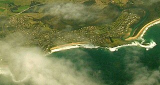
Fingal Bay is the easternmost suburb of the Port Stephens local government area in the Hunter Region of New South Wales, Australia. The only population centre is the township of the same name, which itself is named after the adjacent, small, semi-circular bay. At the 2011 census, the population of the town was 1,503.

Edward River, or Kyalite River, an anabranch of the Murray River and part of the Murray–Darling basin, is located in the western Riverina region of south western New South Wales, Australia.
The Minnamurra River, an open mature wave dominated barrier estuary, is located in the Illawarra region of New South Wales, Australia.

The Budgewoi Lake, a lagoon that is part of the Tuggerah Lakes, is located within the Central Coast Council local government area in the Central Coast region of New South Wales, Australia. The lake is located near the settlement of Budgewoi and is situated about 100 kilometres (62 mi) north of Sydney.
Brokers Point or Brokers Nose or Corrimal Peak or Brokers Peak, is a point on the Illawarra Range, in the state of New South Wales, Australia.
Blicks River, a perennial stream that is part of the Clarence River catchment, is located in the Northern Tablelands district of New South Wales, Australia.
Bobo River, a mostly perennial stream of the Clarence River catchment, is located in the Northern Tablelands district of New South Wales, Australia.

Corang River is a perennial river of the Shoalhaven catchment located in the Southern Tablelands region of New South Wales, Australia.
Never Never River, a perennial stream of the Bellinger River catchment, is located in the Mid North Coast region of New South Wales, Australia.
The Tarcutta Creek, part of the Murray Darling basin, is mostly a perennial stream located in the Riverina region of New South Wales, Australia.
The Tomaga River, an open mature wave dominated barrier estuary or perennial stream, is located in the South Coast region of New South Wales, Australia.
Wallingat River, a watercourse of the Mid-Coast Council system, is located in the Mid North Coast district of New South Wales, Australia.

Greenwell Point is a town in the Shoalhaven region of New South Wales, Australia. It is about 13 km east of Nowra on the South Coast. In the 2016 census of Population and Housing, the town had a population of 1,209.
The Chandlers Creek, a perennial stream that is part of the Clarence River catchment, is located in the Northern Tablelands region of New South Wales, Australia.
The Georges Creek, a perennial stream that is part of the Macleay River catchment, is located in the Northern Tablelands and Mid North Coast regions of New South Wales, Australia.
The Pipers Creek, a watercourse that is part of the Hastings River catchment, is located in the Mid North Coast region of New South Wales, Australia.
Dingo Creek, a perennial stream of the Manning River catchment, is located in the Mid North Coast region of New South Wales, Australia.

Cunjurong Point is a coastal town in New South Wales, Australia in the City of Shoalhaven. At the 2016 census, it had a population of 74.
