
Binda is a village in the Southern Tablelands region of New South Wales, Australia in Upper Lachlan Shire.
South Windsor is a suburb of the town of Windsor in north west Sydney in the state of New South Wales, Australia. It is generally bounded in the west by Rickabys Creek and in the east by South Creek, both tributaries of the Hawkesbury River. It is also home of Bede Polding College, a Catholic secondary school.
Picnic Point, a suburb of local government area City of Canterbury-Bankstown, is 23 kilometres south-west of the Sydney central business district, in the state of New South Wales, Australia. It is a part of South-western Sydney region. Picnic Point is a residential suburb on the northern bank of the Georges River. Located within Picnic Point is Yeramba Lagoon which is the largest tract of National Park within the Canterbury – Bankstown Council, it is home to numerous species of native fauna and flora.
Willow Vale is a Northern Village of the Southern Highlands of New South Wales, Australia, in Wingecarribee Shire. It is located 2 km north of Mittagong and is often considered part of Braemar along with its neighbour Balaclava.
Burradoo is a suburb of Bowral, in the Southern Highlands of New South Wales, Australia, in Wingecarribee Shire.
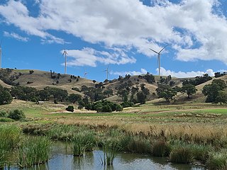
Kangaloon is a village in the Southern Highlands of New South Wales, Australia, in Wingecarribee Shire.

Fitzroy Falls is a village in the Wingecarribee Shire, located within the Southern Highlands region of New South Wales, Australia. The locality was known as Yarrunga, but was renamed after the 81-metre (266 ft) waterfall.
Canyonleigh is a locality in the Southern Highlands of New South Wales, Australia, in Wingecarribee Shire. Canyan Leigh was named by Mrs Jane Murray who took up a property between Paddys River and Long Swamp. The property overlooked the valley and this gave Mrs Murray the idea 'Canyan' or 'Canyon' being the name for a steep sided gully.
Wildes Meadow is a locality in the Southern Highlands of New South Wales, Australia, in Wingecarribee Shire.
Glenquarry is a locality in the Southern Highlands of New South Wales, Australia, in Wingecarribee Shire. It is a scattered village on the banks of the Wingecarribee River.
Wattle Ridge is a locality in the Southern Highlands of New South Wales, Australia, in Wingecarribee Shire. It is located near Buxton and Balmoral.
Nubba is a locality and former railway station on the Main South railway line in New South Wales, Australia, located midway between Wallendbeen and Harden. The station was open between 1882 and 1975 and has now been demolished.
Bribbaree is a small village in the South West Slopes region of New South Wales, Australia spanning the boundary of Weddin Shire and Hilltops Council.
East Kangaloon is a locality in the Southern Highlands of New South Wales, Australia, in Wingecarribee Shire.
Worrigee is a suburb of Nowra in the City of Shoalhaven in New South Wales, Australia. It lies southeast of Nowra. At the 2016 census, it had a population of 5,068.

Dolphin Point is a locality and residential area on the southern fringe of the Milton-Ulladulla conurbation, New South Wales, Australia. It is located about 7 km south of Ulladalla town centre on the southern shore of the Burrill Lake inlet and bounded to the east by the Tasman Sea. It is part of the Shoalhaven local government area. At the 2016 census, it had a population of 204.

Curraweela is a locality in the Upper Lachlan Shire, New South Wales, Australia. It lies about 20 km (12 mi) north of Taralga and about 80 km (50 mi) south Oberon on the road from Goulburn to Oberon and Bathurst. At the 2016 census, it had a population of 47. It had a school from 1878 to 1900, which was variously designated as a "half-time", "provisional" and "house to house" school.
Berringer Lake is a locality in New South Wales, Australia in the City of Shoalhaven.

Berremangra is a locality in the Hilltops Council, New South Wales, Australia. It is on both sides of the Hume Highway about 45 km west of Yass.
Pomeroy is a locality on the border of Goulburn Mulwaree Council and Upper Lachlan Shire in New South Wales, Australia. It lies on the upper Wollondilly River, about 23 km northwest of Goulburn and 110 km northeast of Canberra. At the 2016 census, it had a population of 115.

