
The Macleay River is a river that spans the Northern Tablelands and Mid North Coast districts of New South Wales, Australia.
Tea Gardens is a locality in the Mid-Coast Council local government area, in Mid North Coast region of New South Wales, Australia.
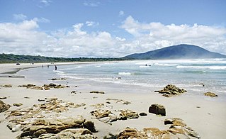
Old Bar is a coastal town in New South Wales, Australia in Mid-Coast Council. It lies around 18 kilometres (11 mi) east of Taree on the Mid North Coast, and around 315 kilometres (196 mi) north of Sydney.
Hastings River, an open and trained intermediate wave dominated barrier estuary, is located in the Northern Tablelands and Mid North Coast districts of New South Wales, Australia.

Hawks Nest is a small town of the Mid-Coast Council local government area in the Hunter and Mid North Coast regions of New South Wales, Australia, located north of Port Stephens between the Tasman Sea and the Myall River. It was named after a large hawk's nest in a tree on the Myall River that was used as a navigational aid. The traditional custodians of this land are the Worimi people.

Three Brothers, three separate mountains of the Mid North Coast region of New South Wales, Australia, are situated approximately 360 kilometres (220 mi) north of Sydney.
Bar Point is a suburb of the Central Coast region of New South Wales, Australia, located on the north bank of the Hawkesbury River 53 kilometres (33 mi) north of Sydney. It is part of the Central Coast Council local government area.
Cheero Point is a waterfront locality and suburb of the Central Coast region of New South Wales, Australia. Cheero Point is located on the west bank of the Mooney Mooney Creek in the Brisbane Water National Park. It is situated 53 kilometres (33 mi) north of Sydney. It is part of the Central Coast Council local government area.

Mooney Mooney Creek is a suburb of the Central Coast region of New South Wales, Australia, located 60 kilometres (37 mi) north of Sydney along both sides of the river after which it is named. It is part of the Central Coast Council local government area.

Bulahdelah is a town and locality in the Mid North Coast region of New South Wales, Australia in the Mid-Coast Council local government area. At the 2016 census, the locality had a population of 1,424. The main population centre, where 69% of the area's population lived in 2006, is the town of Bulahdelah.
Failford is a locality in the Mid-Coast Council local government area on the Mid North Coast of New South Wales, Australia. Located to the east of the Pacific Highway, Failford is about 17 km (11 mi) northwest of Forster. At the 2011 census it had a population of 495.

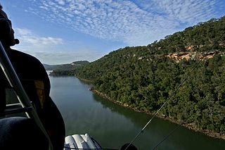
Myall River, an open semi-mature brackish freshwater barrier estuary of the Mid-Coast Council system, is located in the Mid North Coast region of New South Wales, Australia.

Karuah is a locality in both the Port Stephens and Mid-Coast Councils, the Port Stephens lga side is part the Hunter Region while the Mid-Coast lga is in the Mid North Coast region of New South Wales, Australia. It is thought that the name means 'native plum tree' in the local Aboriginal dialect.
In the state of New South Wales, Australia, there are many areas which are commonly known by regional names. Regions are areas that share similar characteristics. These characteristics may be natural such as the Murray River, the coastline, or the Snowy Mountains. Alternatively, the characteristics may be cultural, such as a viticulture land use. New South Wales is divided by numerous regional boundaries, based on different characteristics. In many cases boundaries defined by different agencies are coterminous.

Bellinger River, an open and trained mature wave dominated, barrier estuary, is located in the Mid North Coast region of New South Wales, Australia.

Scotts Head is a coastal village of the Nambucca Valley local government area in the Mid North Coast region of New South Wales, Australia. Located on the coast of the Pacific Ocean, approximately 10 kilometres (6 mi) from the Pacific Highway and 480 kilometres (300 mi) from Sydney, it stretches southwards from just south of the mouth of the Nambucca River to the town of Scotts Head in the south.

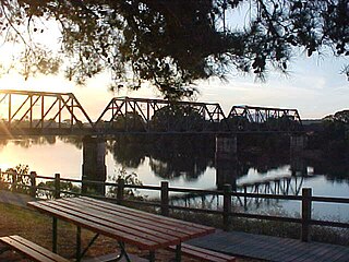
Stratford is a rural locality in the Mid-Coast Council local government area in the Hunter Region of New South Wales, Australia. The largest population centre in the area is the town of Stratford, which is approximately 14 kilometres (9 mi) south of Gloucester and 109 km (68 mi) north of Newcastle. Stratford, which is next to the Avon River, is on Bucketts Way, 66 km (41 mi) from the Pacific Highway, the nearest major highway.

Stewarts River, a mostly perennial stream of the Mid North Coast region, is located in New South Wales, Australia.

Rollands Plains is a village and bounded rural locality in Mid North Coast of New South Wales, Australia.

MidCoast Council is a local government area that is located in the Mid North Coast region of New South Wales, Australia. The council was formed on 12 May 2016 through a merger of the Gloucester Shire, Great Lakes and City of Greater Taree Councils.

