Cape Otway

Last updated

Cape Otway
Victoria
Cape Otway Lighthouse south west pano.jpg
Cape Otway coast
Australia Victoria Colac Otway Shire location map.svg
Red pog.svg
Cape Otway
Coordinates 38°51′0″S143°31′0″E / 38.85000°S 143.51667°E / -38.85000; 143.51667
Population15 (2016 census) [1]
Location
LGA(s) Colac Otway Shire
State electorate(s) Polwarth
Federal division(s) Corangamite
Localities around Cape Otway:
Glenaire Aire Valley Apollo Bay
Hordern Vale Cape Otway Apollo Bay
Southern Ocean Southern Ocean Bass Strait

Cape Otway is a cape and a bounded locality of the Colac Otway Shire in southern Victoria, Australia on the Great Ocean Road; much of the area is enclosed in the Great Otway National Park. The cape marks the boundary between the Southern Ocean on the west and Bass Strait on the east.

Contents

History

Cape Otway was originally inhabited by the Gadubanud people; evidence of their campsites is contained in the middens throughout the region. The traditional Gadubanud name for the cape is Bangurac. [2]

The cape was charted by the British when Lieutenant James Grant sailed through Bass Strait in HMS Lady Nelson in December 1800. Grant named it Cape Albany Otway after Captain William Albany Otway. [3] This was later shortened to Cape Otway.

The British started to colonise the region in 1837 when Joseph Gellibrand and George Hesse became lost in the Otways on an expedition. It was found that Hesse probably died of exposure, while Gellibrand was initially cared for by a local Aboriginal clan but later killed by members of another clan visiting from the Apollo Bay area. [4] The ship Joanna was wrecked near the Cape in 1843, with several survivors making a difficult journey by foot along the coast back toward Geelong. [5] Mr Kearnon attempted to establish a livestock property at Moonlight Head in 1845 but his hut was burnt down and his shepherd supposedly killed by the resident Gadubanud people. [6]

More detailed exploration occurred in 1846 when a number of surveying expeditions entered the area with the view of placing a lighthouse upon Cape Otway. [5] During these assignments, an Aboriginal man was attacked by colonists with stockwhips, while a surveyor's assistant by the name of James Conroy was killed by the Gadubanud. A reprisal force led by the surveyor and consisting of a well-armed militia of Barrabool men was organised by the district official Captain Foster Fyans. This force exterminated almost completely the remaining Gadubanud population of around ten people. [7] [8]

Cape Otway Lighthouse was built on the point of the cape in 1848. The lighthouse is listed on the Victorian Heritage Register. [9]

A telegraph office opened in 1859. The post office opened on 1 September 1880 and closed in 1972. [10]

Eight ships were wrecked along the coast of Cape Otway: [11] Marie (1851), Sacramento (1853), Schomberg (1855), Loch Ard (1878), Joseph H. Scammell (May 1891), Fiji (September 1891), and Casino in 1932. The first American vessel sunk during World War II, MS City of Rayville , was also sunk off the cape by a German mine. Following this, the Americans built a radar bunker on the cape in 1942; it is now open to the public.

Commercial fisheries

The hostile seas, where the Southern Ocean meets with Bass Strait, that surround Cape Otway are home to some of the world's most prized marine species, including crayfish and abalone. On calm days, as many as 20 abalone dive boats commonly operate along the shoreline beneath the lighthouse. Commercial crayfishers use baited pots or traps throughout the reef system, with white floats on the surface marking their locations.

Climate

Cape Otway has an oceanic climate (Cfb) with mild summers and cool damp winters, and only 38 clear days annually.

Climate data for Cape Otway Lighthouse
MonthJanFebMarAprMayJunJulAugSepOctNovDecYear
Record high °C (°F)43.3
(109.9)
42.0
(107.6)
40.6
(105.1)
33.3
(91.9)
27.8
(82.0)
24.4
(75.9)
21.8
(71.2)
25.0
(77.0)
31.0
(87.8)
34.2
(93.6)
39.4
(102.9)
43.4
(110.1)
43.4
(110.1)
Mean daily maximum °C (°F)21.4
(70.5)
21.5
(70.7)
20.4
(68.7)
18.0
(64.4)
15.6
(60.1)
13.7
(56.7)
13.0
(55.4)
13.8
(56.8)
15.2
(59.4)
17.0
(62.6)
18.3
(64.9)
19.9
(67.8)
17.3
(63.1)
Mean daily minimum °C (°F)13.4
(56.1)
14.0
(57.2)
13.3
(55.9)
11.7
(53.1)
10.1
(50.2)
8.5
(47.3)
7.6
(45.7)
7.9
(46.2)
8.5
(47.3)
9.6
(49.3)
10.8
(51.4)
12.1
(53.8)
10.6
(51.1)
Record low °C (°F)3.3
(37.9)
2.8
(37.0)
−1.1
(30.0)
1.7
(35.1)
1.7
(35.1)
1.7
(35.1)
0.0
(32.0)
1.1
(34.0)
−1.1
(30.0)
−0.6
(30.9)
1.4
(34.5)
3.3
(37.9)
−1.1
(30.0)
Average precipitation mm (inches)44.3
(1.74)
41.5
(1.63)
55.4
(2.18)
70.7
(2.78)
91.5
(3.60)
96.6
(3.80)
106.2
(4.18)
104.1
(4.10)
90.1
(3.55)
80.1
(3.15)
62.7
(2.47)
52.5
(2.07)
894.8
(35.23)
Average precipitation days9.38.412.014.817.918.419.920.118.116.313.511.8180.5
Average relative humidity (%)74757576788080787675747476
Source: [12]

Related Research Articles

The history of Victoria refers to the history of the Australian state of Victoria and the area's preceding Indigenous and British colonial societies.

<span class="mw-page-title-main">Bass Strait</span> Sea strait between the Australian mainland and Tasmania

Bass Strait is a strait separating the island state of Tasmania from the Australian mainland. The strait provides the most direct waterway between the Great Australian Bight and the Tasman Sea, and is also the only maritime route into the economically prominent Port Phillip Bay.

<span class="mw-page-title-main">Port Phillip</span> Bay in Victoria, Australia

Port Phillip or Port Phillip Bay is a horsehead-shaped enclosed bay on the central coast of southern Victoria, Australia. The bay opens into the Bass Strait via a short, narrow channel known as The Rip, and is completely surrounded by localities of Victoria's two largest cities — metropolitan Greater Melbourne in the bay's main eastern portion north of the Mornington Peninsula, and the city of Greater Geelong in the much smaller western portion north of the Bellarine Peninsula. Geographically, the bay covers 1,930 km2 (750 sq mi) and the shore stretches roughly 264 km (164 mi), with the volume of water around 25 km3 (6.0 cu mi). Most of the bay is navigable, although it is extremely shallow for its size — the deepest portion is only 24 m (79 ft) and half the bay is shallower than 8 m (26 ft). Its waters and coast are home to seals, whales, dolphins, corals and many kinds of seabirds and migratory waders.

<span class="mw-page-title-main">Portland, Victoria</span> City in Victoria, Australia

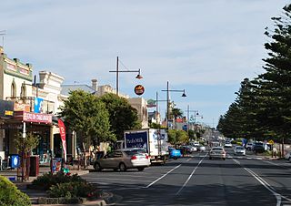
Portland is a city in Victoria, Australia, and is the oldest European settlement in the state. It is also the main urban centre in the Shire of Glenelg and is located on Portland Bay. As of the 2021 census the population was 10,016, increasing from a population of 9,712 taken at the 2016 census.

<span class="mw-page-title-main">Colac, Victoria</span> City in Victoria, Australia

Colac is a small city in the Western District of Victoria, Australia, approximately 150 kilometres south-west of Melbourne on the southern shore of Lake Colac.

<span class="mw-page-title-main">Cape Schanck</span> Town in Victoria, Australia

Cape Schanck, or Tunnahan (Boonwurrung) is a locality at the southernmost tip of the Mornington Peninsula in Melbourne, Victoria, Australia, approximately 72 km (45 mi) south of Melbourne's Central Business District, located within the Shire of Mornington Peninsula local government area. Cape Schanck recorded a population of 569 at the 2021 census.

<span class="mw-page-title-main">Lorne, Victoria</span> Town in Victoria, Australia

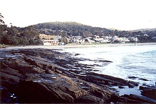
Lorne is a seaside town on Louttit Bay in Victoria, Australia. It is situated about the Erskine River and is a popular destination on the Great Ocean Road tourist route. Lorne is in the Surf Coast Shire and at the 2016 census had a population of 1,114 but this figure grows during the holiday season.

<span class="mw-page-title-main">Apollo Bay</span> Town in Victoria, Australia

Apollo Bay is a coastal town in southwestern Victoria, Australia. It is situated on the eastern side of Cape Otway, along the edge of the Barham River and on the Great Ocean Road, in the Colac Otway Shire. The town had a population of 1,790 at the 2021 census.

<span class="mw-page-title-main">Western District (Victoria)</span> Region in Victoria, Australia

The Western District comprises western regions of the Australian state of Victoria. It is said to be an ill–defined district, sometimes incorrectly referred to as an economic region,. The district is located within parts of the Barwon South West and the Grampians regions; extending from the south-west corner of the state to Ballarat in the east and as far north as Ararat. The district is bounded by the Wimmera district in the north, by the Goldfields district in the east, by Bass Strait and the Southern Ocean in the south, and by the South Australian border in the west. The district is well known for the production of wool. The most populated city in the Western District is the Ballarat region, with 96,940 inhabitants.

<span class="mw-page-title-main">Foster Fyans</span> Australian politician

Foster Fyans was an Irish military officer, penal colony administrator and public servant. He was acting commandant of the second convict settlement at Norfolk Island, the commandant of the Moreton Bay penal settlement at Brisbane, the first police magistrate at Geelong, and commissioner of crown lands for the Portland Bay pastoral district in the Port Phillip District of New South Wales. He is the great-great-grandfather of actor Sam Neill.

<span class="mw-page-title-main">Joseph Gellibrand</span> Australian politician

Joseph Tice Gellibrand was the first Attorney-General of the British colony of Van Diemen's Land, where he gained notoriety with his attempts to establish full rights of trial by jury. He became an integral part of the Port Phillip Association, producing the Batman Treaty in an attempt to obtain extensive landholdings from the local Aboriginal people around Port Phillip. Gellibrand was also later part of an ill-fated expedition into the region west of Geelong, where he disappeared and was assumed to have been killed by Aboriginal people in the Otway Range.

<span class="mw-page-title-main">Forrest, Victoria</span> Town in Victoria, Australia

Forrest is a small rural township in the Otway Ranges, Victoria, Australia. At the 2016 census, Forrest and the surrounding area had a population of 230.

<span class="mw-page-title-main">Gadubanud</span> Aboriginal Australian group from the Cape Otway area in Victoria

The Gadubanud (Katubanut), also known as the Pallidurgbarran, Yarro waetch or Cape Otway tribe (Tindale), are an Aboriginal Australian people of the state of Victoria. Their territory encompasses the rainforest plateau and rugged coastline of Cape Otway. Their numbers declined rapidly following the onset of European colonisation, and little is known of them. However, some may have found refuge at the Wesleyan mission station at Birregurra, and later the Framlingham mission station, and some people still trace their descent from them.

The Gulidjan people, also known as the Kolakngat, or Colac tribe, are an Aboriginal Australian tribe whose traditional lands cover the Lake Colac region of the state of Victoria, Australia. They occupied the grasslands, woodlands, volcanic plains and lakes region east of Lake Corangamite, west of the Barwon River and north of the Otway Ranges. Their territory bordered the Wathaurong to the north, Djargurd Wurrung to the west, Girai Wurrung to the south-west, and Gadubanud to the south-east.

<span class="mw-page-title-main">Parker River</span> Perennial river in Victoria, Australia

The Parker River is a perennial river of the Corangamite catchment, located in the Otways region of the Australian state of Victoria.

The Gellibrand River is a perennial river of the Corangamite catchment, located in the Otways region of the Australian state of Victoria.

Dhauwurd Wurrung is a term used for a group of languages spoken by various groups of the Gunditjmara people of the Western District of Victoria, Australia. Keerray Woorroong is regarded by some as a separate language, by others as a dialect. The dialect continuum consisted of various lects such as Kuurn Kopan Noot, Big Wurrung, Gai Wurrung, and others. There was no traditional name for the entire dialect continuum and it has been classified and labelled differently by different linguists and researchers. The group of languages is also referred to as Gunditjmara language and the Warrnambool language.

Gellibrand is a town in south west Victoria, Australia. The town is located in the Otway Ranges midway between the Princes Highway and Great Ocean Road in the Colac Otway Shire, 176 kilometres (109 mi) south west of the state capital, Melbourne. At the 2016 census, Gellibrand had a population of 210. Gellibrand is home to the Otway Districts Demons Football and Netball Club, who play Australian Rules Football and participate in the Colac & District Football League.

The Border Police of New South Wales was a frontier policing body introduced by the colonial government of New South Wales with the passing of the Crown Lands Unauthorised Occupation Act 1839.

<span class="mw-page-title-main">Blanket Bay</span>

Blanket Bay is a small bay on the coast of Victoria, Australia. The foreshore is part of the Cape Otway National park.

References

  1. Australian Bureau of Statistics (27 June 2017). "Cape Otway (State Suburb)". 2016 Census QuickStats. Retrieved 17 November 2017. OOjs UI icon edit-ltr-progressive.svg
  2. Clark, Ian D. (2002). Dictionary of Aboriginal placenames of Victoria. Melbourne: Victorian Aboriginal Corp. for Languages. p. 53. ISBN   9780957936065.
  3. Grant, James (1803). The narrative of a voyage of discovery, performed in His Majesty's vessel the Lady Nelson, of sixty tons burthen: with sliding keels, in the years 1800, 1801, and 1802, to New South Wales. Printed by C. Roworth for T. Egerton. p. 72. ISBN   978-0-7243-0036-5 . Retrieved 24 January 2012.
  4. "MESSRS. GELLIBRAND AND HESSE". The Courier (Hobart) . Vol. XVII, no. 976. Tasmania, Australia. 9 August 1844. p. 2. Retrieved 5 July 2021 via National Library of Australia.
  5. 1 2 "CAPE OTWAY". Geelong Advertiser and Squatters' Advocate . Vol. VI, no. 574. Victoria, Australia. 2 May 1846. p. 1. Retrieved 5 July 2021 via National Library of Australia.
  6. "SUPPOSED MURDER". Geelong Advertiser . Vol. V, no. 295. Victoria, Australia. 5 March 1845. p. 2. Retrieved 5 July 2021 via National Library of Australia.
  7. "REMINISCENCES OF PIONEER DAYS IN VICTORIA". Weekly Times . No. 1, 198. Victoria, Australia. 23 July 1892. p. 30. Retrieved 5 July 2021 via National Library of Australia.
  8. "EXTERMINATION OF THE CAPE OTWAY TRIBE OF ABORIGINES". Geelong Advertiser and Squatters' Advocate . Vol. VI, no. 606. Victoria, Australia. 26 August 1846. p. 2. Retrieved 5 July 2021 via National Library of Australia.
  9. "Cape Otway Lightstation (H1222)". Victorian Heritage Register . Heritage Victoria . Retrieved 4 July 2014.
  10. Phoenix Auctions History, Post Office List , retrieved 7 March 2021
  11. Australia's Great Ocean Road:Shipwrecks Archived 2007-12-09 at the Wayback Machine
  12. "Climate statistics for Cape Otway". Bureau of Meteorology. Retrieved 6 October 2021.