Warrion, Victoria

Last updated

Warrion
Victoria
WarrionHall.JPG
Warrion Community Hall
Australia Victoria Colac Otway Shire location map.svg
Red pog.svg
Warrion
Coordinates 38°13′0″S143°34′0″E / 38.21667°S 143.56667°E / -38.21667; 143.56667 Coordinates: 38°13′0″S143°34′0″E / 38.21667°S 143.56667°E / -38.21667; 143.56667
Population198 (2016 census) [1]
Postcode(s) 3249
Location
LGA(s) Colac Otway Shire
State electorate(s) Polwarth
Federal Division(s) Wannon
Localities around Warrion:
Dreeite South Dreeite Beeac
Alvie Warrion Ondit
Alvie Coragulac Balintore

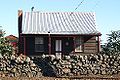
Warrion is a village in south west Victoria, Australia. Its buildings include a motor vehicle and farm equipment workshop, the Ti Tree Hotel, a church, a fire brigade station manned by volunteers and a community hall. Warrion sits at the foot of Warrion Hill. At the 2016 census, Warrion had a population of 198. [1]

Contents

There are a number of early and important references (see below) to first contact with local aboriginal inhabitants.

Warrion Post Office opened on 24 August 1875 and closed in 1976. [2]

The general store was owned throughout the 1950s and until 1980 by George Glover and his wife, Rosie. The Glovers drove a 100E Ford Prefect panel van and sold home-made lunchtime pies to schools across the district. Mr Glover sold the pies from a pie warmer from the rear tailgate. His wife, Rosie, sat on the tailgate dispensing tomato sauce for a penny a serve. The Glovers sold meat, fish, vegetable, apple and apricot pies.

Augustus (Gus) Goonan owned and operated the Ti Tree Hotel, and the service station was owned and operated by Stan Tune.

Main rural industries included cropping of peas and onions, and dairy farming. Warrion has important groundwater resources which are used widely in local farming activities. Farming families included Leahy, Carroll, Kerr, Hay, Cowley, Chant, De Lorenzo, Monaco and Illett.

In recent years, farms have been absorbed into larger landholdings, with an associated decline in rural population. Underground water storage is under threat due to a prolonged drought and an increase in irrigation from large capacity bores on huge dairy farms.

The historic stone walls have recently been roughly plundered without consideration for heritage or visual appeal. The walls have been bulldozed and transported for sale into metropolitan landscaping businesses by some local large dairy farming enterprises.

Warrion Oval

The Warrion recreation reserve is managed by the Warrion Recreation Reserve Committee. The Victorian Cricket Association have scheduled the occasional Premier grade cricket match at the Warrion Oval since 2006, attracting several well-known Australian cricketers as well as large crowds. The oval was home to the Warrion Football Club, which used to compete in the Colac & District Football League until the team disbanded at the end of 1985. The team won the 1938 and 1952 premierships. Curator Eric Hay is renowned across the state for the high quality outfields and turf wickets he produces. A turf wicket was first put in place in 1980 and is regarded as one of the best regional cricketing facilities in Victoria.

Warrion Cricket Club

The Warrion Cricket Club is one steeped in history since its formation in the late 1880s. The club now competes in the Colac District Cricket Association. Its first premiership came in the late 1970s before the club entered its golden era of the 1980s and 1990s when it regularly competed in finals. The club's most recent premiership came in the 2009-10 season when it defeated the Alvie Cricket Club at the Warrion recreation reserve. Jarrod Stinchombe was named man of the match taking four wickets in a commanding win under the guidance of Ray Barrow. The club has produced several district cricketers including Gavin Holland (Richmond) and Phillip Lang (North-Melbourne - Geelong). The club currently fields three Senior teams and Junior teams.

Related Research Articles

Colac, Victoria Town in Victoria, Australia

Colac is a small city in the Western District of Victoria, Australia, approximately 150 kilometres south-west of Melbourne on the southern shore of Lake Colac and the surrounding volcanic plains, approximately 40 kilometres (25 mi) inland from Bass Strait. Colac is the largest city and administrative centre of the Colac Otway Shire. At June 2018, Colac had a population of 12,547.

Cranbourne, Victoria Suburb of Melbourne, Victoria, Australia

Cranbourne is a suburb in Melbourne, Victoria, Australia, 43 km south-east of Melbourne's central business district. Its local government area is the City of Casey. At the 2016 Census, Cranbourne had a population of 20,094 and the greater Cranbourne area 51,340. The ever expanding greater Cranbourne area consists of Cranbourne, Cranbourne North, Cranbourne East, Cranbourne South, Victoria and Cranbourne West.

Newtown is an inner western suburb of Geelong, Victoria, Australia. At the 2016 census, Newtown had a population of 10,155. It is a primarily residential area occupying one of the highest points of urban Geelong, has always been a desirable place of residence and it is the location of many of Geelong's oldest and most valuable properties.

Mortlake, Victoria Town in Victoria, Australia

Mortlake is a town in the Western District of Victoria, Australia on the Hamilton Highway, 50 kilometres (31 mi) north-east of Warrnambool. It is in the Shire of Moyne local government area and the federal Division of Wannon. At the 2001 census, Mortlake had a population of 941, rising to 996 in 2006, and to 1,073 in 2011.

Lake Corangamite

Lake Corangamite, a hypersaline endorheic lake, is located near Colac in the Lakes and Craters region of the Victorian Volcanic Plains of south-west Victoria, Australia. The lake's salinity levels have increased dramatically as the lake level has dropped in recent decades. It is Australia's largest permanent saline lake, covering approximately 230 square kilometres (89 sq mi) with a circumference of 150 kilometres (93 mi). It forms part of the Ramsar-listed Western District Lakes wetland site. The indigenous name of the lake is recorded as Kronimite.

Junction Oval Australian sports ground

Junction Oval is a historic sports ground in the suburb of St Kilda in Melbourne, Victoria, Australia. Its location near the St Kilda Junction gave rise to its name. It is located approximately five kilometres from the centre of Melbourne and is in the southernmost part of the large Albert Park sporting precinct.

Glenferrie Oval

Glenferrie Oval is an Australian rules football stadium located in Hawthorn, a suburb of Melbourne, Victoria, Australia.

The Hoppers Crossing Cricket Club is a cricket club located in Victoria, Australia.

East Melbourne Cricket Ground

The East Melbourne Cricket Ground was a grass oval sports venue located at the corner of Wellington Parade and Jolimont Parade, in East Melbourne, Victoria, Australia. Now part of Yarra Park and being adjacent to the Melbourne Cricket Ground, the site is best known for playing host to many sporting events during the city of Melbourne's early existence, consisting mainly of Cricket & Australian rules football, and occasionally Association Football (soccer).

Punt Road Oval

Punt Road Oval, also known by naming rights sponsorship as the Swinburne Centre, is an Australian rules football ground and former cricket oval located within the Yarra Park precinct of East Melbourne, Victoria, situated a few hundred metres to the east of the Melbourne Cricket Ground (MCG).

The Kensington District Cricket Club is a semi-professional cricket club in Adelaide, South Australia. It competes in the South Australian Grade Cricket League, which is administered by the South Australian Cricket Association (SACA).

Beeac Town in Victoria, Australia

Beeac is a town in the Western District of Victoria, Australia. The town is located on the shore of the hyper-saline Lake Beeac in the Colac Otway Shire local government area, 160 kilometres southwest of the state capital, Melbourne. At the 2016 census, Beeac had a population of 370.

The Colac & District Football Netball League (CDFNL) is a minor country football league based in the South West of Victoria in the city of Colac. As of 2016 the CDFNL has 10 clubs, all are located in the Colac Otway Shire with the exception of Lorne which falls within the Surf Coast Shire. The competition incorporates the two sports of Football and Netball they each have separate age divisions. Football have a Senior and Reserve division followed by Under 13s, Under 15s and Under 18's which are known as Junior's. That's why the CDFNL provides a sporting outlet for the young people in the region.
Netball has six; Under 13's, Under 15's and Under 17's followed by C Grade, B Grade and A Grade.

Lalbert, Victoria Town in Victoria, Australia

Lalbert is a very small farming town in the north-west of Victoria, Australia, within the Shire of Gannawarra. Lalbert is situated 50 kilometres (31 mi) west of Kerang on the Swan Hill-Donald Road. At the 2016 census, Lalbert had a population of 151 declining from 224 just five years earlier.

Yeelanna, South Australia Town in South Australia

Yeelanna is a town on the Lower Eyre Peninsula in South Australia located 77 kilometres (48 mi) north of Port Lincoln. It is on the Tod Highway and Eyre Peninsula Railway between Lock and Cummins. The Yeelanna district is known for its extremely fertile farming land, where nearly all farms in the district are continuously cropped.

Central Reserve

Central Reserve is a cricket and Australian rules football ground in the suburb of Glen Waverley, in the south-east of Melbourne, Victoria, Australia. It is located at the intersection between Waverley Rd and Springvale Rd. It is the current home of the Richmond Cricket Club in the Victorian Premier Cricket competition and it is also the current home of Mazenod Old Collegians Football Club, who currently play in the VAFA, in Premier B. And Glen Waverley Hawks Football Club currently playing in the EFL Division 4.

Wangoom Town in Victoria, Australia

Wangoom is a town in the Western District of Victoria, 255 kilometres (158 mi) from the state capital, Melbourne and 12 kilometres (7.5 mi) from the regional centre of Warrnambool. The population at the 2006 census was 378.

Greenvale Cricket Club is an Australian cricket team competing in the Victorian Premier Cricket competition.

Irrewarra-Beeac Football Netball Club

The Irrewarra-Beeac Football Netball Club is an Australian rules football club which competes in the Colac & District Football League since 1986. They are based in the Victorian town of Irrewarra. Irrewarra is about six miles east of Colac.

Mount Moriac, Victoria Suburb of Surf Coast Shire, Victoria, Australia

Mount Moriac is a rural locality in the Surf Coast Shire, Victoria, Australia. In the 2016 census, Mount Moriac had a population of 240 people.

References

  1. 1 2 Australian Bureau of Statistics (25 October 2007). "Warrion (State Suburb)". 2006 Census QuickStats. Retrieved 17 November 2017.
  2. Phoenix Auctions History, Post Office List , retrieved 29 March 2021

Commons-logo.svg Media related to Warrion, Victoria at Wikimedia Commons