Wye River, Victoria

Last updated • 4 min readFrom Wikipedia, The Free Encyclopedia

Wye River
Victoria
Wye river.jpg
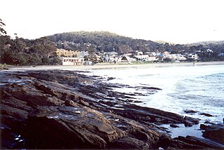
Looking South over Wye River Township
Australia Victoria Colac Otway Shire location map.svg
Red pog.svg
Wye River
Coordinates 38°38′0″S143°53′0″E / 38.63333°S 143.88333°E / -38.63333; 143.88333
Population63 (2016 census) [1]
Postcode(s) 3234
Location
LGA(s) Colac Otway Shire
State electorate(s) Polwarth
Federal division(s) Corangamite
Localities around Wye River:
Barramunga Separation Creek Separation Creek
Kennett River Wye River Bass Strait
Kennett River Kennett River Bass Strait

Wye River is a small town in Victoria, Australia. It is also the name given to the waterway which flows through the town and into the sea. Situated 155 km to the west of Melbourne, on the Otway Coast, part of the scenic Great Ocean Road, the Wye River township is located about 15 km west of the resort town Lorne, Victoria. It became more feasible for Melburnians to holiday there after the section of the Great Ocean Road from Lorne to Apollo Bay was opened in 1932. At the 2016 census, Wye River had a permanent population of 66, although its holiday population is ten times that. [1]

Contents

History

Prior to European colonization, the area was inhabited for tens of thousands of years by the indigenous Gadubanud (Katabanut) people. [2] The site was first occupied by European settlers in 1882. Brothers Alex and Donald Macrae, and their cousin Alex MacLennan, were looking for an area suited to farming and fishing, and settled near Separation Creek, establishing a farm which they named the Wye, after a river in Wales and Herefordshire. Alex MacLennan settled a little further west at a site he named the Kennet, later the settlement of Kennett River, after another UK river.[ citation needed ]

Wye River Post Office opened on 19 January 1914, but some time before 1945 it was reduced to a telegraph office for a considerable period of time, mail being delivered from Lorne. [3] A school was established in the local hall in 1920, but only lasted a year, after the closure of a sawmill resulted in a loss of population. The school was re-established in a converted residence in 1931, operated part-time with the Aireys Inlet school from 1935, and closed permanently in 1942. [4]

On Christmas Day 2015, a bushfire destroyed at least 98 homes in the area. At nearby Separation Creek another 18 homes were destroyed. [5] There were no deaths at either town. [6]

As a consequence, the state government announced a $2,75m relief package and imposed strict new fire regulations to rebuild houses. [7]

Tourism

The area is known for scenic coastal views, beautiful beaches, Otway Forest walks, wildlife including koalas and birds as well as the Great Otway National Park. Active tourism opportunities include fishing and excellent surfing.

The official tourism organization representing Wye River is Otway Coast Tourism. [8]

There are two caravan parks, the Seasonal Foreshore, located close to the main beach, and the BIG4 Wye River Holiday Pad. [9]

There is one pub, the Wye Beach Hotel [10] (formally known as "The Rookery Nook Hotel") and a general store Wye General [11] which also contains the post office and a cafe.

In recent years, the numbers of southern right whales [12] [13] and humpback whales [14] seen around the shores are increasing as the whale populations recover as well as other species such as bottlenose dolphins.

Organizations

Wye River has a Country Fire Brigade and a Surf Life Saving Club. [15] A cycling group called the Wye Riders ride bikes in the morning on the Great Ocean Road. They can often be seen afterwards at the general store having breakfast.

The Wye River Separation Creek Progress Association whose purpose is simply to "advance the welfare and protect the environment" of Wye River and Separation Creek. The association's volunteer committee of 12 meets every few months and hosts a public forum in January that is open to the entire community and the many related service organizations. [16]

Transport

Automobiles are the main form of transport to get to and from the town, via the Great Ocean Road. Within the town, most people walk between destinations. Wye River is serviced by the 101 V/Line coach that travels between Geelong Station and Apollo Bay in both directions.

Media

A few seconds of the 2013 movie Blinder was filmed in Wye River. The scene features a car driving along the Great Ocean Road. The camera was positioned outside the local pub.

In season 1, episode 1 of Surviving Summer, a few seconds show a car driving over the bridge, with a sign which would usually say Wye River, it was replaced with "Shorehaven" In the shot you can see the store/cafe. Shortly after the camera view changes to a shot being taken from the beach, showing the same car driving across the bridge.[ citation needed ]

Notable residents

Related Research Articles

<span class="mw-page-title-main">Great Ocean Road</span> Road in Victoria, Australia

The Great Ocean Road is an Australian National Heritage-listed 240-kilometre (150 mi) stretch of road along the south-eastern coast of Australia, between the Victorian towns of Torquay and Allansford. Built by returned soldiers between 1919 and 1932, and dedicated to soldiers killed during World War I, the road is the world's largest war memorial. Winding through varying terrain along the coast, and providing access to several prominent landmarks, including the Twelve Apostles limestone stack formations, the road is an important tourist attraction.

<span class="mw-page-title-main">Torquay, Victoria</span> Town in Victoria, Australia

Torquay is a seaside resort in Victoria, Australia, which faces Bass Strait, 21 km south of Geelong and is the gateway to the Great Ocean Road. It is bordered on the west by Spring Creek and its coastal features include Point Danger and Zeally Bay. At the 2021 census, Torquay had a population of 18,534.
<span class="mw-page-title-main">Lorne, Victoria</span> Town in Victoria, Australia

Lorne is a seaside town on Louttit Bay in Victoria, Australia. It is situated about the Erskine River and is a popular destination on the Great Ocean Road tourist route. Lorne is in the Surf Coast Shire and at the 2016 census had a population of 1,114 but this figure grows during the holiday season.

<span class="mw-page-title-main">Apollo Bay</span> Town in Victoria, Australia

Apollo Bay is a coastal town in southwestern Victoria, Australia. It is situated on the eastern side of Cape Otway, along the edge of the Barham River and on the Great Ocean Road, in the Colac Otway Shire. The town had a population of 1,790 at the 2021 census.

<span class="mw-page-title-main">Anglesea, Victoria</span> Town in Victoria, Australia

Anglesea is a town in Victoria, Australia. It is located on the Great Ocean Road in the Surf Coast Shire local government area. In the 2016 census, Anglesea had a population of 2,545 people.

<span class="mw-page-title-main">Kennett River, Victoria</span> Town in Victoria, Australia

Kennett River is a small seaside town in Victoria, Australia.

<span class="mw-page-title-main">Forrest, Victoria</span> Town in Victoria, Australia

Forrest is a small rural township in the Otway Ranges, Victoria, Australia. At the 2016 census, Forrest and the surrounding area had a population of 230.
<span class="mw-page-title-main">Electoral district of Polwarth</span> State electoral district of Victoria, Australia

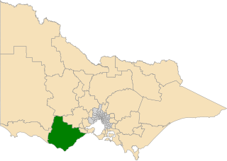
The electoral district of Polwarth is an electoral district of the Victorian Legislative Assembly. It is located in south-west rural Victoria, west of Geelong, and covers the Colac and Corangamite local government areas (LGA), parts of the Moyne, Golden Plains and Surf Coast LGAs, and slivers of the Ararat and Greater Geelong LGAs, running along the Great Ocean Road taking in Anglesea, Cape Otway, Peterborough, Aireys Inlet, Lorne, Wye River, Apollo Bay and Port Campbell, covering the inland towns of Winchelsea, Colac, Camperdown and Terang along the Princes Highway, and Inverleigh, Cressy, Lismore and Mortlake on the Hamilton Highway, and finally, includes the Otway Ranges and Lake Corangamite.

<span class="mw-page-title-main">Great Ocean Walk</span> Australian walking trail

The Great Ocean Walk is a walking trail on Victoria's southwest coast in Australia, traversing several areas of historical and cultural significance. The track makes extensive usage of eco-friendly facilities; with Parks Victoria and tour guide operators attempting to raise environmental awareness. The trail meanders along high cliff tops and sandy beaches.

The Otway Coast comprises a popular beach and national park section of the Great Ocean Road on the south-eastern coast of Australia between the Victorian towns of Lorne and Apollo Bay. The townships on the Otway Coast are: Separation Creek, Wye River, Kennett River, Wongara and Sugarloaf.

<span class="mw-page-title-main">Cumberland River (Victoria)</span> Perennial river in Victoria, Australia

The Cumberland River is a perennial river of the Corangamite catchment, located in the Otways region of the Australian state of Victoria.

<span class="mw-page-title-main">Erskine River</span> River in Victoria, Australia

The Erskine River is a river in southwestern Victoria, Australia. It arises in the Otway Ranges and enters Bass Strait to the east of Cape Otway through the town of Lorne. The Erskine River above the falls is known for its high diversity of native fish species and low occurrence of introduced species.

Eastern View is a locality in the Surf Coast Shire, Victoria, Australia.

Benwerrin is a rural locality in the Surf Coast Shire, Victoria, Australia.

Separation Creek is a small coastal locality in the Shire of Colac Otway, Victoria, Australia. In the 2016 census, Separation Creek had a population of 19.

Grey River is a rural locality in the Shire of Colac Otway, Victoria, Australia. It lies on the Great Ocean Road at the mouth of the Grey River, from which it derives its name.

Wongarra is a coastal locality in the Shire of Colac Otway, Victoria, Australia. In the 2016 census, Wongarra had a population of 37.

Sugarloaf is a small coastal locality in the Shire of Colac Otway, Victoria, Australia. In the 2011 census, the population of Sugarloaf was too low to separately report; however in November 2014 the Victorian Electoral Commission recorded 10 enrolled voters in Sugarloaf, living in 9 properties.

Petticoat Creek is a small coastal locality in the Shire of Colac Otway, Victoria, Australia. In the 2011 census, the population of Petticoat Creek was too low to report separately; however in November 2014 the Victorian Electoral Commission recorded two enrolled voters in Petticoat Creek, living in two properties.

<span class="mw-page-title-main">2015–16 Australian bushfire season</span>

The most destructive bushfire season in terms of property loss since the 2008–09 Australian bushfire season, occurred in the summer of 2015–16, with the loss of 408 houses and at least 500 non-residential buildings as a result of wild fires between 1 June 2015 and 31 May 2016. The season also suffered the most human fatalities since the 2008–09 Australian bushfire season; 6 died in Western Australia, 2 in South Australia and 1 in New South Wales. 8 deaths were as a direct result of fire, and a volunteer firefighter died due to unrelated health complications while on duty.

References

  1. 1 2 Australian Bureau of Statistics (31 October 2012). "Wye River (State Suburb)". 2011 Census QuickStats. Retrieved 17 November 2017. OOjs UI icon edit-ltr-progressive.svg
  2. "Indigenous History of the Otways". Qii House Lorne. Retrieved 12 October 2023.
  3. Phoenix Auctions History, Post Office List , retrieved 29 March 2021
  4. Blake, L. J. (1973). Vision and Realisation: A Centenary History of State Education in Victoria (Volume 2). Education Department of Victoria. p. 1056.
  5. "Great Ocean Road fire: Number of homes lost in Christmas Day blaze rises to 116". ABC News. Australian Broadcasting Corporation (ABC). 26 December 2015. Retrieved 26 December 2015.
  6. "Great Ocean Road fire: Victoria should 'stand proud' that no lives lost at Wye River, Separation Creek". ABC News. ABC. 26 December 2015. Retrieved 26 December 2015.
  7. Booker, Richard Willingham, Chloe (17 January 2016). "Victoria government launches Wye River rebuild". The Sydney Morning Herald. Retrieved 10 August 2023.{{cite web}}: CS1 maint: multiple names: authors list (link)
  8. http://www.otwaycoast.com.au Otway Coast Tourism
  9. http://www.big4wyeriver.com.au/ BIG4 Wye River Holiday Park
  10. http://www.wyebeachhotel.com.au/Wye Beach Hote
  11. http://wyerivergeneralstore.com.auWye Genera
  12. Beckhurst, Allie (14 July 2012), WYE RIVER WHALES , retrieved 10 August 2023
  13. Whale Watching Wye River BIG4 Wye River Holiday Park , retrieved 10 August 2023
  14. Darby, Andrew (5 July 2013). "Whale boom on Surf Coast". The Age. Retrieved 10 August 2023.
  15. http://www.wyeriverslsc.asn.au Wye River Surf Life Saving Club
  16. http://wyesep.org.au The Wye River Separation Creek Progress Association

Commons-logo.svg Media related to Wye River, Victoria at Wikimedia Commons