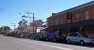
Doveton is a suburb in Melbourne, Victoria, Australia, 31 km south-east of Melbourne's Central Business District, located within the City of Casey local government area. Doveton recorded a population of 9,603 at the 2021 census.

Greenvale is a suburb in Melbourne, Victoria, Australia, 20 km (12 mi) north of Melbourne's Central Business District, located within the City of Hume local government area. Greenvale recorded a population of 21,274 at the 2021 census.

Sorell is a town in Tasmania, Australia, north-east of Hobart. It is located on the Tasman Highway at the junction with the Arthur Highway. Sorell is one of Tasmania's oldest towns, being first settled in 1808 as a small farming community and becoming an official township in 1821. At the 2006 census, Sorell had a population of 1,546, and at the 2011 census, a population of 2,476. and at the 2016 census, a population of 2,907.
Dundas is a suburb of Sydney, New South Wales, Australia. Dundas is located 21 kilometres north-west of the Sydney central business district, in the local government area of the City of Parramatta, and the electoral division of Bennelong. Dundas is a leafy green suburb, notably due to its centrepiece The Ponds Walk, which follows the Ponds Subiaco Creek. Dundas is part of the Northern Sydney and Greater Western Sydney regions.

Jan Juc is a suburb of Torquay, Victoria. At the 2016 census, Jan Juc had a population of 3,683.
Cressy is a small town 35 kilometres (22 mi) south-west of Launceston, Tasmania. It came into existence in the 1850s to service the surrounding wheat farms. At the 2006 census, Cressy had a population of 670. It is known as Tasmania's "Trout capital" for the good fishing in the area. It is also home to an extensive agriculture research facility for the Tasmanian Institute of Agricultural Research.

Buxton is a town 104 kilometres (65 mi) north-east of Melbourne in the Australian state of Victoria. At the 2016 census, Buxton had a population of 233.

Burnside is suburb in the City of Burnside council area in the eastern suburbs of Adelaide. It is primarily a residential suburb. It was named Burnside, an amalgamation of the Scottish word for creek, "burn" and "side" because of the original property's location on the side of Second Creek. Burnside is 7.5 kilometres (4.7 mi) east of the Adelaide city centre by road.
Kemps Creek is a suburb of Sydney, in the state of New South Wales, Australia. It is approximately 39 kilometres (24 mi) west of the Sydney central business district, in the local government areas of the City of Penrith and City of Liverpool. It is part of the Greater Western Sydney region.

Kentlyn is a suburb of Sydney, in the state of New South Wales, Australia 58 kilometres south-west of the Sydney central business district, in the local government area of the City of Campbelltown. It is part of the Macarthur region.
Cambridge Park is a suburb of Sydney, in the state of New South Wales, Australia 53 kilometres west of the Sydney central business district, in the local government area of the City of Penrith. It is part of the Greater Western Sydney region.
Darling Heights is a rural residential locality in the Toowoomba Region, Queensland, Australia. In the 2016 census, Darling Heights had a population of 5,192 people.

Nairne is a small township in the Adelaide Hills of South Australia. Nairne is about 7 kilometres (4 mi) from Mount Barker, South Australia, in the federal Division of Mayo and in the state electoral district of Kavel. At the 2016 census, Nairne had a population of 4,842.
Jerrys Plains is a village in the Hunter Region in New South Wales, Australia about 33 kilometres west of Singleton on the Golden Highway. The surrounding countryside is home to some substantial horse-breeding properties, notably the Australian branch of Ireland's giant Coolmore Stud, as well as viticulture and coal mining.

Runcorn is an outer southern suburb in the City of Brisbane, Queensland, Australia. In the 2016 census, Runcorn had a population of 14,592 people.
Mannerim is a semi-rural locality on the Bellarine Peninsula of Victoria, Australia.
Kurmond is a village 70.5 km west of Sydney, in the state of New South Wales, Australia. It is located in the City of Hawkesbury between Kurrajong and North Richmond on Bells Line of Road.

Bluewater is a town and coastal suburb in the City of Townsville, Queensland, Australia. In the 2016 census the suburb of Bluewater had a population of 1,040 people.

Mullaley is a village in the Gunnedah Shire, New South Wales, Australia.


