| Paraparap Victoria | |||||||||||||||
|---|---|---|---|---|---|---|---|---|---|---|---|---|---|---|---|
 Paraparap | |||||||||||||||
| Coordinates | 38°17′56″S144°11′02″E / 38.29889°S 144.18389°E Coordinates: 38°17′56″S144°11′02″E / 38.29889°S 144.18389°E | ||||||||||||||
| Population | 151 (2016 census) [1] | ||||||||||||||
| Postcode(s) | 3240 | ||||||||||||||
| Location | |||||||||||||||
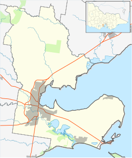
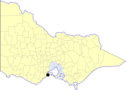
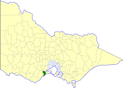
| LGA(s) | Surf Coast Shire | ||||||||||||||
| State electorate(s) | South Barwon | ||||||||||||||
| Federal Division(s) | Corangamite | ||||||||||||||
| |||||||||||||||
Paraparap is a rural locality in the Surf Coast Shire, Victoria, Australia. [2] In the 2011 census, Paraparap had a population of 151 people. [1]
Suburbs and localities are the names of geographic subdivisions in Australia, used mainly for address purposes. The term locality is used in rural areas, while the term suburb is used in urban areas. Australian postcodes closely align with the boundaries of localities and suburbs.

The Surf Coast Shire is a local government area in the Barwon South West region of Victoria, Australia, located in the south-western part of the state. It covers an area of 1,560 square kilometres (600 sq mi) and at the 2016 Census had a population of over 29,000. It includes the towns of Aireys Inlet, Anglesea, Lorne, Moriac, Torquay and Winchelsea. It was formed in 1994 from the amalgamation of the Shire of Winchelsea, Shire of Barrabool and part of the former City of South Barwon, which was, at that point, part of the City of Greater Geelong.

Victoria is a state in south-eastern Australia. Victoria is Australia's smallest mainland state and its second-most populous state overall, making it the most densely populated state overall. Most of its population lives concentrated in the area surrounding Port Phillip Bay, which includes the metropolitan area of its state capital and largest city, Melbourne, Australia's second-largest city. Victoria is bordered by Bass Strait and Tasmania to the south, New South Wales to the north, the Tasman Sea to the east, and South Australia to the west.
The Paraparap Parish was made available for sale in the 1850s, but was much less successful than other sales in the region, with slightly more than half of the lots being sold in the initial sales. The remaining lots were sold gradually over the subsequent decades, with some not being sold until the early twentieth century. Paraparap was first listed as an address in the 1890-91 directory. [3]
The area had a local progress association, the Paraparap and Pettavel Farmers' Progress Association, from March 1909. The association was responsible for the opening of the Paraparap State School and the Telephone Bureau and Post Office at the Moriac railway station. They later sought to improve roads within the area, and Hunts Road was opened as a result. At the road's opening in 1912, state Minister for Works William Edgar declared that project "the finest example of self-help I have ever seen in Victoria". The association was subsequently involved in the development of Hendy Main Road, which opened in 1920. [4]

Moriac is a closed station located in the town of Moriac, on the Warrnambool railway line in Victoria, Australia, opening on 1 October 1877. Remaining facilities include a bluestone platform, with a timber goods platform opposite. Moriac was the junction of the short branch line south to Wensleydale, which opened in 1889, and was closed in 1948.
William Haslem Edgar was an Australian politician.
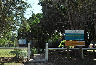
Paraparap State School (No. 3634) opened on 12 December 1909 near what is now the junction of Hunts Road and Hendy Main Road. It initially operated part-time, sharing a teacher with nearby Pettavel State School, but operated full-time by 1912. Wynd writes that the school "was the heart of the district" and "served as both meeting hall and church". A tennis court was built opposite the school in 1926. The school closed on 9 November 1951 due to lack of student numbers. [3]
A postal receiving office opened at Paraparap on 16 November 1910. Paraparap Post Office opened on 1 July 1927 and closed on 19 February 1955. [5]
The locality remains largely rural, and now contains the Drol Kar Buddhist Centre, the headquarters of the Geelong Veteran Cycling Club, the Giddings Road Nature Reserve, and a winery. [6] [7] [8] [9]