| Modewarre Victoria | |||||||||||||||
|---|---|---|---|---|---|---|---|---|---|---|---|---|---|---|---|
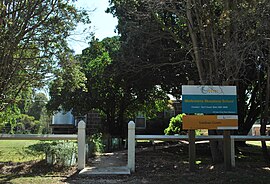
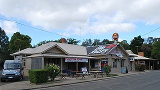
Former Modewarre Primary School | |||||||||||||||
| Coordinates | 38°15′58″S144°07′19″E / 38.26611°S 144.12194°E Coordinates: 38°15′58″S144°07′19″E / 38.26611°S 144.12194°E | ||||||||||||||
| Population | 276 (2016 census) [1] | ||||||||||||||
| Postcode(s) | 3240 | ||||||||||||||
| Location | |||||||||||||||
| LGA(s) | Surf Coast Shire | ||||||||||||||
| State electorate(s) | Polwarth | ||||||||||||||
| Federal Division(s) | Corangamite | ||||||||||||||
| |||||||||||||||
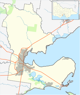
Modewarre is a locality in the Surf Coast Shire, Victoria, Australia. [2] The town adjoins Lake Modewarre. In the 2016 census, Modewarre had a population of 276 people. [1]
Suburbs and localities are the names of geographic subdivisions in Australia, used mainly for address purposes. The term locality is used in rural areas, while the term suburb is used in urban areas. Australian postcodes closely align with the boundaries of localities and suburbs.

The Surf Coast Shire is a local government area in the Barwon South West region of Victoria, Australia, located in the south-western part of the state. It covers an area of 1,560 square kilometres (600 sq mi) and at the 2016 Census had a population of over 29,000. It includes the towns of Aireys Inlet, Anglesea, Lorne, Moriac, Torquay and Winchelsea. It was formed in 1994 from the amalgamation of the Shire of Winchelsea, Shire of Barrabool and part of the former City of South Barwon, which was, at that point, part of the City of Greater Geelong.

Victoria is a state in south-eastern Australia. Victoria is Australia's smallest mainland state and its second-most populous state overall, making it the most densely populated state overall. Most of its population lives concentrated in the area surrounding Port Phillip Bay, which includes the metropolitan area of its state capital and largest city, Melbourne, Australia's second-largest city. Victoria is bordered by Bass Strait and Tasmania to the south, New South Wales to the north, the Tasman Sea to the east, and South Australia to the west.
Modewarre Primary School began as a local Anglican school in the 1850s, became a vested National School in 1859, and closed in 1971. [3]
A post office at Modewarre opened in 1859 and closed in 1967. [4]
The Modewarre Memorial Hall was erected in 1923 in memory of World War I. [5] The Modewarre Avenue of Honour on Cape Otway Road was planted in 1918, and is the last surviving Avenue of Honour in the Surf Coast Shire. Tree number #33 was planted to honour Albert Jacka, Australia's first winner of the Victoria Cross and a Modewarre local. [6]

World War I, also known as the First World War or the Great War, was a global war originating in Europe that lasted from 28 July 1914 to 11 November 1918. Contemporaneously described as "the war to end all wars", it led to the mobilisation of more than 70 million military personnel, including 60 million Europeans, making it one of the largest wars in history. It is also one of the deadliest conflicts in history, with an estimated nine million combatants and seven million civilian deaths as a direct result of the war, while resulting genocides and the 1918 influenza pandemic caused another 50 to 100 million deaths worldwide.

Albert Jacka, was an Australian recipient of the Victoria Cross, the highest decoration for gallantry "in the face of the enemy" that can be awarded to members of the British and Commonwealth armed forces. Jacka was the first Australian to be decorated with the VC during the First World War, receiving the medal for his actions during the Gallipoli Campaign. He later served on the Western Front and was twice further decorated for his bravery.

The Victoria Cross (VC) is the highest and most prestigious award of the British honours system. It is awarded for gallantry "in the presence of the enemy" to members of the British Armed Forces. It may be awarded posthumously. It was previously awarded to Commonwealth countries, most of which have established their own honours systems and no longer recommend British honours. It may be awarded to a person of any military rank in any service and to civilians under military command although no civilian has received the award since 1879. Since the first awards were presented by Queen Victoria in 1857, two-thirds of all awards have been personally presented by the British monarch. These investitures are usually held at Buckingham Palace.
The town has a football club, Modewarre Football Club, which has existed since 1878. It currently plays in the Bellarine Football League, but formerly played in the Geelong & District Football League. [7]
The Modewarre Football Club is an Australian rules football club that plays in the Bellarine Football League and situated near the township of Moriac, near the city of Geelong in Victoria. The club plays its home games at the Mount Moriac Recreation Reserve, Mt Moriac, Victoria.

The Bellarine Football League is an Australian rules football competition based in the Bellarine Peninsula region of Victoria, Australia, formed in 1971.
The Geelong & District Football League is the oldest surviving football competition in Victoria. It is one of three Australian rules football leagues in the Geelong area, the others being the Geelong Football League and the Bellarine Football League. There are 12 teams, and the league has produced over 600 VFL/AFL players.
