
Colac is a small city in the Western District of Victoria, Australia, approximately 150 kilometres south-west of Melbourne on the southern shore of Lake Colac.
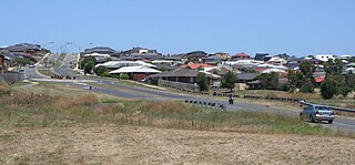
Waurn Ponds is a mainly residential southern suburb of Geelong, Victoria, Australia.

Geelong West is a commercial and residential suburb of Geelong, Victoria, Australia. When Geelong was founded, the area was known as Kildare but its name was changed to Geelong West in 1875. The main street is Pakington Street. At the 2016 census, Geelong West had a population of 6,966.
Bannockburn is a town near Geelong, Victoria, Australia, 88 km southwest of Melbourne. It is located in Golden Plains Shire. In the 2021 census, Bannockburn had a population of 6,470.
Ceres is a locality of Geelong, Victoria, Australia. As one of the highest points in Geelong, Ceres has a lookout which overlooks the city. In the 2016 census, Ceres had a population of 254 people.

Winchelsea is a town in Victoria, Australia. The town is located in the Surf Coast Shire local government area, the suburb or locality of Winchelsea is predominantly within Surf Coast Shire with a small section within the Colac Otway Shire. Winchelsea is located on the Barwon River 115 km south-west of Melbourne and close to Geelong.

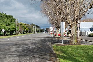
Birregurra, is a town in Colac Otway Shire, Victoria, Australia, approximately 130 kilometres (81 mi) south-west of Melbourne. At the 2021 census, it had a population of 942.

Moriac is a town in Victoria, Australia, located approximately 22 kilometres (14 mi) west of Geelong. It forms part of the Surf Coast Shire. At the 2016 census, Moriac had a population of 782. A Post Office opened on 1 August 1854 as Duneed, was renamed Mount Moriac in 1864, and Moriac in about 1909.

Elaine is a town in Victoria, Australia, located on the Midland Highway between Ballarat and Geelong. At the 2021 census, Elaine and the surrounding area had a population of 232.
Connewarre is a locality in Victoria, Australia, is located in the City of Greater Geelong and Surf Coast Shire, and is named after Lake Connewarre which is situated immediately to its north-east. Connewarre is a version of "kunuwarra", the name of the black swan in the Wathawurrung language. At the 2016 census, Connewarre and the surrounding area had a population of 788.
Beeac is a town in the Western District of Victoria, Australia. The town is located on the shore of the hyper-saline Lake Beeac in the Colac Otway Shire local government area, 160 kilometres southwest of the state capital, Melbourne. At the 2016 census, Beeac had a population of 370.

The Warrnambool railway line is a railway serving the south west of Victoria, Australia. Running from the western Melbourne suburb of Newport through the cities of Geelong and Warrnambool, the line once terminated at the coastal town of Port Fairy before being truncated to Dennington. This closed section of line has been converted into the 37 km long Port Fairy to Warrnambool Rail Trail. The line continues to see both passenger and freight services today.
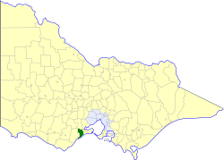
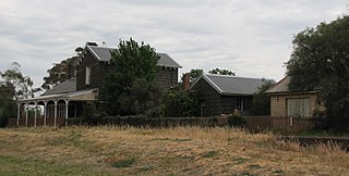
The Shire of Barrabool was a local government area about 100 kilometres (62 mi) southwest of Melbourne, the state capital of Victoria, Australia. The shire covered an area of 575.18 square kilometres (222.1 sq mi), and existed from 1853 until 1994.

Wadawurrung, also rendered as Wathawurrung, Wathaurong or Wada wurrung, and formerly sometimes Barrabool, is the Aboriginal Australian language spoken by the Wathaurong people of the Kulin Nation of Central Victoria. It was spoken by 15 clans south of the Werribee River and the Bellarine Peninsula to Streatham. Glottolog classifies Wathawurrung as extinct, however various regional programs and initiatives promote the usage and revitalisation of Wathaurong.
Buckley is a rural locality in the Surf Coast Shire, Victoria, Australia. It was formerly known as Laketown. In the 2021 census, Buckley had a population of 227.
Wurdiboluc is a rural locality in the Surf Coast Shire, Victoria, Australia. In the 2016 census, Wurdiboluc had a population of 569 people.
Paraparap is a rural locality in the Surf Coast Shire, Victoria, Australia. At the 2016 census, Paraparap had a population of 151 people.
Gnarwarre is a rural locality in the Surf Coast Shire, Victoria, Australia. In the 1800s, the locality was alternately known as Shankhill. In the 2016 census, Gnarwarre had a population of 267 people.
Bellarine is a rural locality in the City of Greater Geelong, Victoria, Australia. In the 2011 census, the population of Bellarine was too low to separately report; however in June 2014 the Victorian Electoral Commission recorded 134 enrolled voters in Bellarine, living in 81 properties.
Norman Houghton is a historian and archivist in Geelong, Victoria, who has published more than 40 books, many focusing on timber tramways and sawmills of the Otway and Wombat Forests of Western Victoria, Australia. Most of his works have been self-published, while he has provided numerous articles to the newsletter and journal of the Light Railway Research Society of Australia.

