Barrabool, Victoria

Last updated

Barrabool
Victoria
Australia Victoria Surf Coast Shire location map.svg
Red pog.svg
Barrabool
Coordinates 38°09′58″S144°13′39″E / 38.16611°S 144.22750°E / -38.16611; 144.22750 Coordinates: 38°09′58″S144°13′39″E / 38.16611°S 144.22750°E / -38.16611; 144.22750
Population235 (2016 census) [1]
Postcode(s) 3221
Location
LGA(s) Surf Coast Shire
State electorate(s) South Barwon
Federal division(s) Corangamite
Localities around Barrabool:
Stonehaven Stonehaven Fyansford
Gnarwarre Barrabool Ceres
Mount Moriac Mount Moriac Waurn Ponds

Barrabool is a rural locality in the Surf Coast Shire, Victoria, Australia. [2] In the 2016 census, Barrabool had a population of 235 people. [1]

Contents

History

The area was first settled by squatters in the late 1830s. [3] The lands of the Barrabool Parish were first advertised for sale in 1839, with the parish, consisting of 25 blocks of varying size, sold on 5 February 1840. [4] Wynd writes that there was "plenty of competition for the rich lands of the Barrabool Hills", and that the sale was much more successful than subsequent 1840s attempts at selling the land in the nearby Gnarwarre and Modewarre parishes. [4] The 1850s saw the development of the Berramongo Estate and the Suisse Vineyard at Barrabool, both of which survive today, and the land of the broader Barrabool Hills region was seen as having a "reputation for fertility" as a farming district. [5] Wheat was a popular and successful crop initially, but the land began to decline in the 1860s, and Geelong Advertiser wrote in 1868 that "the land on the Barrabool Hills, once so noted for its richness, had become exhausted." [6]

Unlike many of the surrounding areas, a clear township never developed at Barrabool. The first community building was the Holy Trinity Anglican Church School, which was built on the Merrawarp Estate in 1847. The Victorian Heritage Register describes it as "the earliest known school building in the Geelong region". [7] [8] The first Holy Trinity Anglican Church was opened nearby in 1855. Tenders for the adjacent vicarage were called in 1855, but Wynd suggests that the vicarage may not have been completed until 1860. [9] The Anglican school became "School No. 50" under the common school scheme, and the Barrabool State School was established in the building in 1874. The school was closed in 1875, and merged with the Ceres State School; the new school would also be called "Barrabool", but located in modern Ceres. The school, vicarage, and the second Anglican church survive, and are listed on the Victorian Heritage Register. The register reports that the Anglican school is the second earliest surviving school in Victoria. [10]

A Presbyterian denominational school, located on Barrabool Road, opened on 19 May 1858 on part of the former "Strathlachlan" estate. A Presbyterian manse was then built, with the foundation stone laid on 25 November 1859. A Presbyterian church was officially opened on 9 April 1871. The school became common school No. 73 in 1863, and a new stone school building was built in the 1870s, with tenders called in 1874. The Presbyterian school closed later that decade, and would later be briefly used for the revived Barrabool State School. The Presbyterian church survives as the Barrabool Uniting Church. [11]

A Bible Christian Church was established at the corner of Polleys and Balanclea Roads in the 1850s, with the foundation stone laid on 17 November 1856. Wynd reports a Wesleyan church and school were also existent in the 1850s, further west on Polleys Road. [12] These churches have long since closed; their closure dates are unknown.

The original Barrabool State School that had been closed and merged with Ceres in 1875 re-opened in 1921, initially in the stone building that had served as the Presbyterian school in the late 1870s. A new two-acre site opposite had been purchased, and a new building for the school was built thereafter. [11] The school closed in the 20th century, though its closure date is unknown. The Public Record Office records "Barrabool Hills" as a former name for the school; the date of this usage is also unknown. [13]

A postal receiving office opened at Barrabool around 1902, and closed on 23 December 1914. A returning office again opened there on 1 August 1921, became Barrabool Post Office on 1 July 1927, and closed on 30 June 1963. [14]

Barrabool today

The Surf Coast Shire heritage overlay protects eleven surviving buildings in Barrabool with heritage value: the Holy Trinity Anglican Church School, Holy Trinity Anglican Church and Parsonage and the Neuchatel property, which are also listed on the Victorian Heritage Register, the "Ballanclea", "Tasman", "Foymount", "Berramongo", and "Merrawarp" homesteads, Wescott's Stable, the Barrabool Presbyterian Church, and the "Stanbury" barn. [15]

The Barrabool Cricket Club remains active, fielding four senior men's teams in the Bellarine Peninsula Cricket Association, a senior women's team in the Barwon Women's Cricket Competition and four junior teams in the Geelong Junior Cricket Association. [16] The Barrabool Memorial Gates at the entrance to the local sports ground are listed on the Victorian War Heritage Inventory, as they were dedicated in memory of World War I and the first pioneers of the district. [17]

The Uniting Church holds fortnightly services at their Barrabool church (the former Presbyterian church) on the corner of Andersons and Barrabool Roads. [18] The Anglican church no longer holds services, but is open to viewings by appointment. [19]

The McAdam Park motocross race track was located at Barrabool from 1962 until 2015, when it closed after a community campaign by the Barrabool Rural Protection Group against the facility and a Victorian Civil and Administrative Tribunal decision blocking its redevelopment. The site was subsequently divided into three residential lots. [20] [21]

Related Research Articles

Geelong West, Victoria Suburb of Geelong, Victoria, Australia

Geelong West is a commercial and residential suburb of Geelong, Victoria, Australia. When Geelong was founded, the area was known as Kildare but its name was changed to Geelong West in 1875. The main street is Pakington Street. At the 2016 Census, Geelong West had a population of 6,966.

Newtown is an inner western suburb of Geelong, Victoria, Australia. At the 2016 census, Newtown had a population of 10,155. It is a primarily residential area occupying one of the highest points of urban Geelong, has always been a desirable place of residence and it is the location of many of Geelong's oldest and most valuable properties.

Belmont, Victoria Suburb of Geelong, Victoria, Australia

Belmont is a southern suburb of Geelong, Victoria, Australia. The name means "beautiful hill". Belmont is geographically separated from the Geelong central business district by the Barwon River. The suburb is primarily residential, with some light industry along Barwon Heads Road. The suburb is part of the City of Greater Geelong local government area. At the 2011 census, Belmont had a population of 13,616.

Ceres, Victoria Town in Victoria, Australia

Ceres is a locality of Geelong, Victoria, Australia. As one of the highest points in Geelong, Ceres has a lookout which overlooks the city. In the 2016 census, Ceres had a population of 254 people.

Anakie, Victoria Town in Victoria, Australia

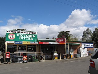
Anakie is a rural township between Geelong and Bacchus Marsh, Victoria, Australia. At the 2016 census, Anakie and the surrounding area had a population of 690. The town is divided between the City of Greater Geelong and Golden Plains Shire local government areas.

Winchelsea, Victoria Town in Victoria, Australia

Winchelsea is a town in Victoria, Australia. The town is located in the Surf Coast Shire local government area, the suburb or locality of Winchelsea is predominantly within Surf Coast Shire with a small section within the Colac Otway Shire. Winchelsea is located on the Barwon River 115 km south-west of Melbourne and close to Geelong.

Inverleigh, Victoria Town in Victoria, Australia

Inverleigh is a small rural township in Victoria, Australia located 28 kilometres (17 mi) west from the City of Geelong and 87 kilometres (54 mi) from the state capital, Melbourne. The town is divided between Golden Plains Shire and Surf Coast Shire. In the 2016 census, the central area of Inverleigh had a population of 1,474. Inverleigh is known to be a popular stopover destination on the way to Lorne. The Inverleigh Hotel is very popular attracting customers from Geelong.

Cape Otway is a cape and a bounded locality of the Colac Otway Shire in southern Victoria, Australia on the Great Ocean Road; much of the area is enclosed in the Great Otway National Park.

Christ Church, Geelong Church in Victoria, Australia

The Christ Church is an Anglican church located in Geelong, Victoria, Australia. Designed by Edmund Blacket, the church is the oldest Anglican church in Victoria, in continuous use on its original site.

The Barrabool Hills are a small region in south-Western Victoria, on the western outskirts of Geelong. The National Trust of Australia describes the hills as being a "distinctive upland ridge located to the west of Geelong, on the south side of the Barwon River", that "slope steeply on the northern side down to the Barwon River, and more gently southward to the coastal lowland." The area stretches roughly through the modern localities of Gnarwarre, Barrabool and Ceres, and straddles the intersection of the City of Greater Geelong, Surf Coast Shire and Golden Plains Shire.

Stonehaven, Victoria Suburb of Geelong, Victoria, Australia

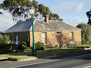
Stonehaven is a small settlement about 10 km west of Geelong, Victoria, on the Hamilton Highway. It consists of a number of scattered farmhouses, the former primary school building, a community hall and a Country Fire Authority (CFA) fire station. The fire station is sometimes used as a polling booth for state and federal elections. The Ceres Bridge Estate winery has its vineyard in Stonehaven, producing chardonnay and pinot noir.

Louis Reginald Williams (1890–1980) was an ecclesiastical architect in Australia. He designed churches throughout the country, particularly in Victoria, primarily Anglican but also Methodists, Presbyterians, Lutherans and Christian Scientists. He himself regarded St Andrew's Anglican Church, Brighton in Melbourne, as his greatest work.

Buckley is a rural locality in the Surf Coast Shire, Victoria, Australia. It was formerly known as Laketown. In the 2016 census, Buckley had a population of 211 people.

Mount Moriac is a rural locality in the Surf Coast Shire, Victoria, Australia. In the 2016 census, Mount Moriac had a population of 240 people.

Paraparap is a rural locality in the Surf Coast Shire, Victoria, Australia. At the 2016 census, Paraparap had a population of 151 people.

Gnarwarre is a rural locality in the Surf Coast Shire, Victoria, Australia. In the 1800s, the locality was alternately known as Shankhill. In the 2016 census, Gnarwarre had a population of 267 people.

Bellarine is a rural locality in the City of Greater Geelong, Victoria, Australia. In the 2011 census, the population of Bellarine was too low to separately report; however in June 2014 the Victorian Electoral Commission recorded 134 enrolled voters in Bellarine, living in 81 properties.

Garrison Church, Sydney Church in New South Wales, Australia

The Garrison Church is a heritage-listed active Anglican church building located at Argyle Street in the inner city Sydney suburb of Millers Point in the City of Sydney local government area of New South Wales, Australia. It was designed by Henry Ginn, Edmund Blacket and built from 1840 to 1846 by Edward Flood and George Patton. It is also known as Holy Trinity Anglican Church and Hall. The property is owned by Anglican Church Property Trust and was added to the New South Wales State Heritage Register on 2 April 1999.

Holy Trinity Church, Fortitude Valley

Holy Trinity Church is a heritage-listed Anglican church at 141 Brookes Street, Fortitude Valley, City of Brisbane, Queensland, Australia. It is the second church on that site. It was designed by Francis Drummond Greville Stanley built from 1876 to 1877 by James Robinson. It was modified in 1920-1921, 1925 and 1929. It was added to the Queensland Heritage Register on 21 October 1992.

Holy Trinity Anglican Church, Herberton

Holy Trinity Anglican Church is a heritage-listed church at 38 Broadway Street, Herberton, Tablelands Region, Queensland, Australia. It was designed by Eyre & Munro and built in 1889 by H Petersen. It is also known as Holy Trinity Church of England. It was added to the Queensland Heritage Register on 21 October 1992.

References

  1. 1 2 Australian Bureau of Statistics (27 June 2017). "Barrabool (SSC)". 2016 Census QuickStats. Retrieved 16 November 2017. OOjs UI icon edit-ltr-progressive.svg
  2. "Barrabool (entry 100271)". VICNAMES. Government of Victoria . Retrieved 10 July 2014.
  3. Wynd, Ian (1992). Barrabool: Land of the Magpie. p. 9. ISBN   0646089072.
  4. 1 2 Wynd 1992, p. 17.
  5. Wynd 1992, p. 25.
  6. Wynd 1992, p. 33.
  7. "Former Holy Trinity Anglican Church School (H0889)". Victorian Heritage Register . Heritage Victoria . Retrieved 11 July 2014.
  8. Wynd 1992, p. 65.
  9. Wynd 1992, p. 66.
  10. "Holy Trinity Anglican Church and Vicarage (H0888)". Victorian Heritage Register . Heritage Victoria . Retrieved 12 July 2014.
  11. 1 2 Wynd 1992, p. 67-69.
  12. Wynd 1992, p. 69.
  13. "Barrabool (Primary School No. 73; previously known as Barrabool Hills)". Public Record Office Victoria. Archived from the original on 5 March 2016. Retrieved 11 July 2014.
  14. "Barrabool Post Office". Phoenix Auctions. Retrieved 4 February 2021.
  15. "Surf Coast Planning Scheme" (PDF). Department of Planning, Transport and Local Infrastructure. Retrieved 12 July 2014.
  16. "Barrabool Cricket Club". Community Directory. City of Greater Geelong. Retrieved 2 August 2021.
  17. "Barrabool Memorial Gates". Victorian War Heritage Inventory. Heritage Victoria . Retrieved 12 July 2014.
  18. "Port Phillip West Congregations" (PDF). Uniting Church in Australia. Archived from the original (PDF) on 1 April 2014. Retrieved 11 July 2014.
  19. "Parish Churches". Winchelsea Anglican Parish. Retrieved 11 July 2014.
  20. Cannon, Anthea (9 March 2014). "Motocross track stopped in its tracks". Geelong Advertiser. Retrieved 11 July 2014.
  21. "Home buyers jump at chance to secure sites at former McAdam Park motocross circuit". Geelong Advertiser. 17 December 2016. Retrieved 16 November 2017.