
Geelong is a port city located on Corio Bay and the Barwon River, in the state of Victoria, Australia. The traditional owners of the land on which Geelong sits are the Wadawurrung people of the Kulin nation.

The City of Wyndham is a local government area in Victoria, Australia in the outer south-western suburbs of Melbourne, within the Melbourne Metropolitan Area, between Melbourne and the regional city of Geelong. It has an area of 542 square kilometres (209 sq mi). The city had a population of 255,322 in June 2018. For the year to 2018 the City of Wyndham increased its population by 14,251, the largest number of any LGA in Victoria, as well being the second most populous and the second fastest growing at a rate of 5.9 per cent.

Werribee is a suburb of Melbourne, Victoria, Australia, 32 km south-west of Melbourne's Central Business District, located within the City of Wyndham local government area. Werribee recorded a population of 40,345 at the 2016 Census.

The Barwon River is a perennial river of the Corangamite catchment, located in The Otways and the Bellarine Peninsula regions of the Australian state of Victoria.
Waurn Ponds is a mainly residential southern suburb of Geelong, Victoria, Australia.
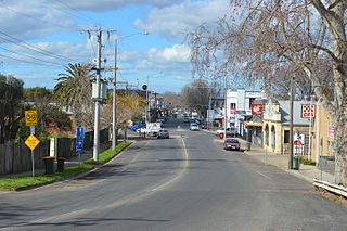
Bacchus Marsh is an urban centre and suburban locality in Victoria, Australia located approximately 50 kilometres (30 mi) north west of the state capital Melbourne and 14 kilometres (9 mi) west of Melton at a near equidistance to the major cities of Melbourne, Ballarat and Geelong. The population of the Bacchus Marsh urban area was 22,223 at June 2018. Bacchus Marsh is the largest urban area in the local government area of Shire of Moorabool.

The Bellarine Peninsula is a peninsula located south-west of Melbourne in Victoria, Australia, surrounded by Port Phillip, Corio Bay and Bass Strait. The peninsula, together with the Mornington Peninsula, separates Port Phillip Bay from Bass Strait. The peninsula itself was originally occupied by Indigenous Australian clans of the Wathaurong nation, prior to European settlement in the early 19th century. Early European settlements were initially centred on wheat and grain agriculture, before the area became a popular tourist destination with most visitors arriving by paddle steamer on Port Phillip in the late 19th century.

The Werribee River is a perennial river of the Port Phillip catchment that is located on the expansive lowland plain southwest of Melbourne, Victoria, Australia. The headwaters of a tributary, the Lerderderg River, are north of Ballan near Daylesford and it flows across the basalt plain, through the suburb of Werribee to enter Port Phillip. A linear park follows the Werribee River along much of its course. In total the Werribee River completes a journey of approximately 110 kilometres (68 mi).
Mount Duneed is a suburb of Geelong, Victoria, Australia. It is divided between the City of Greater Geelong and Surf Coast Shire local government areas. Mount Duneed itself is an extinct volcano and the remains of the crater can be seen in the Mount Duneed Recreation Reserve.
The Wathaurong nation, also called the Wathaurung,Wadawurrung and Wadda Wurrung, are an Aboriginal Australian people living in the area near Melbourne, Geelong and the Bellarine Peninsula in the state of Victoria. They are part of the Kulin alliance. The Wathaurung language was spoken by 25 clans south of the Werribee River and the Bellarine Peninsula to Streatham. The area they inhabit has been occupied for at least the last 25,000 years.

Mount Cottrell is a town in Victoria, Australia, 31 km west of Melbourne's Central Business District, located within the Cities of Melton and Wyndham local government areas. Mount Cottrell recorded a population of 569 at the 2016 Census.
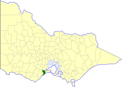
The City of South Barwon was a local government area in Victoria, Australia, which contained a number of Geelong suburbs south of the Barwon River, and extending to Torquay in the south and Barwon Heads to the east. The city covered an area of 165.4 square kilometres (63.9 sq mi), and existed from 1863 until 1994.
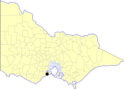
The Shire of Barrabool was a local government area about 100 kilometres (62 mi) southwest of Melbourne, the state capital of Victoria, Australia. The shire covered an area of 575.18 square kilometres (222.1 sq mi), and existed from 1853 until 1994.

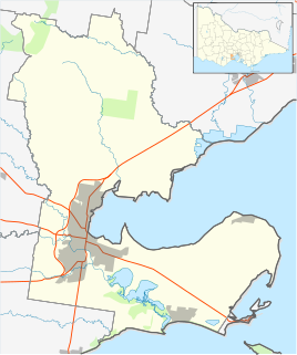
The Shire of Corio was a local government area located between Geelong and Werribee, about 60 kilometres (37 mi) southwest of Melbourne, the state capital of Victoria, Australia. The shire, which included all of Geelong's northern suburbs, covered an area of 704.66 square kilometres (272.1 sq mi), and existed from 1861 until 1993.
The Gulidjan people, also known as the Kolakngat, or Colac tribe, are an Aboriginal Australian tribe whose traditional lands cover the Lake Colac region of the state of Victoria, Australia. They occupied the grasslands, woodlands, volcanic plains and lakes region east of Lake Corangamite, west of the Barwon River and north of the Otway Ranges. Their territory bordered the Wathaurong to the north, Djargurd Wurrung to the west, Girai Wurrung to the south-west, and Gadubanud to the south-east.

The Kulin languages are a group of closely related languages of the Kulin people, part of the Kulinic branch of Pama–Nyungan.
The Boonwurrung language, also anglicised as Bunurong, Bun wurrung, and other variant spellings, is an Aboriginal Australian language traditionally spoken by the Boonwurrung people of the Kulin nation of central Victoria prior to European settlement in the colony of Victoria. The last remaining traditional native speakers died in the early 20th century; however there is an active revival movement under way in the Boonwurrung community.

Mount Moriac is a rural locality in the Surf Coast Shire, Victoria, Australia. In the 2016 census, Mount Moriac had a population of 240 people.
The Kurung were identified as an indigenous Australian group of the State of Victoria by Norman Tindale. The theory that they constituted an independent tribe has been challenged with modern scholarship generally considering them a clan, associated to one of two major tribes. Their language is unconfirmed.
The Mount Cottrell massacre involved the murder of an estimated 10 Wathaurong people near Mount Cottrell in the colony of Victoria in 1836, in retaliation for the killing of two European settlers.
