Gnarwarre, Victoria

Last updated

Gnarwarre
Victoria
Australia Victoria Surf Coast Shire location map.svg
Red pog.svg
Gnarwarre
Coordinates 38°09′29″S144°08′23″E / 38.15806°S 144.13972°E / -38.15806; 144.13972 Coordinates: 38°09′29″S144°08′23″E / 38.15806°S 144.13972°E / -38.15806; 144.13972
Population267 (2016 census) [1]
Postcode(s) 3221
Location
LGA(s) Surf Coast Shire
State electorate(s) South Barwon
Federal division(s) Corangamite
Localities around Gnarwarre:
Inverleigh Murgheboluc Stonehaven
Inverleigh Gnarwarre Barrabool
Buckley Buckley
Mount Moriac
Mount Moriac

Gnarwarre is a rural locality in the Surf Coast Shire, Victoria, Australia. [2] In the 1800s, the locality was alternately known as Shankhill. [3] In the 2016 census, Gnarwarre had a population of 267 people. [1]

Contents

History

The area was first settled by squatters in the late 1830s. [4] The Gnarwarre Parish was first advertised for sale in 1839, with the parish, consisting of 22 lots of 640 acres or bigger, put up for sale on 10 June 1840. The sale was dramatically less successful than the February sale of blocks in the Barrabool Parish, with only four blocks being sold; virtually all of the remainder would be eventually sold in the 1850s. [5] The Gnarwarre Parish did not see the same significant subdivision that occurred in the nearby Modewarre and Duneed parishes, which Wynd attributes to the land being seen as more suitable for grazing. [6]

The population in the Gnarwarre area, as opposed to areas further east, was largely Catholic. A Catholic school was established at Gnarwarre in 1853, and was used as a church on Sundays. [7] A more permanent school building was slowly constructed over several years, and finally opened on 2 February 1862; Wynd suggests that poverty on the part of the local population had meant that further work was only done when funds became available. [8] An Anglican school also opened at Gnarwarre in November 1856, and a Primitive Methodist church opened around 1865. [8] The Catholic school became a common school, then in 1872 the first Gnarwarre State School, but was closed down at the end of 1874 as it was to be replaced by a new school on a new two-acre site. [8]

The Shankhill Hotel was opened by James Murphy in 1856, but was burned down in 1864 and not rebuilt. The Gnarwarre Hotel was opened by Patrick Corbett in 1864 on a site "a little distance west" of the former hotel. [9] A post office opened on 1 October 1857. [10] In addition to the hotel, in 1861, Gnarwarre had a butcher, a blacksmith, and store. [9] The former Catholic church and school ceased being used for services from around 1900, was used as a dance hall during World War I, and was demolished in 1959. The Gnarwarre Hotel closed in 1922 and was demolished in 1968. [9] Gnarwarre Post Office closed on 30 June 1963. [10]

Gnarwarre State School would outlive the remainder of the village, but closed and opened numerous times with changing student numbers. The school, having opened on a new site from the old Catholic school at the start of 1875, closed in 1879–80, reopened in 1881, closed again from 1950 to 1956, and was re-opened again in 1957. It was replaced by a new school in the 1960s, but closed permanently in 1991 because of falling student numbers. [8] Wynd, writing in 1992, states that some of Gnarwarre's buildings survived until the 1960s, but that a motorist would see "absolutely nothing to recall the existence of Shankhill/Gnarwarre." [9]

There were also three unsuccessful attempts at founding other settlements within the modern Gnarwarre locality: Lanark, Barwon, and Pollocksford. Lanark was advertised as being at the junction of what is now Mount Pollock Road at Gnarwarre; a street pattern was laid out, and a land auction took place on 23 January 1854. Wynd notes that there is "no record of who bought land, and no evidence that any settlement ever developed there". [11] Barwon was auctioned on 9 March 1854, advertised as being "on the Ballarat Road". It was described in the Geelong Advertiser in 1874 as being "a sort of no man's land where anybody and everybody runs their stock" and had disappeared by the 1880s. [12] Pollocksford, straddling the Barwon River in modern Gnarwarre and Murgheboluc, was marked for a settlement, and an Anglican school was proposed there in the 1860s, but was never built. [12]

Gnarwarre today

The Gnarwarre Public Hall and a Country Fire Authority station are located at Gnarwarre. [13] [14]

Gnarwarre is a base for two major horseracing studs. Tony Santic, the owner of Melbourne Cup-winning horse Makybe Diva, bases his breeding and training outfit, Makybe Racing and Breeding, at Gnarwarre. [15] A second operator, Rosemont Stud, also operates in Gnarwarre, and bought 44% of the Makybe farm in 2012. [16] The locality is also home to a major wool-growing property, Roxby Park. [17]

Graeme Lloyd, the first Australian to play in a winning World Series baseball team, was raised in Gnarwarre. [18]

Related Research Articles

<span class="mw-page-title-main">Makybe Diva</span> British-bred Australian Thoroughbred racehorse

Makybe Diva is a champion Australian Thoroughbred racehorse who is the only horse to win three Melbourne Cups and the only mare to win it more than once. She achieved the feat in 2003, 2004, and 2005. She also won the 2005 Cox Plate. She was the highest stakes-earner in Australian history, winning more than A$ 14 million.

<span class="mw-page-title-main">Ocean Grove, Victoria</span> Town in Victoria, Australia

Ocean Grove is a seaside town in Victoria, Australia, located on the Bellarine Peninsula. At the 2016 census, Ocean Grove had a population of 14,165.

<span class="mw-page-title-main">Grovedale, Victoria</span> Suburb of Geelong, Victoria, Australia

Grovedale is a southern suburb of Geelong, Victoria, Australia. At the 2021 census, Grovedale had a population of 14,869.

<span class="mw-page-title-main">Mungindi</span> Town in New South Wales, Australia

Mungindi is a town and locality on the border of New South Wales (NSW) and Queensland, Australia. The town is within Moree Plains Shire in New South Wales. Within Queensland, the locality is split between the Shire of Balonne and the Goondiwindi Region with the town in the Shire of Balonne. It possesses a New South Wales postcode. Mungindi sits on the Carnarvon Highway and straddles the Barwon River which is the border between New South Wales and Queensland. At the 2016 census, Mungindi had a population of 601 on the New South Wales side, while the population on the Queensland side was 146.

<span class="mw-page-title-main">Fyansford, Victoria</span> Suburb of Geelong, Victoria, Australia

Fyansford is a township on the western edge of Geelong, Victoria, Australia, named after Captain Foster Fyans who came to Geelong as a Police magistrate in October, 1837. It is located at the junction of the Barwon and Moorabool rivers. At the 2016 census, Fyansford had a population of 196.

<span class="mw-page-title-main">Highton, Victoria</span> Suburb of Geelong, Victoria, Australia

Highton is a residential suburb of Geelong, Victoria, Australia. With views across Geelong, Corio Bay and the surrounding region, Highton is located along the banks of the Barwon River and across the rolling Barrabool Hills. The Barwon River straddles Highton to the north and east, while it is bordered by the hilly Ceres and Wandana Heights to the west, the former Kardinia Creek separates the suburb from Belmont to the south-east, and the Princes Highway and Pigdons Road to the south separate the suburb from Waurn Ponds.

<span class="mw-page-title-main">Belmont, Victoria</span> Suburb of Geelong, Victoria, Australia

Belmont is a southern suburb of Geelong, Victoria, Australia. The name means "beautiful hill". Belmont is geographically separated from the Geelong central business district by the Barwon River. The suburb is primarily residential, with some light industry along Barwon Heads Road. The suburb is part of the City of Greater Geelong local government area. At the 2011 census, Belmont had a population of 13,616.

<span class="mw-page-title-main">Bannockburn, Victoria</span> Town in Victoria, Australia

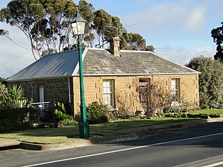
Bannockburn is a rural township near Geelong, Victoria, Australia, 88 km southwest of Melbourne. It is located in Golden Plains Shire. In the 2021 census, Bannockburn had a population of 6,470.

<span class="mw-page-title-main">Ceres, Victoria</span> Town in Victoria, Australia

Ceres is a locality of Geelong, Victoria, Australia. As one of the highest points in Geelong, Ceres has a lookout which overlooks the city. In the 2016 census, Ceres had a population of 254 people.

<span class="mw-page-title-main">Winchelsea, Victoria</span> Town in Victoria, Australia

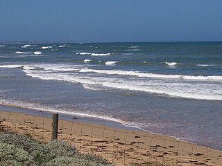
Winchelsea is a town in Victoria, Australia. The town is located in the Surf Coast Shire local government area, the suburb or locality of Winchelsea is predominantly within Surf Coast Shire with a small section within the Colac Otway Shire. Winchelsea is located on the Barwon River 115 km south-west of Melbourne and close to Geelong.

<span class="mw-page-title-main">Foster Fyans</span> Australian politician

Foster Fyans was an Irish military officer, penal colony administrator and public servant. He was acting commandant of the second convict settlement at Norfolk Island, the commandant of the Moreton Bay penal settlement at Brisbane, the first police magistrate at Geelong, and commissioner of crown lands for the Portland Bay pastoral district in the Port Phillip District of New South Wales. He is the great-great-grandfather of actor Sam Neill.

Connewarre, is a locality in Victoria, Australia, is located in the City of Greater Geelong and Surf Coast Shire, and is named after Lake Connewarre which is situated immediately to its north-east. Connewarre is a version of "kunuwarra", the name of the black swan in the Wathawurrung language. At the 2016 census, Connewarre and the surrounding area had a population of 788.

The Barrabool Hills are a small region in south-Western Victoria, on the western outskirts of Geelong. The National Trust of Australia describes the hills as being a "distinctive upland ridge located to the west of Geelong, on the south side of the Barwon River", that "slope steeply on the northern side down to the Barwon River, and more gently southward to the coastal lowland." The area stretches roughly through the modern localities of Gnarwarre, Barrabool and Ceres, and straddles the intersection of the City of Greater Geelong, Surf Coast Shire and Golden Plains Shire.

Buckley is a rural locality in the Surf Coast Shire, Victoria, Australia. It was formerly known as Laketown. In the 2016 census, Buckley had a population of 211 people.

Wurdiboluc is a rural locality in the Surf Coast Shire, Victoria, Australia. In the 2016 census, Wurdiboluc had a population of 569 people.

Mount Moriac is a rural locality in the Surf Coast Shire, Victoria, Australia. In the 2016 census, Mount Moriac had a population of 240 people.

Paraparap is a rural locality in the Surf Coast Shire, Victoria, Australia. At the 2016 census, Paraparap had a population of 151 people.

Bellarine is a rural locality in the City of Greater Geelong, Victoria, Australia. In the 2011 census, the population of Bellarine was too low to separately report; however in June 2014 the Victorian Electoral Commission recorded 134 enrolled voters in Bellarine, living in 81 properties.

Barrabool is a rural locality in the Surf Coast Shire, Victoria, Australia. In the 2016 census, Barrabool had a population of 235 people.

References

  1. 1 2 Australian Bureau of Statistics (27 June 2017). "Gnarwarre (SSC)". 2016 Census QuickStats. Retrieved 17 November 2017. OOjs UI icon edit-ltr-progressive.svg
  2. "Gnarwarre (entry 16461)". VICNAMES. Government of Victoria . Retrieved 20 June 2014.
  3. Wynd, Ian (1992). Barrabool: Land of the Magpie. p. 74. ISBN   0646089072.
  4. Wynd 1992, p. 9.
  5. Wynd 1992, p. 17-18.
  6. Wynd 1992, p. 18.
  7. Wynd 1992, p. 74.
  8. 1 2 3 4 Wynd 1992, p. 75.
  9. 1 2 3 4 Wynd 1992, p. 76.
  10. 1 2 Phoenix Auctions History. "Post Office List". Phoenix Auctions. Retrieved 4 February 2021.
  11. Wynd 1992, p. 77.
  12. 1 2 Wynd 1992, p. 79.
  13. "Gnarwarre Public Hall" . Retrieved 12 July 2014.
  14. "Brigade Locations" (PDF). Country Fire Authority. Retrieved 20 June 2014.
  15. Pearson, Erin (19 December 2012). "Accountant jailed over $700,000 Makybe Diva racing thefts". Geelong Advertiser. Retrieved 20 June 2014.
  16. "Santic sells 44 percent of Makybe farm". Breeding and Racing. 23 May 2012. Retrieved 20 June 2014.
  17. Mullane, Luke (11 September 2002). "Roxby Park up for auction". The Courier. Retrieved 20 June 2014.
  18. "Graeme Lloyd". SABR Baseball Biography Project. Society for American Baseball Research. Retrieved 20 June 2014.