Ceres, Victoria

Last updated

Ceres
Geelong,  Victoria
Stone house at Ceres Victoria.JPG
Historic stone house at Ceres
Australia Victoria Greater Geelong City location map.svg
Red pog.svg
Ceres
Coordinates 38°10′S144°16′E / 38.167°S 144.267°E / -38.167; 144.267 Coordinates: 38°10′S144°16′E / 38.167°S 144.267°E / -38.167; 144.267
Population254 (2016 census) [1]
Postcode(s) 3221
LGA(s) City of Greater Geelong
State electorate(s) South Barwon
Federal division(s) Corangamite
Localities around Ceres:
Stonehaven Fyansford Fyansford
Barrabool Ceres Wandana Heights and Highton
Barrabool Waurn Ponds Waurn Ponds

Ceres is a locality of Geelong, Victoria, Australia. As one of the highest points in Geelong, Ceres has a lookout which overlooks the city. In the 2016 census, Ceres had a population of 254 people. [1]

Contents

History

The Ceres area was first settled by squatters in the late 1830s, and the lots of the Barrabool Parish were advertised in 1839, with the land being sold on 5 February 1840. There was reportedly "plenty of competition" for the Barrabool Hills lands, and the area became part of "Roslin", owned by David Fisher. The government had not provided for a settlement in the Barrabool Parish, and Fisher, after selling much of his estate in 1846, advertised a section of the remainder for sale as the new village of Ceres in March 1850. [2] The town is presumably named after the Roman goddess of agriculture or less likely the dwarf planet or more likely the village of Ceres in Fife, Scotland since it is in an area called Roslin which is in Scotland.

The first business to open in Ceres was the Wheat Sheaf Inn in September 1850, which became a social centre for much of the Barrabool district. A second hotel, the Rising Sun, opened in 1853. [3] The Post Office opened on 14 February 1856. [4] In 1856, the village was reported to have the Seidel Bros. vineyard, a blacksmith's forge and quarrier, a physician, a store, a shoemaker, a post office, a butcher, a surgeon, the two hotels, and a second forge. [5] Coal was first discovered at Ceres in 1842, and a shaft sunk in 1854, but despite much excitement economical quantities were never found. [6] A meeting at Ceres on 10 November 1855 agreed to build a cemetery, which subsequently opened as the Barrabool Hills Cemetery (now Highton Cemetery) in modern Highton. [7]

A Wesleyan church and school building opened at Ceres in 1865. The Wesleyan school became a common school and then the first Ceres State School (No. 15), but was closed in 1875 and merged with the then Barrabool State School (No. 50) to form a new state school (No. 1602). The new school, physically located in what is now Ceres, was initially named Barrabool, but was renamed the Ceres State School in 1890. [6]

The Ceres Literary Association developed in 1855 and began construction of a mechanics' institute; the building was partially completed in 1859 when the organisation disbanded. The Ceres Total Abstinence society began agitating for their own hall in 1861 and completed it in 1862. Wynd suggests that it is unclear if this was merely the completion of the prior hall, or an entirely new building. [8] The building survives today, and is now home to the Theatre of the Winged Unicorn. [9] A third hotel, the Barrabool Inn, was built in 1861. [3]

The village grew in population into the 1890s, but had begun its decline before this. The Wheat Sheaf Inn and the Rising Sun hotels closed in the 1870s. Most of the Wheat Sheaf Inn was demolished, apart from the dining room, which was retained as a hayshed. It was later damaged in a storm, and the stone donated to the Shire of Barrabool. The Rising Sun was demolished entirely. The Barrabool Inn operated until 1909, when its license lapsed and it became a private house; it was demolished in the twentieth century. [10] The Ceres Post Office closed in 1962. [4]

Former Temperance Hall, now
Theatre of the Winged Unicorn Hall at Ceres Victoria.JPG
Former Temperance Hall, now
Theatre of the Winged Unicorn

Ceres today

The town has grown since the beginning of the 21st century, although it remains a country atmosphere, including by keeping old gas lights along its main street (lit with electricity). A number of historical homesteads can be found in the township and surrounding hills. Many are constructed from locally hewn Barrabool sandstone.

Ceres Primary School, dating from 1875, continues to operate, and had 86 students in 2013. [11]

The Uniting Church maintains an active congregation at their church in Wheatsheaf Street, with services held monthly in rotation with their Barrabool and Moriac churches. [12]

The town is home to the Theatre of the Winged Unicorn, a fringe theatre group, which operates out of the former Temperance Hall. [13]

Ceres is also home to the Barrabool Rural Fire Brigade which is located on 15 Wheatsheaf Street, Ceres.

The Barrabool Cricket Club is also based in Ceres fielding four senior men's teams in the Bellarine Peninsula Cricket Association, a senior women's team in the Barwon Women's Cricket Competition and four junior teams in the Geelong Junior Cricket Association. [14]

Wesleyan Chapel built 1853 Wesleyan Chapel Ceres Victoria.JPG
Wesleyan Chapel built 1853

Notable people

Singer and songwriter, local Taylor Henderson, achieved fame after becoming runner-up in the 2013 season of The X Factor Australia.

Related Research Articles

Daventry Market town and civil parish in Northamptonshire, England

Daventry is a market town and civil parish in the West Northamptonshire unitary authority in Northamptonshire, England, close to the border with Warwickshire. At the 2011 Census Daventry had a population of 25,026, making it the sixth largest town in Northamptonshire.

City of Greater Geelong Local government area in Victoria, Australia

The City of Greater Geelong is a local government area in the Barwon South West region of Victoria, Australia, located in the western part of the state. It covers an area of 1,248 square kilometres (482 sq mi) and, had a population of 271,057 as of the 2021 Australian census. It is primarily urban with the vast majority of its population living in the Greater Geelong urban area, while other significant settlements within the LGA include Anakie, Balliang, Barwon Heads, Batesford, Ceres, Clifton Springs, Drysdale, Lara, Ocean Grove, Portarlington and St Leonards. It was formed in 1993 from the amalgamation of the Rural City of Bellarine, Shire of Corio, City of Geelong, City of Geelong West, City of Newtown, City of South Barwon, and parts of Shire of Barrabool and Shire of Bannockburn.

Cheltenham, Victoria Suburb of Melbourne, Victoria, Australia

Cheltenham is a suburb in Melbourne, Victoria, Australia, 18 km south-east of Melbourne's Central Business District, located within the Cities of Bayside and Kingston local government areas. Cheltenham recorded a population of 23,992 at the 2021 census.

Waurn Ponds, Victoria Suburb of Geelong, Victoria, Australia

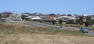
Waurn Ponds is a mainly residential southern suburb of Geelong, Victoria, Australia.

Geelong West, Victoria Suburb of Geelong, Victoria, Australia

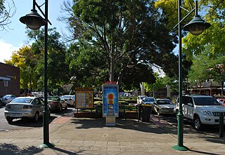
Geelong West is a commercial and residential suburb of Geelong, Victoria, Australia. When Geelong was founded, the area was known as Kildare but its name was changed to Geelong West in 1875. The main street is Pakington Street. At the 2016 census, Geelong West had a population of 6,966.

Newtown is an inner western suburb of Geelong, Victoria, Australia. At the 2016 census, Newtown had a population of 10,155. It is a primarily residential area occupying one of the highest points of urban Geelong, has always been a desirable place of residence and it is the location of many of Geelong's oldest and most valuable properties.

Highton, Victoria Suburb of Geelong, Victoria, Australia

Highton is a residential suburb of Geelong, Victoria, Australia. With views across Geelong, Corio Bay and the surrounding region, Highton is located along the banks of the Barwon River and across the rolling Barrabool Hills. The Barwon River straddles Highton to the north and east, while it is bordered by the hilly Ceres and Wandana Heights to the west, the former Kardinia Creek separates the suburb from Belmont to the south-east, and the Princes Highway and Pigdons Road to the south separate the suburb from Waurn Ponds.

Belmont, Victoria Suburb of Geelong, Victoria, Australia

Belmont is a southern suburb of Geelong, Victoria, Australia. The name means "beautiful hill". Belmont is geographically separated from the Geelong central business district by the Barwon River. The suburb is primarily residential, with some light industry along Barwon Heads Road. The suburb is part of the City of Greater Geelong local government area. At the 2011 census, Belmont had a population of 13,616.
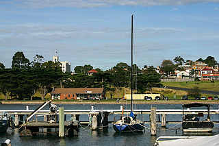
Portarlington, Victoria Town in Victoria, Australia

Portarlington is a historic coastal township located on the Bellarine Peninsula, 28 km from the city of Geelong, in the state of Victoria, Australia. It has a diverse population which includes a wide range of ethnic backgrounds, a high proportion of retirees, and a large seasonal holiday influx. The gently rising hills behind the town feature vineyards and olive groves, and offer spectacular panoramic views across Port Phillip Bay. Portarlington is a popular family holiday destination and a centre of fishing and aquaculture (mussels). At one time the town claimed the largest Caravan Park in the Southern Hemisphere, although the size has reduced considerably in recent decades. With direct ferry links to the city of Melbourne Portarlington also serves as a gateway to the historic towns and surf beaches of the Bellarine Peninsula.

Winchelsea, Victoria Town in Victoria, Australia

Winchelsea is a town in Victoria, Australia. The town is located in the Surf Coast Shire local government area, the suburb or locality of Winchelsea is predominantly within Surf Coast Shire with a small section within the Colac Otway Shire. Winchelsea is located on the Barwon River 115 km south-west of Melbourne and close to Geelong.

Coffee palace Type of residential hotel

A coffee palace was an often large and elaborate residential hotel that did not serve alcohol, most of which were built in Australia in the late 19th century.

Geelong Arts Centre

Geelong Arts Centre, formerly the Geelong Performing Arts Centre (GPAC), is a performing arts, functions, and events venue located in Geelong, Victoria, Australia. The complex is located between Little Malop and Ryrie Streets in central Geelong, and comprises a number of venues. It also hosts Creative Engine, a sector of the organisation that runs programs such as Community Fuel.

The Barrabool Hills are a small region in south-Western Victoria, on the western outskirts of Geelong. The National Trust of Australia describes the hills as being a "distinctive upland ridge located to the west of Geelong, on the south side of the Barwon River", that "slope steeply on the northern side down to the Barwon River, and more gently southward to the coastal lowland." The area stretches roughly through the modern localities of Gnarwarre, Barrabool and Ceres, and straddles the intersection of the City of Greater Geelong, Surf Coast Shire and Golden Plains Shire.

Victoria Square House Commercial in Birmingham, England

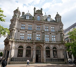
Victoria Square House, is an office building on the south side of Victoria Square, Birmingham, England. It was formerly Birmingham's Head Post Office, designed in the French Renaissance style by architect for the Office of Works Henry Tanner for the General Post Office.
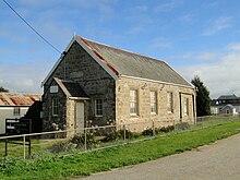
Buckley is a rural locality in the Surf Coast Shire, Victoria, Australia. It was formerly known as Laketown. In the 2016 census, Buckley had a population of 211 people.

Mount Moriac is a rural locality in the Surf Coast Shire, Victoria, Australia. In the 2016 census, Mount Moriac had a population of 240 people.

Paraparap is a rural locality in the Surf Coast Shire, Victoria, Australia. At the 2016 census, Paraparap had a population of 151 people.
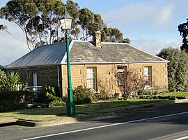
Gnarwarre is a rural locality in the Surf Coast Shire, Victoria, Australia. In the 1800s, the locality was alternately known as Shankhill. In the 2016 census, Gnarwarre had a population of 267 people.

Barrabool is a rural locality in the Surf Coast Shire, Victoria, Australia. In the 2016 census, Barrabool had a population of 235 people.

References

  1. 1 2 Australian Bureau of Statistics (27 June 2017). "Ceres (SSC)". 2016 Census QuickStats. Retrieved 16 November 2017. OOjs UI icon edit-ltr-progressive.svg
  2. Wynd, Ian (1992). Barrabool: Land of the Magpie. pp. 22, 69. ISBN   0646089072.
  3. 1 2 Wynd 1992, p. 69.
  4. 1 2 Post Office List, Phoenix Auctions History, retrieved 9 March 2021
  5. Wynd 1992, p. 69-70.
  6. 1 2 Wynd 1992, p. 72.
  7. "Barrabool Hills (Highton) Cemetery". Geelong Cemeteries Trust. Retrieved 12 July 2014.
  8. Wynd 1992, p. 73.
  9. "Ceres Temperance Hall circa 1862". Theatre of the Winged Unicorn. Archived from the original on 14 July 2014. Retrieved 11 July 2014.
  10. Wynd 1992, p. 74.
  11. "2013 Annual Report". Ceres Primary School. Retrieved 11 July 2014.[ permanent dead link ]
  12. "Port Phillip West Congregations" (PDF). Uniting Church in Australia. Archived from the original (PDF) on 1 April 2014. Retrieved 11 July 2014.
  13. "Theatre of the Winged Unicorn" . Retrieved 11 July 2014.
  14. "Barrabool Cricket Club". Community Directory. City of Greater Geelong. Retrieved 2 August 2021.