North Geelong, Victoria

Last updated

North Geelong
Geelong,  Victoria
North Geelong Sphinx Hotel.JPG
North Geelong Sphinx Hotel
Population2,966 (2016 census) [1]
Postcode(s) 3215
Elevation19 m (62 ft)
Location
LGA(s) City of Greater Geelong
State electorate(s) Lara
Federal division(s) Corio
Suburbs around North Geelong:
Bell Park Norlane North Shore
Bell Park North Geelong Corio Bay
Hamlyn Heights Geelong West Rippleside
Drumcondra

North Geelong is a suburb of Geelong in the Australian state of Victoria. The suburb was bypassed by traffic from Melbourne coming from the Princes Freeway by the creation of the Geelong Ring Road, which was complete in 2009. At the 2016 census, North Geelong had a population of 2,966. [1]

Contents

The Australian department store, Target (not affiliated with the American Target Corporation), was founded in Geelong in 1925 and was called Lindsay's at the time. Its head office was located on Thompson Road but is no longer there.

The suburb has an Australian rules football team competing in the Geelong & District Football League and a Croatian association football team North Geelong Warriors FC that are currently competing in the National Premier Leagues Victoria.

History

From 1858 to 1971 a gasworks was operated by the Geelong Gas Company on a site on Victoria and Douro Streets with a connecting rail to the Geelong Ports. The current Post Office opened in 1987. An earlier office dating from 1886 was replaced by Rippleside in 1986. [2]

Osborne House was built on the shores of Corio Bay in 1858 as a private residence, later being used by the Royal Australian Navy, local council officers, and is currently the home of the Geelong Maritime Museum.

In the 1950s through to the early 1970s the suburb saw a drastic increase in housing construction, in part fuelled by Geelong's growing industries and manufacturing sector.

In 1973, the Victoria Street level crossing adjacent to the southern end of the station was replaced by a road overpass, known as the Margaret Street overpass, and a pedestrian underpass. In 1976, both platforms were extended by over 60 metres. The main station building on Platform 1 was replaced on 8 August 1990, and in 2008 the smaller building on Platform 2 was replaced by a metal shelter.

In 1998 hotel owner Ray Ramia erected a 15m-high polystyrene replica of the Great Sphinx of Giza atop his hotel, known as the Sphinx Hotel. [3]

In Fyansford Cement Works Railway, originally opened in 1918, was removed in the early 2000s after the cement works closure in 2000. The train lines removal helped ease growing congestion on Thompson Road, and reduced noise pollution for local residents.[ citation needed ] Prior to its removal, a bike and pedestrian path, known as Linear Park, was constructed in the 1980s alongside the rail line.

In 2012 Bayside Demolition [4] started operating from the federal mills and has since become Geelong's leading demolition contractor

In 2012, a part of North Geelong was redistributed. This included businesses and houses on the eastern side of Melbourne Road and around St. Helens Park, between Victoria Street to Swinburne Street. Initially residents hoped to become their own suburb called 'St. Helens', though the name was unavailable and instead joined neighbouring Rippleside.

In 2017, Target announced they would be leaving their North Geelong headquarters for a larger facility. Their new facility is currently being constructed at Williams Landing opposite the rail station of the same name in Melbourne's west.

Geelong Arena

The Geelong Arena includes an indoor pool, basketball court capable of hosting 2000 people. The Arena also acts as an events centre hosting numerous musicians and acts over the years, and served as a venue during the 2006 Commonwealth Games basketball tournaments.

Geelong Golf Club

Formed in 1892, the original 18-hole course was one of Australia's oldest courses and was open for more than 100 years. The golf course was closed for a number of years during its re-development of the site and has since re-opened as a nine-hole course. [5]

In late 2013 construction of the Geelong Golf Club Residential Estate began on the golf club site, with plans for 350 new homes, parks and 9-hole golf course included as a part of the redevelopment.

Geelong Saleyards

The early Geelong Town Corporation bought land for the saleyards in 1867 and opened the facility in 1869. It has operated as a livestock exchange ever since. [6]

Its location was chosen based on its proximity to North Geelong Station, with two rail lines, the Ballarat and Warrnambool lines, converging nearby.

North Geelong Resource Recovery Centre & Transfer station

Located on Douro Street, the facility accepts most domestic waste. Recyclable materials such as paper, glass, metal, white goods and technology are accepted free of charge. Some items like furniture and books are resold at an on site shop. [7]

North Geelong is also the home of Bayside Demolition, and a number of major industrial businesses that contribute to its strong resources recycling contribution to Geelongs economy

Public Spaces & Parkland

Corio Bay Foreshore

The area runs parallel to the St Helens Boat ramp, popular with recreational fisherman. With a clear view of the nearby Corio Quay shipping ports.

Cowies Creek

The efforts of the adjoining Wathaurong Aboriginal Co-operative and Geelong City Council have aided in the Cowies Creek preservation. Cowies Creek is a public wetland with boardwalks running throughout. The conservation area hosts native species, including snakes, lizards and water birds, as well as various bush trees and grasses.

Car parking, space and scattered picnic tables service the area.

Osborne Park

Osborne Park is a reserve adjacent to historic Osborne House. The reserve has two ovals, one with a turf wicket and also accommodates a fire brigade, running track and netball court.

Osborne Avenue Reserve

This small neighbourhood park includes a slide, swing and rocker.

Tom McKean Linear Park

In Fyansford Cement Works Railway, originally opened in 1918, was removed in the early 2000s after the cement works closure in 2000. The train lines removal helped ease growing congestion on Thompson Road, and reduced noise pollution for local residents. [ citation needed ] Prior to its removal, a bike and pedestrian path, known as Linear Park, was constructed in the 1980s alongside the rail line.

The Linear Park runs through North Geelong, Bell Park, Hamlyn Heights through to Fyansford.

Western Oval

The sport and recreational reserve has a playground, sports oval suitable for cricket and football and netball courts. Its historic Grand Stand remains in use.

Wathaurong Aboriginal Co-operative

The Wathaurong Aboriginal Co-operative is a local community centre which serves the local Wathaurong people, who originally inhabited North Geelong and its surrounding suburbs prior to white settlement in the 1850s.

Transport

Buses

Several bus routes serve the suburb, including:

Route 1, Route 20, Route 22 and Route 24.

North Geelong Station

The North Geelong railway station services North Geelong and its surrounding suburbs.

Heritage listings

North Geelong contains a number of heritage listed sites, including:

See also

Related Research Articles

<span class="mw-page-title-main">Geelong</span> City in Victoria, Australia

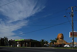
Geelong is a port city in Victoria, Australia, located at the eastern end of Corio Bay and the left bank of Barwon River, about 65 km (40 mi) southwest of Melbourne.

<span class="mw-page-title-main">City of Greater Geelong</span> Local government area in Victoria, Australia

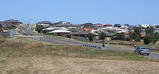
The City of Greater Geelong is a local government area in the Barwon South West region of Victoria, Australia, located in the western part of the state. It covers an area of 1,248 square kilometres (482 sq mi) and, had a population of 271,057 as of the 2021 Australian census. It is primarily urban with the vast majority of its population living in the Greater Geelong urban area, while other significant settlements within the LGA include Anakie, Balliang, Barwon Heads, Batesford, Ceres, Clifton Springs, Drysdale, Lara, Ocean Grove, Portarlington and St Leonards. It was formed in 1993 from the amalgamation of the Rural City of Bellarine, Shire of Corio, City of Geelong, City of Geelong West, City of Newtown, City of South Barwon, and parts of Shire of Barrabool and Shire of Bannockburn.

Hamilton Highway is a rural highway in western Victoria, Australia, linking Geelong and the town of Hamilton, through the localities of Inverleigh, Cressy, Lismore, Derrinallum, Darlington, Mortlake, and Penshurst. Glenelg Highway links Hamilton across the South Australian border to Mount Gambier, making Hamilton Highway a popular alternative Melbourne-Mount Gambier route.

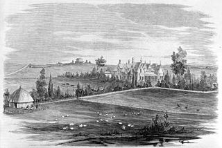
This is a timeline of major events in the history of the city of Geelong, Australia.

Lovely Banks is a northern suburb of Geelong, Victoria, Australia. Once an agricultural and rural area, the suburb is quickly developing into a residential area adjoining the Geelong suburbs of Bell Park, Corio and Norlane. At the 2016 census Lovely Banks had a population of 2,301.

<span class="mw-page-title-main">Waurn Ponds, Victoria</span> Suburb of Geelong, Victoria, Australia

Waurn Ponds is a mainly residential southern suburb of Geelong, Victoria, Australia.

<span class="mw-page-title-main">North Shore, Victoria</span> Suburb of Geelong, Victoria, Australia

North Shore is an industrial and residential suburb of Geelong, Victoria, Australia. The suburb overlooks Corio Bay. A small residential area is east of the North Shore railway station with a few neighbourhood shops.

<span class="mw-page-title-main">Fyansford, Victoria</span> Suburb of Geelong, Victoria, Australia

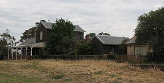
Fyansford is a township on the western edge of Geelong, Victoria, Australia, named after Captain Foster Fyans who came to Geelong as a Police magistrate in October, 1837. It is located at the junction of the Barwon and Moorabool rivers. At the 2016 census, Fyansford had a population of 196.

<span class="mw-page-title-main">Bell Park, Victoria</span> Suburb of Geelong, Victoria, Australia

Bell Park is a residential suburb of Geelong, Victoria, Australia. It is located 3 km north-west of the Geelong city centre and is bordered to the north by Cowies Creek, to the east by Thompson Road, to the south by the Midland Highway and to the west by Anakie Road.

<span class="mw-page-title-main">Bell Post Hill, Victoria</span> Suburb of Geelong, Victoria, Australia

Bell Post Hill is a residential suburb of Geelong, Victoria, Australia. At the 2016 census, Bell Post had a population of 4,919.

<span class="mw-page-title-main">Belmont, Victoria</span> Suburb of Geelong, Victoria, Australia

Belmont is a southern suburb of Geelong, Victoria, Australia. The name means "beautiful hill". Belmont is geographically separated from the Geelong central business district by the Barwon River. The suburb is primarily residential, with some light industry along Barwon Heads Road. The suburb is part of the City of Greater Geelong local government area. At the 2011 census, Belmont had a population of 13,616. It is also the home of champion junior mountain bike cyclist Luis Goldstraw, also known as Princess Louisa.

<span class="mw-page-title-main">Rippleside, Victoria</span> Suburb of Geelong, Victoria, Australia

Rippleside is a suburb of Geelong, Victoria, Australia. The suburb overlooks Corio Bay. At the 2016 census, Rippleside had a population of 875.

<span class="mw-page-title-main">Barwon Heads, Victoria</span> Town in Victoria, Australia

Barwon Heads is a coastal township on the Bellarine Peninsula, near Geelong, Victoria, Australia. It is situated on the west bank of the mouth of the Barwon River below Lake Connewarre, while it is bounded to the west by farmland, golf courses and the saline ephemeral wetland of Murtnaghurt Lagoon. At the 2016 census, Barwon Heads had a population of 3,875.

<span class="mw-page-title-main">Bannockburn, Victoria</span> Town in Victoria, Australia

Bannockburn is a town near Geelong, Victoria, Australia, 88 km southwest of Melbourne. It is located in Golden Plains Shire. In the 2021 census, Bannockburn had a population of 6,470.

<span class="mw-page-title-main">North Geelong railway station</span> Railway station in Geelong, Victoria, Australia

North Geelong railway station is located on the Warrnambool line in Victoria, Australia. It serves the northern Geelong suburb of North Geelong, and opened on 1 August 1883 as West Geelong. It was renamed North Geelong on 1 January 1886.

<span class="mw-page-title-main">North Shore railway station</span> Railway station in Geelong, Victoria, Australia

North Shore railway station is located on the Warrnambool line in Victoria, Australia. It serves the northern Geelong suburbs of North Shore and Norlane, and it opened on 15 April 1895. It was renamed Corio on 27 September 1909, and was renamed North Shore on 1 December 1913.

<span class="mw-page-title-main">Corio railway station</span> Railway station in Geelong, Victoria, Australia

Corio railway station is located on the Warrnambool line in Victoria, Australia. It serves the northern Geelong suburb of Corio, and it opened on 15 September 1890 as Cowie's Creek. It was renamed Cowie on 9 May 1904, and renamed Corio on 1 December 1913.

<span class="mw-page-title-main">Geelong and Melbourne Railway Company</span>

The Geelong and Melbourne Railway Company was a railway company in Victoria, Australia. Alexander Thomson, a member of the Victorian Legislative Council, introduced and mentored a bill to incorporate the Geelong and Melbourne Railway Company. On 8 February 1853, the operation of Melbourne and Geelong Railway Company and Mount Alexander and Murray River Railway Company was approved by the Victoria Government. Thomson was one of the directors and presided at the first shareholder meeting. Work began at the Geelong end in 1854 but progress was slow due to a labour shortage caused by the Victorian gold rush, so the Victorian government hired out 100 prisoners to the company at a daily rate of five shillings each. They were housed in prison hulks moored in Corio Bay. English engineer and surveyor, Edward Snell, undertook the survey and design of the line, including a station and extensive workshops at Geelong, and a number of bluestone and timber bridges.

<span class="mw-page-title-main">Scotchmans Creek Trail</span>

The Scotchmans Creek Trail is a shared use path for cyclists and pedestrians, which follows Scotchmans Creek through the eastern suburbs of Melbourne, Victoria, Australia.

<span class="mw-page-title-main">Railway tunnels in Victoria</span>

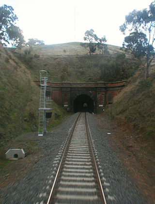
The Australian state of Victoria has only ever had about 10 tunnels on its railway network, with some others on private narrow gauge tramways. This is due to the relatively easy terrain through which most of the lines were built.

References

  1. 1 2 Australian Bureau of Statistics (27 June 2017). "North Geelong (State Suburb)". 2016 Census QuickStats. Retrieved 16 November 2017. OOjs UI icon edit-ltr-progressive.svg
  2. Phoenix Auctionsl History, Post Office List , retrieved 17 January 2021
  3. "Sphinx with the lot, but hold the pyramids". Geelong Advertiser . www.geelongadvertiser.com.au. Retrieved 8 June 2008.
  4. "Follow us on facebbok". Bayside Demolition Geelong. Retrieved 31 March 2023.
  5. "Geelong Golf Course" . Retrieved 15 August 2015.
  6. "ABout the Geelong Saleyards" . Retrieved 25 August 2017.
  7. "Geelong Resource Recovery Centre and Transfer Station". www.geelongaustralia.com.au. Retrieved 17 October 2018.

38°06′29″S144°20′35″E / 38.108°S 144.343°E / -38.108; 144.343