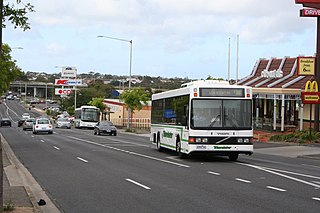
Geelong is a port city in Victoria, Australia, located at the eastern end of Corio Bay and the left bank of Barwon River, about 75 km (47 mi) southwest of Melbourne. With an estimated population of 282,809 in 2023, Geelong is the second largest city in the state of Victoria. It is the administrative centre for the City of Greater Geelong municipality, which is Port Phillip's only regional metropolitan area, and covers all the urban, rural and coastal reserves around the city including the entire Bellarine Peninsula and running from the plains of Lara in the north to the rolling hills of Waurn Ponds to the south, with Corio Bay to the east and the Barrabool Hills to the west.

The City of Greater Geelong is a local government area in the Barwon South West region of Victoria, Australia, located in the western part of the state. It covers an area of 1,248 square kilometres (482 sq mi) and, had a population of 271,057 as of the 2021 Australian census. It is primarily urban with the vast majority of its population living in the Greater Geelong urban area, while other significant settlements within the LGA include Anakie, Balliang, Barwon Heads, Batesford, Ceres, Clifton Springs, Drysdale, Lara, Ocean Grove, Portarlington and St Leonards. It was formed in 1993 from the amalgamation of the Rural City of Bellarine, Shire of Corio, City of Geelong, City of Geelong West, City of Newtown, City of South Barwon, and parts of Shire of Barrabool and Shire of Bannockburn.

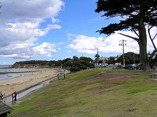
Torquay is a seaside resort in Victoria, Australia, which faces Bass Strait, 21 km south of Geelong and is the gateway to the Great Ocean Road. It is bordered on the west by Spring Creek and its coastal features include Point Danger and Zeally Bay. At the 2021 census, Torquay had a population of 18,534.

The Barwon River is a perennial river of the Corangamite catchment, located in The Otways and the Bellarine Peninsula regions of the Australian state of Victoria.

Clifton Springs is a coastal town located on the Bellarine Peninsula, near Geelong, Victoria, Australia.
St. Albans Park is a residential suburb of Geelong, Victoria, 6 km southeast from Geelong's city centre. It is bounded by Boundary Road (West), Coppards Road (East), Townsend Road (North) and the Barwon River (South). The suburbs that surround it are Whittington, Breakwater, Moolap and Marshall. The suburb extends around the St. Albans Homestead and stud, a historic house and accompanying stables. At the 2021 census, St. Albans Park had a population of 4,942.

Bell Post Hill is a residential suburb of Geelong, Victoria, Australia. At the 2016 census, Bell Post had a population of 4,919.

Belmont is a southern suburb of Geelong, Victoria, Australia. The name means "beautiful hill". Belmont is geographically separated from the Geelong central business district by the Barwon River. The suburb is primarily residential, with some light industry along Barwon Heads Road. The suburb is part of the City of Greater Geelong local government area. At the 2011 census, Belmont had a population of 13,616.

Drysdale is a rural township near Geelong, Victoria, Australia, located on the Bellarine Peninsula. The town has an approximate population of over 3,700. Drysdale forms part of an urban area, along with nearby Clifton Springs, that had an estimated population of 13,494 at June 2016.

Barwon Heads is a coastal township on the Bellarine Peninsula, near Geelong, Victoria, Australia. It is situated on the west bank of the mouth of the Barwon River below Lake Connewarre, while it is bounded to the west by farmland, golf courses and the saline ephemeral wetland of Murtnaghurt Lagoon. At the 2016 census, Barwon Heads had a population of 3,875.

Point Lonsdale is a coastal township on the Bellarine Peninsula, near Queenscliff, Victoria, Australia. The town is divided between the Borough of Queenscliffe and the City of Greater Geelong. Point Lonsdale is also one of the headlands which, with Point Nepean, frame The Rip, the entrance to Port Phillip. The headland is dominated by the Point Lonsdale Lighthouse. At the 2016 census, Point Lonsdale had a population of 2,684. The population grows rapidly over the summer months through to the Easter period due to its popularity as a holiday destination.

St Leonards is a coastal township on the Bellarine Peninsula near Geelong, Victoria, Australia. Situated 33 kilometres (21 mi) east of Geelong, at the eastern end of the Bellarine Peninsula and the northern end of Swan Bay, St Leonards was a filming location for the Australian television series SeaChange.

Winchelsea is a town in Victoria, Australia. The town is located in the Surf Coast Shire local government area, the suburb or locality of Winchelsea is predominantly within Surf Coast Shire with a small section within the Colac Otway Shire. Winchelsea is located on the Barwon River 115 km south-west of Melbourne and close to Geelong.

The Bellarine Peninsula is a peninsula located south-west of Melbourne in Victoria, Australia, surrounded by Port Phillip, Corio Bay and Bass Strait. The peninsula, together with the Mornington Peninsula, separates Port Phillip Bay from Bass Strait. The peninsula itself was originally occupied by Indigenous Australian clans of the Wadawurrung nation, prior to European settlement in the early 19th century. Early European settlements were initially centred on wheat and grain agriculture, before the area became a popular tourist destination with most visitors arriving by paddle steamer on Port Phillip in the late 19th century.
Mount Duneed is a suburb of Geelong, Victoria, Australia. It is divided between the City of Greater Geelong and Surf Coast Shire local government areas. Mount Duneed itself is an extinct volcano and the remains of the crater can be seen in the Mount Duneed Recreation Reserve.
Connewarre is a locality in Victoria, Australia, is located in the City of Greater Geelong and Surf Coast Shire, and is named after Lake Connewarre which is situated immediately to its north-east. Connewarre is a version of "kunuwarra", the name of the black swan in the Wathawurrung language. At the 2016 census, Connewarre and the surrounding area had a population of 788.

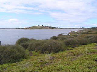
Lake Connewarre, a shallow estuarine 880-hectare (2,200-acre) lake on the Barwon River, is located on the Bellarine Peninsula southeast of Geelong in the Australian state of Victoria.

Lake Connewarre State Wildlife Reserve (LCSWR) is a 3411.1 ha Park in Victoria, Australia, that contains a diverse range of unique and significant ecosystems including a river, tidal delta, lakes, swamps, salt marshes and grasslands.
Curlewis is a bounded rural locality of the City of Greater Geelong local government area on the Bellarine Peninsula, Victoria, Australia. At the 2021 census, Curlewis had a population of 4,175.
Bellarine is a rural locality in the City of Greater Geelong, Victoria, Australia. In the 2011 census, the population of Bellarine was too low to separately report; however in June 2014 the Victorian Electoral Commission recorded 134 enrolled voters in Bellarine, living in 81 properties.


