Related Research Articles

Grovedale is a mainly residential southern suburb of Geelong, Victoria, Australia. At the 2016 census, Grovedale had a population of 14,308.
Lovely Banks is a northern suburb of Geelong, Victoria, Australia. Once an agricultural and rural area, the suburb is quickly developing into a residential area adjoining the Geelong suburbs of Bell Park, Corio and Norlane. At the 2016 Census Lovely Banks had a population of 2,301.

Norlane is a northern suburb of Geelong, in Victoria, Australia. Norlane is bordered in the south by Cowies Creek, in the north by Cox Road, in the west by Thompson Road and in the east by Station Street. It is about 7 km from the Geelong central business district and approximately 70 km from the state capital, Melbourne. It is about one kilometre from the shore of Corio Bay. At the 2016 Census, Norlane had a population of 8,306.
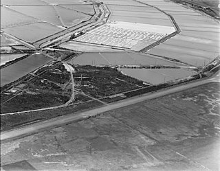
Moolap is a residential and industrial suburb of Geelong, Victoria, Australia. The name Moolap is derived from an Aboriginal word for nearby Point Henry, moo-laa, thought to mean 'men gathering to go fishing'.
Breakwater is a residential and industrial suburb of Geelong, Victoria, Australia, located on the Barwon River, 4 km south-south-east of the Geelong central business district. At the 2016 Census Breakwater had a population of 1,014. Breakwater is home to the Geelong Racing Club, Geelong Racecourse and the Geelong Showgrounds.
Leopold is a residential eastern suburb of Geelong and is a gateway to the Bellarine Peninsula. At the 2016 Census, Leopold had a population of 12,814.

Geelong West is a commercial and residential suburb of Geelong, Victoria, Australia. When Geelong was founded, the area was known as Kildare but its name was changed to Geelong West in 1875. The main street is Pakington Street. At the 2016 Census, Geelong West had a population of 6,966.
Drumcondra is a wealthy residential bayside suburb of Geelong, Victoria, Australia, overlooking Corio Bay. It is the smallest suburb in Geelong and one of the smallest in Victoria. It was named after Drumcondra, which is an inner suburb of Dublin, Ireland. At the 2016 census, Drumcondra had a population of 560.
Newtown is an inner western suburb of Geelong, Victoria, Australia. At the 2016 census, Newtown had a population of 10,155. It is a primarily residential area occupying one of the highest points of urban Geelong, has always been a desirable place of residence and it is the location of many of Geelong's oldest and most valuable properties.
East Geelong is a residential suburb of Geelong, Victoria, Australia. At the 2016 census, East Geelong had a population of 3,862.

Hamlyn Heights is a residential suburb of Geelong. It located to the west of the city on hills that overlook Corio Bay.
Bannockburn is a rural township near Geelong, Victoria, Australia, 88 km southwest of Melbourne. It is located in Golden Plains Shire. In the 2016 census, Bannockburn had a population of 5,283.
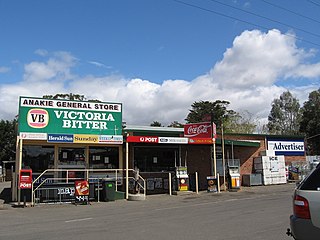
Anakie is a rural township between Geelong and Bacchus Marsh, Victoria, Australia. At the 2016 census, Anakie and the surrounding area had a population of 690. The town is divided between the City of Greater Geelong and Golden Plains Shire local government areas.
Rossmore is a suburb of Sydney, in the state of New South Wales, Australia.

Inverleigh is a small rural township in Victoria, Australia located 28 kilometres (17 mi) west from the City of Geelong and 87 kilometres (54 mi) from the state capital, Melbourne. The town is divided between Golden Plains Shire and Surf Coast Shire. In the 2016 census, the central area of Inverleigh had a population of 1,474. Inverleigh is known to be a popular stopover destination on the way to Lorne. The Inverleigh Hotel is very popular attracting customers from Geelong.

The City of Geelong West was a local government area about 5 kilometres (3 mi) west of the regional city of Geelong, Victoria, Australia. The city covered an area of 5.26 square kilometres (2.0 sq mi), and existed from 1875 until 1993.

Moorabool is a bounded rural locality of the City of Greater Geelong local government area in Victoria, Australia.
Bellarine is a rural locality in the City of Greater Geelong, Victoria, Australia. In the 2011 census, the population of Bellarine was too low to separately report; however in June 2014 the Victorian Electoral Commission recorded 134 enrolled voters in Bellarine, living in 81 properties.
Barrabool is a rural locality in the Surf Coast Shire, Victoria, Australia. In the 2016 census, Barrabool had a population of 235 people.
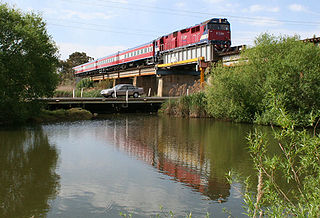
Cowies Creek Rail Bridge No. 1 is a bridge in Victoria, Australia, on the Geelong-Ballarat rail line in the outer Geelong suburb of Bell Post Hill. Constructed of bluestone in 1860 to cross both Cowies Creek and a roadway, the structure is listed in the Victorian Heritage Register.
References
- 1 2 Australian Bureau of Statistics (27 June 2017). "Manifold Heights (State Suburb)". 2016 Census QuickStats. Retrieved 16 November 2017.
- ↑ "Manifold Heights | Victorian Places". www.victorianplaces.com.au. Retrieved 12 November 2018.
- ↑ Phoenix Auctions History, Post Office List , retrieved 10 March 2021
- ↑ "Holy Spirit Church (H1110)". Victorian Heritage Register. Heritage Victoria. Retrieved 2014-03-26.
Coordinates: 38°08′24″S144°19′48″E / 38.140°S 144.33°E
| | This article about a location in Barwon South West (region) is a stub. You can help Wikipedia by expanding it. |