
Geelong is a port city located on Corio Bay and the Barwon River, in the state of Victoria, Australia. Geelong is 75 kilometres (47 mi) south-west of the state capital, Melbourne. It is the second largest Victorian city, with an estimated urban population of 268,277 as of June 2018. It is also Australia's second fastest growing city. Geelong runs from the plains of Lara in the north to the rolling hills of Waurn Ponds to the south, with Corio Bay to the east and the Barrabool Hills to the west. Geelong is the administrative centre for the City of Greater Geelong municipality, which covers urban, rural and coastal areas surrounding the city, including the Bellarine Peninsula.

Werribee is a suburb of Melbourne, Victoria, Australia, 32 km south-west of Melbourne's Central Business District, located within the City of Wyndham local government area. Werribee recorded a population of 40,345 at the 2016 Census.

Deer Park is a suburb of Melbourne, Victoria, Australia, 17 km west of Melbourne's Central Business District, located within the City of Brimbank local government area. Deer Park recorded a population of 18,126 at the 2016 Census.
Corio is a residential and industrial area, which forms one of the largest suburbs of Geelong, Victoria in Australia. It is located approximately 9 km north of the Geelong central business district. The area was formerly known as Cowie's Creek after James Cowie, an early land owner who was active in the local and state government.

Norlane is a northern suburb of Geelong, in Victoria, Australia. Norlane is bordered in the south by Cowies Creek, in the north by Cox Road, in the west by Thompson Road and in the east by Station Street. It is about 7 km from the Geelong central business district and approximately 70 km from the state capital, Melbourne. It is about one kilometre from the shore of Corio Bay. At the 2016 Census, Norlane had a population of 8,306.
Leopold is a residential eastern suburb of Geelong and is a gateway to the Bellarine Peninsula. At the 2016 Census, Leopold had a population of 12,814.
Manifold Heights is a residential suburb of Geelong. At the 2016 census, Manifold Heights had a population of 2,649.

Geelong North is a suburb of Geelong in the Australian state of Victoria. The suburb was bypassed by traffic from Melbourne coming from the Princes Freeway by the creation of the Geelong Ring Road, which was complete in 2009. At the 2016 census, Geelong North had a population of 2,966. It is often referred to as North Geelong
Highton is an affluent residential suburb of Geelong, Victoria, Australia. With views across Geelong, Corio Bay and the surrounding region, Highton is located along the banks of the Barwon River and across the rolling Barrabool Hills. The Barwon River straddles Highton to the north and east, while it is bordered by the hilly Ceres and Wandana Heights to the west, the former Kardinia Creek separates the suburb from Belmont to the south-east, and the Princes Highway and Pigdons Road to the south separate the suburb from Waurn Ponds.

Belmont is a southern suburb of Geelong, Victoria, Australia. The name means "beautiful hill". Belmont is geographically separated from the Geelong central business district by the Barwon River. The suburb is primarily residential, with some light industry along Barwon Heads Road. The suburb is part of the City of Greater Geelong local government area. At the 2011 census, Belmont had a population of 13,616.

Rippleside is a suburb of Geelong, Victoria, Australia. The suburb overlooks Corio Bay. At the 2016 census, Rippleside had a population of 875.

Hamlyn Heights is a residential suburb of Geelong. It located to the west of the city on hills that overlook Corio Bay.

Avondale Heights is a suburb 11 km north-west of Melbourne, Victoria, Australia. Its local government area is the City of Moonee Valley. At the 2016 Census, Avondale Heights had a population of 11,633.

The Geelong Ring Road is a freeway ring road in Australia that extends for 27 km (17 mi) beside Geelong's western suburbs from the Princes Freeway at Corio to the Princes Highway at Waurn Ponds. It also connects to the Midland Highway towards Ballarat, and the Hamilton Highway. Sections one and two were officially opened 14 December 2008, with section three on 14 June 2009. Section four opened in January 2013 extending to the Princes Highway at Mount Moriac, which now avoids the narrow and windy road from Waurn Ponds towards Winchelsea.

Wheeler Heights is a suburb of Northern Sydney, in the state of New South Wales, Australia. Wheeler Heights is located 22 kilometers north-east of the Sydney central business district, in the local government area of Northern Beaches Council and is part of the Northern Beaches region. Wheeler Heights was designated as a separate suburb in 1977 with a postcode of 2097 but was reassigned as a locality within Collaroy in 1984. In 2001, all localities were renamed Urban Places. In 2011, Wheeler Heights, along with Collaroy Plateau, was re-established as a suburb by the Geographical Names Board of NSW, after lobbying by the community, who had never ceased considering it to be a suburb since its loss of that title in 1984.

Belconnen is the most inner suburb of the larger district of Belconnen in Canberra, Australia. Sharing its name with the larger district which encapsulates it, the suburb is surrounded with well developed infrastructure, and planning which allows it sunset views from the Brindabellas on its western side. The suburb contains important amenities for the District of Belconnen including the Belconnen Town Centre and Lake Ginninderra as well as its own well populated residential areas. It is bounded by Ginninderra Drive, Aikman Drive, Eastern Valley Way, Belconnen Way and Coulter Drive. It has a number of parks such as Margaret Timpson Park, Eastern Valley Oval, and on the foreshores of Lake Ginninberra, Diddams Close Park and John Knight Memorial Park.

Dover Heights is a coastal, eastern suburb of Sydney, in the state of New South Wales, Australia. Dover Heights is 9 kilometres east of the Sydney central business district, in the local government area of Waverley Council. Its postcode is 2030.

Gilles Plains is a suburb of the greater Adelaide, South Australia area, approximately 15 km north of the Adelaide central business district.
River Heights is a neighbourhood in Lawson Suburban Development Area, Saskatoon, Saskatchewan. Its eastern boundary borders the South Saskatchewan River. The suburb is just south of the Mall at Lawson Heights. Development of the neighbourhood began in the very early 1960s, with full build out completed by the early 1980s. Most of the neighbourhood's land was annexed by the city in the late 1950s, with the eastern third of the district annexed in 1974.
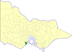
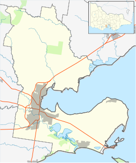
The Shire of Barrabool was a local government area about 100 kilometres (62 mi) southwest of Melbourne, the state capital of Victoria, Australia. The shire covered an area of 575.18 square kilometres (222.1 sq mi), and existed from 1853 until 1994.

