
Geelong is a port city located on Corio Bay and the Barwon River, in the state of Victoria, Australia. Geelong is 75 kilometres (47 mi) south-west of the state capital, Melbourne. It is the second largest Victorian city, with an estimated urban population of 268,277 as of June 2018. It is also Australia's second fastest growing city. Geelong runs from the plains of Lara in the north to the rolling hills of Waurn Ponds to the south, with Corio Bay to the east and the Barrabool Hills to the west. Geelong is the administrative centre for the City of Greater Geelong municipality, which covers urban, rural and coastal areas surrounding the city, including the Bellarine Peninsula.

Colac is a small city in the Western District of Victoria, Australia, approximately 150 kilometres south-west of Melbourne on the southern shore of Lake Colac and the surrounding volcanic plains, approximately 40 kilometres (25 mi) inland from Bass Strait. Colac is the largest city and administrative centre of the Colac Otway Shire. At June 2018, Colac had a population of 12,547.

Cressy is a country town in Victoria, Australia, about 38 km north of Colac on the Ballarat road. It is divided between Golden Plains Shire, the Shire of Colac Otway and Corangamite Shire. At the 2016 census, Cressy and the surrounding area had a population of 175. Terry Lewis played Australian rules football for Cressy in 1987. Lewis is regarded as one of the greatest footballers Cressy has ever seen.

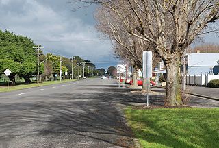
Birregurra is a town on Gulidjan Country in Victoria, Australia approximately 130 kilometres (81 mi) south-west of Melbourne. The town is divided between the Shire of Colac Otway and the Surf Coast Shire. At the 2016 census, Birregurra had a population of 828.

Colac railway station is located on the Warrnambool line in Victoria, Australia. It serves the town of Colac, and opened on 27 July 1877, as the terminus of the line from Birregurra. On 2 July 1883, the line was extended to Camperdown.
Beeac is a town in the Western District of Victoria, Australia. The town is located on the shore of the hyper-saline Lake Beeac in the Colac Otway Shire local government area, 160 kilometres southwest of the state capital, Melbourne. At the 2016 census, Beeac had a population of 370.

The Warrnambool railway line is a railway serving the south west of Victoria, Australia. Running from the western Melbourne suburb of Newport through the cities of Geelong and Warrnambool, the line once terminated at the coastal town of Port Fairy before being truncated to Dennington. This closed section of line has been converted into the 37 km long Port Fairy to Warrnambool Rail Trail. The line continues to see both passenger and freight services today.

The Crowes railway line was a 2 ft 6 in narrow gauge railway located in the Otway Ranges in south-western Victoria, Australia, running from the main line to Port Fairy at Colac to Beech Forest and later to Crowes.
The Colac & District Football Netball League (CDFNL) is a minor country football league based in the South West of Victoria in the city of Colac. As of 2016 the CDFNL has 10 clubs, all are located in the Colac Otway Shire with the exception of Lorne which falls within the Surf Coast Shire. The competition incorporates the two sports of Football and Netball they each have separate age divisions. Football have a Senior and Reserve division followed by Under 13s, Under 15s and Under 18's which are known as Junior's. That's why the CDFNL provides a sporting outlet for the young people in the region.
Netball has six; Under 13's, Under 15's and Under 17's followed by C Grade, B Grade and A Grade.

Wensleydale is a small rural community in Victoria, Australia.

Gellibrand is a town in south west Victoria, Australia. The town is located in the Otway Ranges midway between the Princes Highway and Great Ocean Road in the Colac Otway Shire, 176 kilometres (109 mi) south west of the state capital, Melbourne. At the 2016 census, Gellibrand had a population of 210. Gellibrand is home to the Otway Districts Demons Football and Netball Club, who play Australian Rules Football and participate in the Colac & District Football League.

The Alvie Football Netball Club is an Australian rules football club which competes in the Colac DFL since its founding in 1937. They are based in the Victorian town of Alvie. Alvie is approximately 12 km northwest of Colac, the main regional centre for the region. The current club champion and captain is Charlie Johns
Mount Moriac is a rural locality in the Surf Coast Shire, Victoria, Australia. In the 2016 census, Mount Moriac had a population of 240 people.
Pennyroyal is a rural locality in Victoria, Australia. Most of the locality is situated in the Surf Coast Shire; a small section is situated in the Shire of Colac Otway. In the 2016 census, Pennyroyal had a population of 86.
Benwerrin is a rural locality in the Surf Coast Shire, Victoria, Australia.
The Forrest railway line is a former branch railway in Victoria, Australia. It branched off the Warrnambool railway line at Birregurra, and ran through the foothills of the Otway Ranges to the town of Forrest.
Mount Sabine is a rural locality in the Shire of Colac Otway, Victoria, Australia. The small locality is located deep in the Otway Ranges, and is mostly densely forested.
Wongarra is a coastal locality in the Shire of Colac Otway, Victoria, Australia. In the 2016 census, Wongarra had a population of 37.
Norman Houghton is a historian and archivist in Geelong, Victoria, who has published over 30 books, many focusing on timber tramways and sawmills of the Otway and Wombat Forests of Western Victoria, Australia. Most of his works have been self-published, while he has provided numerous articles to the newsletter and journal of the Light Railway Research Society of Australia
The Alvie railway line was a branch line in Victoria, Australia, that left the Warrnambool line just west of Colac and proceeded in a generally north-westerly direction to Alvie. It was 16 kilometres long, and operated from 1923 to 1954.
