The City of Whitehorse is a local government area in Victoria, Australia in the eastern suburbs of Melbourne. It has an area of 64.3 km2 (25 sq mi) and an estimated residential population of 171,167 as of June 2021.
The City of Manningham is a local government area in Victoria, Australia in the north-eastern suburbs of Melbourne and is divided into 12 suburbs, with the largest being Doncaster and Doncaster East. It comprises an area of 113 square kilometres and had a population of 125,508 in June 2018.

Box Hill is a suburb of Melbourne, Victoria, Australia, 14 kilometres (8.7 mi) east of the city's Central Business District (CBD), located within the City of Whitehorse local government area. Box Hill recorded a population of 14,353 at the 2021 census.

The City of Warrnambool is a local government area in the Barwon South West region of Victoria, Australia, located in the south-western part of the state. It covers an area of 121 square kilometres (47 sq mi) and in June 2018 had a population of 34,862. It is entirely surrounded by the Shire of Moyne and the Southern Ocean. It is one of only a few regional councils in Victoria to remain serving just one urban district after the amalgamation process of 1994, although through that process it did gain some portions of the former Shire of Warrnambool.
Blackburn North is a suburb of Melbourne, Victoria, Australia, 17 km east of Melbourne's Central Business District, located within the City of Whitehorse local government area. Blackburn North recorded a population of 7,627 at the 2021 census.

Box Hill North is a suburb of Melbourne, Victoria, Australia, 14 km east from Melbourne's Central Business District, located within the City of Whitehorse local government area. Box Hill North recorded a population of 12,337 at the 2021 census.
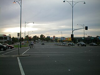
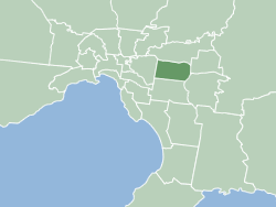
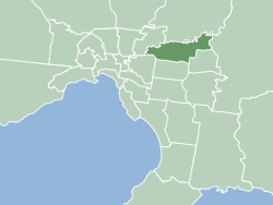
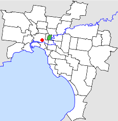
Nunawading is a suburb of Melbourne, Victoria, Australia, 18 km east of Melbourne's Central Business District, located within the City of Whitehorse and City of Manningham local government areas. Nunawading recorded a population of 12,413 at the 2021 census.

Vermont South is a suburb of Melbourne, Australia, 26 km east of its Central Business District. It had a population of 11,954 at the 2021 census.
The City of Collingwood was a local government area about 3 kilometres (2 mi) east-northeast of Melbourne, the state capital of Victoria, Australia. The city covered an area of 4.48 square kilometres (1.73 sq mi), and existed from 1855 until 1994.

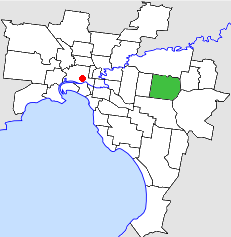
The City of Box Hill was a local government area about 15 kilometres (9 mi) east of Melbourne, the state capital of Victoria, Australia. The city covered an area of 21.50 square kilometres (8.30 sq mi), and existed from 1927 until 1994.
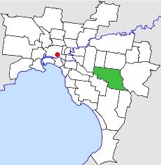
The City of Nunawading was a local government area about 20 kilometres (12 mi) east of Melbourne, the state capital of Victoria, Australia. The city covered an area of 41.61 square kilometres (16.07 sq mi), and existed from 1925 until 1994.

The City of Doncaster & Templestowe was a local government area about 20 kilometres (12 mi) east-northeast of Melbourne, the state capital of Victoria, Australia. The city covered an area of 89.42 square kilometres (34.53 sq mi), and existed from 1915 until 1994. At its peak in the early 1990s, it had a population of just over 100,000.
The City of Waverley was a local government area about 20 kilometres (12 mi) east-southeast of Melbourne, the state capital of Victoria, Australia. The city covered an area of 60.86 square kilometres (23.50 sq mi), and existed from 1857 until 1994.

The City of Ringwood was a local government area about 25 kilometres (16 mi) east of Melbourne, the state capital of Victoria, Australia. The city covered an area of 22.76 square kilometres (8.79 sq mi), and existed from 1924 until 1994.

The City of Croydon was a local government area about 30 kilometres (19 mi) east of Melbourne, the state capital of Victoria, Australia. The city covered an area of 34.32 square kilometres (13.25 sq mi), and existed from 1961 until 1994.

The Shire of Swan Hill was a local government area in north-western Victoria, Australia, along the Murray River. The shire covered an area of 6,550 square kilometres (2,529.0 sq mi), and existed from 1893 until 1995. From 1939 onwards, Swan Hill itself was managed by a separate entity; the City of Swan Hill. After a large-scale statewide amalgamation program by the Victorian Government in 1994–1995, they were reunited under the Rural City of Swan Hill.

The City of Swan Hill was a local government area in northwestern Victoria, Australia, along the Murray River. The city covered an area of 13.66 square kilometres (5.27 sq mi), and existed from 1939 until 1995.

The City of Mildura was a local government area on the Murray River, in northwestern Victoria, Australia. The city covered an area of 29.86 square kilometres (11.5 sq mi), and existed from 1920 until 1995.

The Shire of Ripon was a local government area about 160 kilometres (99 mi) west-northwest of Melbourne, the state capital of Victoria, Australia. The shire covered an area of 1,533 square kilometres (591.9 sq mi), and existed from 1861 until 1994.
