The Shire of Cardinia is a local government area in Victoria, Australia, in the south-east of Melbourne between Western Port and the Yarra Ranges on the outskirts of Melbourne. It has an area of 1,283 square kilometres, and had a population of 107,120 in June 2018.
Emerald is a town in the Greater Melbourne area of Victoria, Australia, 44 km south-east of Melbourne's Central Business District, located within the Shires of Cardinia and Yarra Ranges local government areas. Emerald recorded a population of 5,890 at the 2021 census.
Menzies Creek is a town in Victoria, Australia, 40 km east of Melbourne's Central Business District, located within the Shires of Cardinia and Yarra Ranges local government areas. Menzies Creek recorded a population of 966 at the 2021 census.

Officer is a suburb of Melbourne, Victoria, Australia, 48 km south-east of Melbourne's Central Business District and the second most populous in the Shire of Cardinia after Pakenham. Officer recorded a population of 18,503 at the 2021 census.

Pakenham is a suburb of Melbourne in Victoria, Australia, 53 km (33 mi) south-east of Melbourne's Central Business District and the most populous in the Shire of Cardinia. Pakenham recorded a population of 54,118 at the 2021 census.

Dandenong is a southeastern suburb of Melbourne, Victoria, Australia, about 29 km (18 mi) from the Melbourne CBD. It is the council seat of the City of Greater Dandenong local government area, with a recorded population of 30,127 at the 2021 census. Situated mainly on the northwest bank of the lower Dandenong Creek, it is 21.6 km (13.4 mi) from the eponymous Dandenong Ranges to its northeast and completely unrelated in both location and nature of the settlement.
Beaconsfield is a suburb of Melbourne, Victoria, Australia, 44 km (27 mi) south-east of Melbourne's Central Business District, located within the Shire of Cardinia and City of Casey local government areas. Beaconsfield recorded a population of 7,267 at the 2021 census.

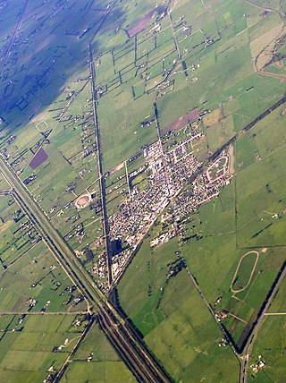
Bunyip is a town in Gippsland, Victoria, Australia, 81 km south-east of Melbourne's Central Business District, located within the Shire of Cardinia local government area. Bunyip recorded a population of 3,131 at the 2021 census.

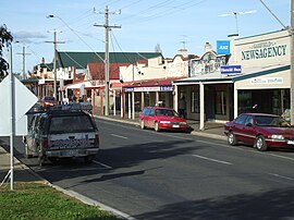
Cockatoo is a town in Victoria, Australia, 48 km south-east of Melbourne's central business district, located within the Shire of Cardinia local government area. Cockatoo recorded a population of 4,408 at the 2021 census.
Bannockburn is a town near Geelong, Victoria, Australia, 88 km southwest of Melbourne. It is located in Golden Plains Shire. In the 2021 census, Bannockburn had a population of 6,470.

Drouin is a town in the West Gippsland region, 90 kilometres (56 mi) east of Melbourne, in the Australian state of Victoria. Its local government area is the Shire of Baw Baw, and is home to the shire council's headquarters despite being the second-largest town in the shire, behind neighbouring Warragul. The town's name is believed to be derived from an Aboriginal word meaning "north wind". New housing developments have accelerated the town's residential growth in recent years. As at the 2016 census, Drouin had a population of 11,887 people.

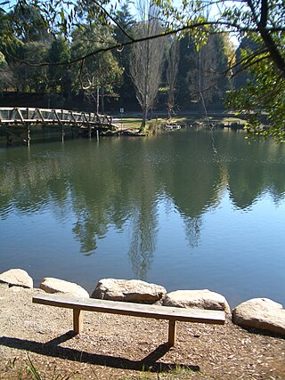
Gembrook is a town in Victoria, Australia, 54 kilometres (34 mi) south-east of Melbourne's Central Business District, located within the Shire of Cardinia local government area. Gembrook recorded a population of 2,559 at the 2021 census.

Birregurra, is a town in Colac Otway Shire, Victoria, Australia, approximately 130 kilometres (81 mi) south-west of Melbourne. At the 2021 census, it had a population of 942.
Beaconsfield Upper is a town in Victoria, Australia, 45 km south-east of Melbourne's Central Business District, located within the Shire of Cardinia local government area. Beaconsfield Upper recorded a population of 2,997 at the 2021 census.

Cardinia is a town in Victoria, Australia, 52 km south-east of Melbourne's Central Business District, located within the Shire of Cardinia local government area. Cardinia recorded a population of 342 at the 2021 census.
Clematis is a town in Victoria, Australia, 42 km south-east from Melbourne's central business district, located within the Shire of Cardinia local government area. Clematis recorded a population of 352 at the 2021 census.

Longwarry is a town in Victoria, Australia, 83 kilometres (52 mi) south-east of Melbourne's Central Business District, located within the Shires of Baw Baw and Cardinia local government areas. Longwarry recorded a population of 2,436 at the 2021 census.
Garfield North is a locality in Victoria, Australia, 68 km south-east of Melbourne's Central Business District, located within the Shire of Cardinia local government area. Garfield North recorded a population of 236 at the 2021 census.
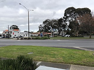
Koo Wee Rup is a town and satellite suburb in Victoria, Australia, 63 km south-east of Melbourne's Central Business District, located within the Shire of Cardinia local government area. Built on former marshland now converted to market gardens, Koo Wee Rup recorded a population of 4,047 at the 2021 census.
Previously known as Pakenham East, Honora Fields is the newest suburb of the Greater Melbourne metropolitan area situated south-east of Melbourne City. Honora Fields is located in the Shire of Cardinia local government area.