Traralgon is a town located in the east of the Latrobe Valley in the Gippsland region of Victoria, Australia and the most populous city in the City of Latrobe and the region. The urban population of Traralgon at the 2021 census was 26,907. It is the largest and fastest growing city in the greater Latrobe Valley area, which has a population of 77,168 at the 2021 Census and is administered by the City of Latrobe.

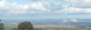
Morwell is a town in the Latrobe Valley area of Gippsland, in South-Eastern Victoria, Australia approximately 152 km (94 mi) east of Melbourne.

Warragul is a town in Victoria, Australia, 102 kilometres south-east of Melbourne. Warragul lies between the Strzelecki Ranges to the south and the Mount Baw Baw Plateau of the Great Dividing Range to the north. As of the 2021 census, the town had a population of 19,856 people. Warragul forms part of a larger urban area that includes nearby Drouin that had an estimated total population of 42,827 as of the 2021 census.

Bairnsdale is a city in East Gippsland, Victoria, Australia in a region traditionally inhabited by the Tatungalung clan of the Gunaikurnai people.

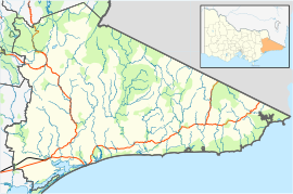
The Gippsland Lakes are a network of coastal lakes, marshes and lagoons in East Gippsland, Victoria, Australia covering an overall area of about 354 km2 (137 sq mi) between the rural towns of Lakes Entrance, Bairnsdale and Sale. The largest of the lakes are Lake Wellington, Lake King and Lake Victoria. The lakes are collectively fed by the Avon, Thomson, Latrobe, Mitchell, Nicholson and Tambo Rivers, and drain into Bass Strait through a short canal about 2 km (1.2 mi) southwest of Lakes Entrance town centre.

Lakes Entrance is a seaside resort and fishing port in eastern Victoria, Australia. It is situated approximately 320 kilometres (200 mi) east of Melbourne, near a managed, artificial channel connecting the Gippsland Lakes to Bass Strait. At the 2016 census, Lakes Entrance had a population of 4,810.
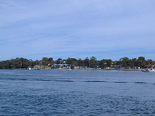
Paynesville is a resort town in the Gippsland region of Victoria, Australia. At the 2021 census, Paynesville had a population of 3,636. The town is located 293 kilometres (182 mi) by road east of the state capital, Melbourne. It is known as the boating capital of Victoria.
The Gunaikurnai or Gunai/Kurnai people, also referred to as the Gunnai or Kurnai, are an Aboriginal Australian nation of south-east Australia. They are the Traditional Custodians of most of present-day Gippsland and much of the southern slopes of the Victorian Alps. The Gunaikurnai nation is composed of five major clans. Many of the Gunaikurnai people resisted early European squatting and subsequent settlement during the nineteenth century, resulting in a number of deadly confrontations between Europeans and the Gunaikurnai. There are about 3,000 Gunaikurnai people alive today, predominantly living in Gippsland. The Gunaikurnai dialects are the traditional language of the Gunaikurnai people, although there are very few fluent speakers today.

Stratford is a town on the Avon River in Victoria, Australia, 232 kilometres (144 mi) east of Melbourne on the Princes Highway in Shire of Wellington. At the 2016 census, Stratford had a population of 2617. The town services the local regional community and travellers on the Princes Highway. Stratford's principal industries are dairying, sheep, cattle and horse breeding and vegetable crops. The town has numerous coffee shops and cafes, a cellar door for a local winery, Design Gallery, model railway shop, a pub, parks and playgrounds for car travelers to break their journey.

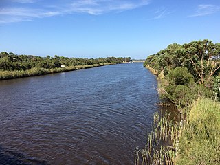
The Mitchell River is a perennial river of the East Gippsland catchment, located in the Australian state of Victoria. The unregulated river provides a unique example of riparian ecology, flowing generally south with the catchment area drawing from the steep mountains of the Victorian Alps to enter Lake King, one of the Gippsland Lakes, and then empty into the Bass Strait.
Benambra is a small town 28 kilometres (17 mi) north-east of Omeo and 430 kilometres (267 mi) east of the state capital Melbourne, in the Australian Alps of East Gippsland, Victoria, Australia. Nearby towns include Swifts Creek, Ensay, and the major town of Bairnsdale. At the 2016 census, Benambra and the surrounding area had a population of 149.

Metung is a town in East Gippsland region of Victoria, Australia. The town is 314 kilometres (195 mi) east of the state capital Melbourne and between the larger towns of Bairnsdale and Lakes Entrance. It is on a small peninsula 31 kilometres (19 mi) south-east of Bairnsdale, separating Lake King and Bancroft Bay on the Gippsland Lakes.

The Tambo River or Berrawan is a perennial river of the Mitchell River catchment, located in the East Gippsland region of the Australian state of Victoria. With a total length in excess of 186 kilometres (116 mi), the Tambo River is one of the longest rivers in the East Gippsland drainage basin, extending from the steep forested southern slopes of the Victorian Alps through forest and farmland to the Gippsland Lakes.

The Bemm River is a perennial river, located in the East Gippsland region of the Australian state of Victoria.
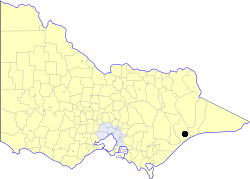
The City of Bairnsdale was a local government area about 280 kilometres (174 mi) east of Melbourne, the state capital of Victoria, Australia. The city covered an area of 27.20 square kilometres (10.5 sq mi), and existed from its split from the Shire of Bairnsdale in 1967 until 1994.
Johnsonville is a town in the East Gippsland region of Victoria, Australia. It is located on the Princes Highway 18.9 km east from the city of Bairnsdale and 18.3 km west from the tourist resort and fishing port of Lakes Entrance. The town encompasses an area of approximately 5,617 hectares, 56 square kilometres or 13,879 acres.
The Brodribb River is a perennial river of the Snowy River catchment, located in the East Gippsland region of the Australian state of Victoria.
Lindenow is a town in Victoria, Australia, located on Bairnsdale-Dargo Road, in the Shire of East Gippsland near Bairnsdale.
The Brabiralung are an Indigenous Australian people, one of the five clans of Gippsland, in the state of Victoria, Australia, belonging to a wider regional grouping known as the Kurnai.
Wy Yung is a town in Victoria, Australia, located on Great Alpine Road, in the Shire of East Gippsland near Bairnsdale. The town's name means wild duck in the local Indigenous language.