
Traralgon is a city located in the east of the Latrobe Valley in the Gippsland region of Victoria, Australia. The urban population of Traralgon at the 2016 census was 25,485. It is the largest and fastest growing city in the greater Latrobe Valley area, which has a population of 74,170 at June 2016 and is administered by the City of Latrobe.

Sale is a city situated in the Gippsland region of the Australian state of Victoria. It had an estimated urban population of 15,021 as of June 2018.

Morwell is a town in the Latrobe Valley area of Gippsland, in South-Eastern Victoria, Australia approximately 149 km (93 mi) east of Melbourne.

Maffra is a town in Victoria, Australia, 220 kilometres (140 mi) east of Melbourne. It is in the Shire of Wellington local government area. It relies mainly on dairy farming and other agriculture, and is the site of one of Murray-Goulburn Cooperative's eight processing plants in Victoria. Maffra is a detour off the Princes Highway and is near Sale, Stratford, Newry, Tinamba, Heyfield and Rosedale. At the 2016 census, Maffra had a population of 4,316.

Orbost is an historic tourist town in the Shire of East Gippsland, Victoria, Australia, 375 kilometres (233 mi) east of Melbourne and 235 kilometres (146 mi) south of Canberra where the Princes Highway crosses the Snowy River. It is about 16 kilometres (10 mi) from the surf and fishing seaside town of Marlo on the coast of Bass Strait and 217 km drive to Mount Hotham Snow Resort. At the 2006 census, Orbost had a population of 2452. Orbost is the service centre for the primary industries of beef, dairy cattle and sawmilling. More recently, tourism has become an important and thriving industry, being the major town close to several national parks that are between the east access to either the surf or the snow, including the famous Snowy River National Park, Alpine National Park, Errinundra National Park, Croajingolong National Park and Cape Conran Coastal Park.

Stratford is a town on the Avon River in Victoria, Australia, 232 kilometres (144 mi) east of Melbourne on the Princes Highway in Shire of Wellington. At the 2006 census, Stratford had a population of 1950. The town services the local regional community and travellers on the Princes Highway. Stratford's principal industries are dairying, sheep, cattle and horse breeding and vegetable crops. The town has numerous coffee shops and cafes, a cellar door for a local winery, Design Gallery, model railway shop, a pub, parks and playgrounds for car travellers to break their journey.
Foster is a dairying and grazing town 174 kilometres (108 mi) south-east of Melbourne on the South Gippsland Highway in Victoria, Australia. At the 2016 census Foster had an urban population of 1,164. It is about 20 kilometres (12 mi) north of the Gippsland coastline which includes Shallow Inlet, Corner Inlet, Waratah Bay, Yanakie and Wilsons Promontory.
Newry is a town in Victoria, Australia, located on Newry - Boisdale Road, north west of Maffra, in the Shire of Wellington. The town had a population in 2016 of 427 people.
Valencia Creek is a rural town in East Gippsland, Victoria, Australia on the Boisdale - Valencia Creek Road, north of Maffra in the Shire of Wellington. The junction of Valencia Creek and the Avon River are a short distance upstream. The foothills of the Great Dividing Range start immediately north of Valencia Creek, while dairy farms lie to the south along the Avon River flats to Boisdale.
Briagolong is a town in the Australian state of Victoria, located 20 kilometres north of Maffra and some 270 kilometres east of Melbourne, in the Shire of Wellington region of Gippsland. At the 2016 census, Briagolong had a population of 1,081.
Cowwarr is a town in Victoria, Australia, 27 kilometres north-east of Traralgon, 174 kilometres east of Melbourne, in the Shire of Wellington. At the 2006 census, Cowwarr and the surrounding area had a population of 563.

Rosedale is a pastoral and agricultural town 184 kilometres east of Melbourne via the Princes Highway. It is situated on the southern side of the LaTrobe River. Once a staging post on the Port Albert to Sale and Port Albert to Walhalla coach runs, it was the administrative centre of the Shire of Rosedale which extended to the east and included the Ninety Mile Beach. It is now part of the Wellington Shire centred in Sale. At the 2006 census, Rosedale had a population of 1,077. The town is in the area of Gippsland explored separately by the Scotsman, Angus McMillan, and the Polish aristocrat, Count Paul von Strzelecki, in 1840. A memorial to McMillan is located in Rosedale, and one to Strzelecki near Traralgon to the west. McMillan named the region Gippsland after Governor Gipps.

The electoral district of Gippsland East is an electoral district of the Victorian Legislative Assembly. It covers most of eastern Victoria and includes the towns of Bairnsdale, Lakes Entrance, Orbost, Omeo, Maffra and Heyfield. Gippsland East is the state's third largest electorate in area and covers 27,531 square kilometres.
Benambra is a small town 28 kilometres (17 mi) north-east of Omeo and 430 kilometres (267 mi) east of the state capital Melbourne, in the Australian Alps of East Gippsland, Victoria, Australia. Nearby towns include Swifts Creek, Ensay, and the major town of Bairnsdale. At the 2016 census, Benambra and the surrounding area had a population of 149.

Bruthen is a small town located alongside the Tambo River between Bairnsdale and Ensay on the Great Alpine Road in East Gippsland, Victoria, Australia. At the 2016 census, Bruthen had a population of 814. Bruthen is 26 km (16 mi) east of Bairnsdale and 311 km (193 mi) east of the state capital Melbourne.
Maffra Secondary College is a Year 7 to Year 12 government secondary college situated in the Gippsland town of Maffra, Victoria. It has around 700 students enrolled from Year 7 to 12, and takes in students from Maffra and surrounding towns, including Boisdale, Newry, Stratford, Heyfield, Valencia Creek, Briagolong and Cowwarr.
The North Gippsland Football League is an Australian rules football league in the Central Gippsland area of Victoria, Australia, formed in 1955 through the merger of the Cowwarr Football League and the Sale District Football League.
The East Gippsland Football League is an Australian rules football League in the East Gippsland region of Victoria, Australia.

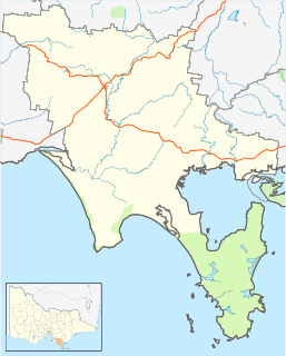
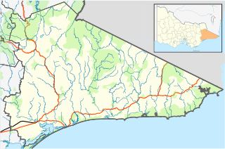
The Shire of Maffra was a local government area about 20 kilometres (12 mi) north-northwest of Sale, the major regional centre in central Gippsland, Victoria, Australia. The shire covered an area of 4,167.43 square kilometres (1,609.1 sq mi), and existed from 1875 until 1994.
Johnsonville is a town in the East Gippsland region of Victoria, Australia. It is located on the Princes Highway 18.9 km east from the city of Bairnsdale and 18.3 km west from the tourist resort and fishing port of Lakes Entrance. The town encompasses an area of approximately 5,617 hectares, 56 square kilometres or 13,879 acres.
