Electoral district of Gippsland East

Last updated

Gippsland East
VictoriaLegislative Assembly
Electoral district of Gippsland East (Victoria) 2022.svg
Location of Gippsland East (dark green) in Victoria
State Victoria
Created1889
MP Tim Bull
Party National Party
Namesake East Gippsland
Electors 46,335 (2018)
Area27,544 km2 (10,634.8 sq mi)
DemographicRural
Electorates around Gippsland East:
Ovens Valley
Benambra
New South Wales New South Wales
Eildon
Narracan
Gippsland East Tasman Sea
Gippsland South Tasman Sea Tasman Sea

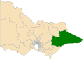
The electoral district of Gippsland East is an electoral district of the Victorian Legislative Assembly. It covers most of eastern Victoria and includes the towns of Bairnsdale, Lakes Entrance, Orbost, Omeo, Maffra and Heyfield. Gippsland East is the state's third largest electorate in area and covers 27,544 square kilometres. [1]

Contents

The National Party held the seat without interruption from 1920 to 1999. However at the 1999 election independent candidate Craig Ingram unexpectedly won the seat after receiving preferences from the independent, One Nation and Labor candidates. [2]

Ingram's victory affected state politics—Ingram and fellow Independents Susan Davies and Russell Savage contributed to the end of the Kennett era by agreeing to back Labor to form government after the 1999 election. [1] Ingram was also returned in the 2002 and 2006 elections. He was defeated in 2010 by National candidate Tim Bull.

Members for Gippsland East

MemberPartyTerm
  Henry Foster Unaligned1889–1902
  James Cameron Ministerialist1902–1920
  Commonwealth Liberal
  Nationalist
 Sir Albert Lind Farmers Union 1920–1961
  Country
  Bruce Evans Country 1961–1975
  National Country 1975–1982
  National 1982–1992
  David Treasure National 1992–1999
  Craig Ingram Independent 1999–2010
  Tim Bull National 2010–present

Election results

2022 Victorian state election: Gippsland East [3] [4] [5]
PartyCandidateVotes%±%
National Tim Bull 26,73763.3+6.6
Labor Stephen Richardson7,19117.0−4.7
Greens Nissa Ling2,6916.4+0.2
Shooters, Fishers, Farmers Ricky Muir 2,4605.8+5.8
Freedom Ed Barnes1,3403.2+3.2
Family First Carl John Fechner1,0682.5+2.5
Animal Justice Sally Court7251.7+1.7
Total formal votes42,21295.5+1.2
Informal votes1,9924.5−1.2
Turnout 44,20489.0+1.3
Two-party-preferred result
National Tim Bull 31,25973.9+6.3
Labor Stephen Richardson11,02726.1−6.3
National hold Swing +6.3

List of towns in Gippsland East

Bairnsdale, Boisdale, Briagolong, Bruthen, Buchan, Cann River, Dargo, Ensay, Heyfield, Lakes Entrance, Lindenow, Maffra, Mallacoota, Metung, Newry, Omeo, Orbost, Paynesville, Raymond Island, Stratford, Swan Reach, Swifts Creek and Wy Yung. [2]

Related Research Articles

<span class="mw-page-title-main">Shire of East Gippsland</span> Local government area in Victoria, Australia

The Shire of East Gippsland is a local government area in Gippsland, Victoria, Australia, located in the eastern part of the state. It covers an area of 20,940 square kilometres (8,080 sq mi) and in June 2018 had a population of 46,818.

<span class="mw-page-title-main">Orbost</span> Town in Victoria, Australia

Orbost is a historic early settlers town in the Shire of East Gippsland, Victoria, 375 kilometres (233 mi) east of Melbourne and 235 kilometres (146 mi) south of Canberra where the Princes Highway crosses the Snowy River. It is about 16 kilometres (10 mi) from the surf and fishing seaside town of Marlo on the coast of Bass Strait and 217 km drive to Hotham Alpine Resort. Orbost is the service centre for the primary industries of beef, dairy cattle and sawmilling. More recently, tourism has become an important and thriving industry, being the major town close to several national parks that are between the east access to either the surf or the snow, including the famous Snowy River National Park, Alpine National Park, Errinundra National Park, Croajingolong National Park and Cape Conran Coastal Park.

<span class="mw-page-title-main">East Gippsland</span> Region of Victoria, Australia

East Gippsland is the eastern region of Gippsland, Victoria, Australia covering 31,740 square kilometres (14%) of Victoria. It has a population of 80,114.

<span class="mw-page-title-main">Gippsland railway line</span> Railway line in Victoria, Australia

The Gippsland line is a railway line serving the Latrobe Valley and Gippsland regions of Victoria, Australia. It runs east from the state capital Melbourne through the cities of Moe, Morwell, Traralgon, Sale and terminating at Bairnsdale.

<span class="mw-page-title-main">Electoral district of Benambra</span> State electoral district of Victoria, Australia

The electoral district of Benambra is one of the electoral districts of Victoria, Australia, for the Victorian Legislative Assembly. It covers an area of 10,037 square kilometres (3,875 sq mi) in north-eastern Victoria. The largest settlement is the city of Wodonga. Benambra also includes the towns of Baranduda, Barnawartha, Beechworth, Chiltern, Corryong, Eskdale, Kiewa, Mitta Mitta, Mount Beauty, Rutherglen, Tallangatta, Tangambalanga, Tawonga, Wahgunyah, and Yackandandah. It lies in the Northern Victoria Region of the upper house, the Legislative Council.

<span class="mw-page-title-main">Electoral district of Richmond (Victoria)</span> State electoral district of Victoria, Australia

Richmond is an electoral district of the Legislative Assembly in the Australian state of Victoria. It is currently a 13 km² electorate in the inner east of Melbourne, encompassing the suburbs of Richmond, Cremorne, Burnley, Abbotsford, Collingwood, Clifton Hill, North Fitzroy and Fitzroy. Historically a very safe seat for the Labor Party, Richmond has in recent elections become increasingly marginal against the Greens, who narrowly failed to win it at the 2014 Victorian state election.

<span class="mw-page-title-main">Electoral district of Bass</span> State electoral district of Victoria, Australia

The electoral district of Bass is one of the electoral districts of Victoria, Australia, for the Victorian Legislative Assembly. It covers an area of 1,358 square kilometres (524 sq mi) south east of Melbourne, stretching from the satellite suburb of Clyde through rural areas to the coast at Inverloch and Phillip Island. It includes the suburbs and towns of Bass, Cape Paterson, Clyde, Corinella, Cowes, Grantville, Inverloch, Kilcunda, Koo Wee Rup, Lang Lang, Pearcedale, Rhyll, San Remo, Tooradin, Ventnor and Wonthaggi. It lies within the Eastern Victoria Region of the upper house, the Legislative Council.

<span class="mw-page-title-main">Electoral district of Bayswater</span> State electoral district of Victoria, Australia

The electoral district of Bayswater is one of the electoral districts of Victoria, Australia, for the Victorian Legislative Assembly. It covers an area of 39 square kilometres (15 sq mi) in outer eastern Melbourne, and includes the suburbs of Bayswater, Heathmont, Kilsyth South and The Basin, and parts of Bayswater North, Boronia, Ringwood and Wantirna. It lies within the Eastern Metropolitan Region of the upper house, the Legislative Council.

<span class="mw-page-title-main">Electoral district of Polwarth</span> State electoral district of Victoria, Australia

The electoral district of Polwarth is an electoral district of the Victorian Legislative Assembly. It is located in south-west rural Victoria, west of Geelong, and covers the Colac and Corangamite local government areas (LGA), parts of the Moyne, Golden Plains and Surf Coast LGAs, and slivers of the Ararat and Greater Geelong LGAs, running along the Great Ocean Road taking in Anglesea, Cape Otway, Peterborough, Aireys Inlet, Lorne, Wye River, Apollo Bay and Port Campbell, covering the inland towns of Winchelsea, Colac, Camperdown and Terang along the Princes Highway, and Inverleigh, Cressy, Lismore and Mortlake on the Hamilton Highway, and finally, includes the Otway Ranges and Lake Corangamite.

<span class="mw-page-title-main">Electoral district of Mildura</span> State electoral district of Victoria, Australia

Mildura is an electoral district of the Legislative Assembly in the Australian state of Victoria and sits within the Northern Victoria electorate. It is a 37,529 km2 rural electorate in the far-north-west of the state, encompassing the regional towns of Hopetoun, Mildura, Ouyen, Red Cliffs and Robinvale.

<span class="mw-page-title-main">Electoral district of Carrum</span>

The electoral district of Carrum is an electoral district of the Victorian Legislative Assembly. It lies in the south eastern suburbs of Melbourne, covering Bangholme, Bonbeach, Carrum, Carrum Downs, Patterson Lakes, Sandhurst, Seaford and Skye.

<span class="mw-page-title-main">Electoral district of Morwell</span> State electoral district of Victoria, Australia

The electoral district of Morwell is an electoral district of the Victorian Legislative Assembly. It covers the regional centres of Moe, Morwell and Traralgon, as well as the surrounding rural areas in the middle of Gippsland.

<span class="mw-page-title-main">Electoral district of Caulfield</span>

The electoral district of Caulfield is an electoral district of the Victorian Legislative Assembly. The electorate is surrounded by the other electoral districts of Prahran, Albert Park, Malvern, Oakleigh, Bentleigh and Brighton.

<span class="mw-page-title-main">Electoral district of Prahran</span> State electoral district of Victoria, Australia

Prahran is an electoral district of the Legislative Assembly in the Australian state of Victoria. It was created by the Electoral Act Amendment Act 1888, taking effect at the 1889 elections. The electorate is the state’s smallest by area, covering a little under 11 km² in the inner south-east of Melbourne. It includes the suburbs of South Yarra, Prahran and Windsor, as well as parts of Balaclava, St Kilda, St Kilda East and Toorak.

<span class="mw-page-title-main">Craig Ingram</span> Australian politician

Craig Ingram is a former Australian politician, and was the Independent Member of Parliament for Gippsland East in the Victorian Legislative Assembly from 1999 to 2010. In 2012 he was appointed as executive officer for the Amateur Fisherman's Association of the NT (AFANT).

<span class="mw-page-title-main">Electoral district of Gippsland South</span> State electoral district of Victoria, Australia

The electoral district of Gippsland South is a Lower House electoral district of the Victorian Parliament. It is located within the Eastern Victoria Region of the Legislative Council.

<span class="mw-page-title-main">Electoral district of Bendigo East</span> State electoral district of Victoria, Australia

Bendigo East is an electoral district of the Legislative Assembly in the Australian state of Victoria. It covers an area of 2,711 square kilometres (1,047 sq mi) covering the part of the city of Bendigo east of the Yungera railway line and surrounding rural areas to the north, east and south. It includes the Bendigo suburbs of East Bendigo, Epsom, Flora Hill, Junortoun, Kennington, Quarry Hill, Spring Gully, Strathdale, Strathfieldsaye and White Hills, and the surrounding towns of Axedale, Goornong, Huntly, Mandurang, Raywood and Sedgwick. It also includes parts of the localities of Eaglehawk, Elmore, Golden Square and Ravenswood, and the Bendigo campus of La Trobe University. It lies within the Northern Victoria Region of the upper house, the Legislative Council.

<span class="mw-page-title-main">Electoral district of Bendigo West</span> State electoral district of Victoria, Australia

Bendigo West is an electoral district of the Legislative Assembly in the Australian state of Victoria. It is a 1,524 square kilometres (588 sq mi) electorate centred on the city of Bendigo west of the Yungera railway line, and including surrounding rural towns to the west and south-west. It encompasses the localities of Bendigo City, California Gully, Castlemaine, Harcourt, Long Gully, Maldon, Marong, Newstead and West Bendigo. It also includes parts of the Bendigo suburbs of Eaglehawk, Golden Square and Kangaroo Flat. It lies within the Northern Victoria Region of the upper house, the Legislative Council.

<span class="mw-page-title-main">Tim Bull</span> Australian politician

Timothy Owen Bull is an Australian politician. He has been a National Party member of the Victorian Legislative Assembly since 2010, representing the electorate of Gippsland East. He served as Minister for Local Government and Minister for Aboriginal Affairs in the Napthine Ministry from March to December 2014.

Gippsland Province was an electorate of the Victorian Legislative Council from November 1882 until 2006. It was based in the Gippsland region of Victoria, Australia.

References

  1. 1 2 "Gippsland East". Victoria Votes. Retrieved 15 February 2015.
  2. 1 2 "Gippsland East District profile". Victorian Electoral Commission. Archived from the original on 6 October 2009. Retrieved 10 February 2015.
  3. Green, Antony (11 January 2023). "VIC22 – 2-Party Preferred Results and Swings by District". Antony Green's Election Blog. Retrieved 28 January 2023.
  4. VIC 2021 Final Redistribution, ABC News. [Retrieved 1 January 2023.
  5. Gippsland East District results, Victorian Electoral Commission. Retrieved 1 December 2022.