| Ashwood Victoria—Legislative Assembly | |||||||||||||||
|---|---|---|---|---|---|---|---|---|---|---|---|---|---|---|---|
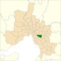
Interactive map of electoral district boundaries from the 2022 state election | |||||||||||||||
| State | Victoria | ||||||||||||||
| Created | 2022 | ||||||||||||||
| MP | Matt Fregon | ||||||||||||||
| Party | Labor | ||||||||||||||
| Namesake | Suburb of Ashwood | ||||||||||||||
| Electors | 51,209 (2022) | ||||||||||||||
| Area | 29.44 km2 (11.4 sq mi) | ||||||||||||||
| Demographic | Urban | ||||||||||||||
| |||||||||||||||

The electoral district of Ashwood is an electorate of the Victorian Legislative Assembly in Melbourne, Australia. It was created in the redistribution of electoral boundaries in 2021, and came into effect at the 2022 Victorian state election. [1]
Contents
Ashwood covers areas of the abolished districts of Burwood and Mount Waverley with its boundaries being Burke Road to the west, the Monash Freeway to the south, Burwood Highway and Toorak Road to the north, and Blackburn Road to the east. The seat contains the suburbs of Ashburton, Ashwood, Chadstone, Glen Iris, Mount Waverley, and parts of Burwood, Burwood East, and Camberwell. [2]
The abolished seats of Burwood and Mount Waverley were held by Labor MPs Will Fowles and Matt Fregon respectively.
