| Shepparton Victoria—Legislative Assembly | |||||||||||||||
|---|---|---|---|---|---|---|---|---|---|---|---|---|---|---|---|
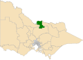
Interactive map of electoral district boundaries from the 2022 state election | |||||||||||||||
| State | Victoria | ||||||||||||||
| Dates current | 1945–1955 1967–present | ||||||||||||||
| MP | Kim O'Keeffe | ||||||||||||||
| Party | National | ||||||||||||||
| Namesake | Shepparton | ||||||||||||||
| Electors | 48,765 (2018) | ||||||||||||||
| Area | 3,289 km2 (1,269.9 sq mi) | ||||||||||||||
| Demographic | Provincial and rural | ||||||||||||||
| |||||||||||||||

The electoral district of Shepparton is a rural Lower House electoral district of the Victorian Parliament. It is located within the Northern Victoria Region of the Legislative Council.
Contents
- Members for Shepparton
- First incarnation (1945–1955)
- Second incarnation (1967–present)
- Election results
- References
- External links
The electoral district of Shepparton covers an area of 3,289 square kilometres. [1]
Shepparton includes the country towns of Ardmona, Barmah, Congupna, Dookie, Katunga, Kialla, Mooroopna, Nathalia, Picola, Shepparton, Strathmerton, Tallygaroopna, Tatura and Toolamba. [1] The district also includes the Barmah National Park.
It is a rich agricultural area with orchards, vineyards and dairy farms. Much of the electorate is an important irrigation area served by water from the Main East Goulburn Channel. The rest of the land is used for pasture, fodder crops and cattle and sheep grazing.
Shepparton was held by the National/Country Party from its creation in 1945 until 2014, although it was abolished for a twelve-year period between 1955 and 1967. [2] The current member is National Kim O'Keeffe, who was elected at the 2022 state election, [3] defeating Independent Suzanna Sheed, who was elected in the 2014 election. [4]