Melton Victoria—Legislative Assembly | |
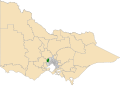
---|---|
State | Victoria |
Created | 1992 |
MP | Steve McGhie |
Party | Labor |
Electors | 53,306 (2018) |
Area | 332 km2 (128.2 sq mi) |
Demographic | Outer metropolitan |
The electoral district of Melton is an electoral district of the Victorian Legislative Assembly. [1] It contains the towns of Aintree, Bacchus Marsh, Balliang, Balliang East, Blackwood, Brookfield, Greendale, Kurunjang, Melton, Melton South, Melton West, Mount Cottrell, Sydenham West, and Toolern Vale as well as parts of Diggers Rest, Plumpton, Rockbank and Truganina.
Member | Party | Term | |
---|---|---|---|
David Cunningham | Labor | 1992–1999 | |
Don Nardella | Labor | 1999–2017 | |
Independent | 2017–2018 | ||
Steve McGhie | Labor | 2018–present | |
Party | Candidate | Votes | % | ±% | |
---|---|---|---|---|---|
Labor | Steve McGhie | 12,626 | 38.1 | +3.7 | |
Liberal | Graham Watt | 8,137 | 24.6 | +8.2 | |
Independent | Ian Birchall | 3,258 | 9.8 | +9.8 | |
Independent | Jarrod James Bingham | 2,044 | 6.2 | +6.2 | |
Shooters, Fishers, Farmers | Paul Blackborrow | 1,356 | 4.1 | +4.1 | |
Democratic Labour | Ashley Alp | 1,352 | 4.1 | +1.2 | |
Greens | Praise Morris | 1,339 | 4.0 | −0.5 | |
Family First | Richard Brunt | 780 | 2.4 | +2.4 | |
Freedom | Tony Dobran | 669 | 2.0 | +2.0 | |
Animal Justice | Fiona Adin-James | 583 | 1.8 | −1.0 | |
Justice | Samantha Jane Donald | 516 | 1.6 | +1.6 | |
New Democrats | Jasleen Kaur | 197 | 0.6 | +0.6 | |
Health Australia | Lucienne Ciappara | 155 | 0.5 | +0.5 | |
Independent | Jason Spencer Perera | 118 | 0.4 | +0.4 | |
Total formal votes | 33,130 | 90.6 | +0.5 | ||
Informal votes | 3,455 | 9.4 | −0.5 | ||
Turnout | 36,585 | 73.0 | −4.3 | ||
Two-party-preferred result | |||||
Labor | Steve McGhie | 17,930 | 54.2 | −1.6 | |
Liberal | Graham Watt | 15,164 | 45.8 | +1.6 | |
Labor hold | Swing | −1.6 |
The City of Greater Geelong is a local government area in the Barwon South West region of Victoria, Australia, located in the western part of the state. It covers an area of 1,248 square kilometres (482 sq mi) and, had a population of 271,057 as of the 2021 Australian census. It is primarily urban with the vast majority of its population living in the Greater Geelong urban area, while other significant settlements within the LGA include Anakie, Balliang, Barwon Heads, Batesford, Ceres, Clifton Springs, Drysdale, Lara, Ocean Grove, Portarlington and St Leonards. It was formed in 1993 from the amalgamation of the Rural City of Bellarine, Shire of Corio, City of Geelong, City of Geelong West, City of Newtown, City of South Barwon, and parts of Shire of Barrabool and Shire of Bannockburn.
Cranbourne is an electoral district of the Victorian Legislative Assembly. It is located south-east of Melbourne and includes the suburbs of Botanic Ridge, Cranbourne, Cranbourne East, Cranbourne North, Cranbourne West, Junction Village, as well as parts of Clyde, Clyde North, Cranbourne South, Devon Meadows, Lynbrook and Lyndhurst. It was created prior to the 1992 state election.
The electoral district of Bass is one of the electoral districts of Victoria, Australia, for the Victorian Legislative Assembly. It covers an area of 1,358 square kilometres (524 sq mi) south east of Melbourne, stretching from the satellite suburb of Clyde through rural areas to the coast at Inverloch and Phillip Island. It includes the suburbs and towns of Bass, Cape Paterson, Clyde, Corinella, Cowes, Grantville, Inverloch, Kilcunda, Koo Wee Rup, Lang Lang, Pearcedale, Rhyll, San Remo, Tooradin, Ventnor and Wonthaggi. It lies within the Eastern Victoria Region of the upper house, the Legislative Council.
The electoral district of Albert Park is one of the electoral districts of Victoria, Australia, for the Victorian Legislative Assembly. It covers an area of 21 square kilometres (8.1 sq mi) in inner suburban Melbourne, and includes the suburbs of Albert Park, Middle Park, Port Melbourne, St Kilda West, Southbank, South Melbourne, South Wharf, and parts of St Kilda. It lies within the Southern Metropolitan Region of the upper house, the Legislative Council.
The electoral district of Polwarth is an electoral district of the Victorian Legislative Assembly. It is located in south-west rural Victoria, west of Geelong, and covers the Colac and Corangamite local government areas (LGA), parts of the Moyne, Golden Plains and Surf Coast LGAs, and slivers of the Ararat and Greater Geelong LGAs, running along the Great Ocean Road taking in Anglesea, Cape Otway, Peterborough, Aireys Inlet, Lorne, Wye River, Apollo Bay and Port Campbell, covering the inland towns of Winchelsea, Colac, Camperdown and Terang along the Princes Highway, and Inverleigh, Cressy, Lismore and Mortlake on the Hamilton Highway, and finally, includes the Otway Ranges and Lake Corangamite.
The electoral district of Brunswick is an electorate of the Victorian Legislative Assembly. It covers an area of 14 square kilometres (5.4 sq mi) in inner northern Melbourne, and includes the suburbs of Brunswick, Brunswick East, Carlton North, Fitzroy North, Princes Hill and parts of Brunswick West. It lies within the Northern Metropolitan Region of the upper house, the Legislative Council.
Derrimut was an electoral district of the Victorian Legislative Assembly. It was located in the western suburbs of Melbourne and contained the suburbs of Albion, Derrimut as well as parts of St Albans and Sunshine.
The electoral district of Geelong is an electoral district of the Victorian Legislative Assembly. It centres on inner metropolitan Geelong and following the June 2013 redistribution of electoral boundaries includes the suburbs of Belmont, Breakwater, East Geelong, Geelong, Geelong West, Newtown and South Geelong, Herne Hill, Manifold Heights, Newcomb, Newtown, St Albans Park, Thomson, Whittington and part of Fyansford.
Lara is a seat in the Victorian Legislative Assembly. It covers much of the area between the western suburbs of Melbourne and the regional city of Geelong. Most of the voters come from the very northern suburbs of Geelong, including Lara, Bell Post Hill and Corio. The district also includes the country towns of Anakie, Balliang and Little River but these add very few voters to the district.
The electoral district of Melbourne is an electorate of the Victorian Legislative Assembly. It currently includes the localities of Docklands, Carlton, Melbourne, East Melbourne, West Melbourne, North Melbourne, Parkville, Newmarket, Kensington and Flemington, and includes Melbourne University. The district has been in existence since 1856.
Western Victoria Region is one of the eight electoral regions of Victoria, Australia, which elects five members to the Victorian Legislative Council by proportional representation. The region was created in 2006 following the 2005 reform of the Victorian Legislative Council.
The electoral district of Niddrie is a metropolitan electorate approximately 8 kilometres (5 mi) northwest of Melbourne, Australia in Victoria's Legislative Assembly.
The electoral district of Gippsland South is a Lower House electoral district of the Victorian Parliament. It is located within the Eastern Victoria Region of the Legislative Council.
Ripon is a single member electoral district of the Victorian Legislative Assembly. It is a rural electorate based in western Victoria. In 1946 the electoral district of Ripon was first contested but then abolished in the 1955 election after being held by Labor for seven of these years. Ripon was re-created in 1976, essentially as a replacement for Hampden and Kara Kara.
The electoral district of Werribee is an electoral district of the Legislative Assembly in the Australian state of Victoria. It has existed in two incarnations, first from 1976 to 2002, and was created again in the 2013 redistribution and came into effect at the 2014 state election.
This is a list of electoral results for the Electoral district of Melton in Victorian state elections.
The electoral district of Ashwood is an electorate of the Victorian Legislative Assembly in Melbourne, Australia. It was created in the redistribution of electoral boundaries in 2021, and came into effect at the 2022 Victorian state election.
The Electoral district of Laverton is an electoral district of the Victorian Legislative Assembly in Australia. It was created in the redistribution of electoral boundaries in 2021, and came into effect at the 2022 Victorian state election.
This is a list of electoral district results for the 2022 Victorian state election for the Legislative Assembly.