Electoral district of Footscray

Last updated

Footscray
VictoriaLegislative Assembly
Electoral district of Footscray (Victoria) 2022.svg
Location of Footscray (dark green) in Greater Melbourne
State Victoria
Dates current1877–1904
1927–present
MP Katie Hall
Party Labor Party
Namesake Footscray, Victoria
Electors 51,602 (2018)
Area23 km2 (8.9 sq mi)
DemographicInner metropolitan
Coordinates 37°48′S144°52′E / 37.800°S 144.867°E / -37.800; 144.867 Coordinates: 37°48′S144°52′E / 37.800°S 144.867°E / -37.800; 144.867

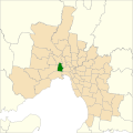
The electoral district of Footscray is an electoral district of the Victorian Legislative Assembly. It lies just north of Melbourne, covering the suburbs of Footscray, Maidstone, Maribyrnong, Seddon, West Footscray, and parts of Yarraville.

Contents

The seat was first created by The Electoral Act Amendment Act 1876 taking effect at the 1877 elections. [1] It was abolished in 1904 and recreated in 1927. In its current incarnation it has been held by the Labor Party for its entire existence. It has usually been a comfortably safe Labor seat, as it lies in Labor's traditional heartland of western and northern Melbourne.

Members for Footscray

First incarnation (1877–1904)
MemberPartyTerm
  Mark Last King Unaligned1877–1879
  William Clark Unaligned1879–1894
  John Hancock Labor 1894–1899
  Samuel Mauger Independent1900–1901
  Jacob Fotheringham Liberal1901–1902
  Alexander McDonald Liberal1902–1904
Second incarnation (1927–present)
MemberPartyTerm
  George Prendergast Labor 1927–1937
  Jack Mullens Labor 1937–1945
  Jack Holland Labor 1945–1955
  Roy Schintler Labor 1955–1958
  Ernie Shepherd Labor 1958
  Bill Divers Labor 1958–1970
  Robert Fordham Labor 1970–1992
  Bruce Mildenhall Labor 1992–2006
  Marsha Thomson Labor 2006–2018
  Katie Hall Labor 2018–present

Election results

2022 Victorian state election: Footscray [2]
PartyCandidateVotes%±%
Labor Katie Hall 14,07844.2−10.6
Greens Elena Pereyra7,06122.2+2.0
Liberal Emete Joesika5,45617.1+0.0
Victorian Socialists Jorge Jorquera3,1609.9+9.9
Democratic Labour Alan Williams7512.4+2.4
Animal Justice Shohre Mansouri Jajaee7212.3−3.7
Family First Russell Muir5961.9+1.9
Total formal votes31,82396.6+1.9
Informal votes1,1363.4−1.9
Turnout 32,95967.5−18.1
Two-candidate-preferred result
Labor Katie Hall 17,35454.6−24.1
Greens Elena Pereyra14,45145.4+45.4
Labor hold 
Results are not final. Last updated at 10:45 on 29 November 2022.

Related Research Articles

<span class="mw-page-title-main">Victorian Legislative Council</span> Upper house of Parliament of Victoria, Australia

The Victorian Legislative Council (VLC) is the upper house of the bicameral Parliament of Victoria, Australia, the lower house being the Legislative Assembly. Both houses sit at Parliament House in Spring Street, Melbourne. The Legislative Council serves as a house of review, in a similar fashion to its federal counterpart, the Australian Senate. Although, it is possible for legislation to be first introduced in the Council, most bills receive their first hearing in the Legislative Assembly.

<span class="mw-page-title-main">Electoral district of Benambra</span> State electoral district of Victoria, Australia

The electoral district of Benambra is one of the electoral districts of Victoria, Australia, for the Victorian Legislative Assembly. It covers an area of 10,037 square kilometres (3,875 sq mi) in north-eastern Victoria. The largest settlement is the city of Wodonga. Benambra also includes the towns of Baranduda, Barnawartha, Beechworth, Chiltern, Corryong, Eskdale, Kiewa, Mitta Mitta, Mount Beauty, Rutherglen, Tallangatta, Tangambalanga, Tawonga, Wahgunyah, and Yackandandah. It lies in the Northern Victoria Region of the upper house, the Legislative Council.

<span class="mw-page-title-main">Electoral district of Bass</span> State electoral district of Victoria, Australia

The electoral district of Bass is one of the electoral districts of Victoria, Australia, for the Victorian Legislative Assembly. It covers an area of 1,358 square kilometres (524 sq mi) south east of Melbourne, stretching from the satellite suburb of Clyde through rural areas to the coast at Inverloch and Phillip Island. It includes the suburbs and towns of Bass, Cape Paterson, Clyde, Corinella, Cowes, Grantville, Inverloch, Kilcunda, Koo Wee Rup, Lang Lang, Pearcedale, Rhyll, San Remo, Tooradin, Ventnor and Wonthaggi. It lies within the Eastern Victoria Region of the upper house, the Legislative Council.

<span class="mw-page-title-main">Electoral district of Albert Park</span> State electoral district of Victoria, Australia

The electoral district of Albert Park is one of the electoral districts of Victoria, Australia, for the Victorian Legislative Assembly. It covers an area of 21 square kilometres (8.1 sq mi) in inner suburban Melbourne, and includes the suburbs of Albert Park, Middle Park, Port Melbourne, St Kilda West, Southbank, South Melbourne, South Wharf, and parts of St Kilda. It lies within the Southern Metropolitan Region of the upper house, the Legislative Council.

<span class="mw-page-title-main">Electoral district of Bayswater</span> State electoral district of Victoria, Australia

The electoral district of Bayswater is one of the electoral districts of Victoria, Australia, for the Victorian Legislative Assembly. It covers an area of 39 square kilometres (15 sq mi) in outer eastern Melbourne, and includes the suburbs of Bayswater, Heathmont, Kilsyth South and The Basin, and parts of Bayswater North, Boronia, Ringwood and Wantirna. It lies within the Eastern Metropolitan Region of the upper house, the Legislative Council.

<span class="mw-page-title-main">Electoral district of Essendon</span>

The electoral district of Essendon is an electoral district of the Victorian Legislative Assembly. It was first created in 1904 after the abolition of the larger Essendon and Flemington electorate, and covers some of the north-western suburbs of Melbourne, including Essendon, Moonee Ponds and Ascot Vale.

<span class="mw-page-title-main">Electoral district of Hawthorn</span>

The electoral district of Hawthorn is an electoral district of the Victorian Legislative Assembly. It was first proclaimed in 1888 taking effect at the 1889 elections.

<span class="mw-page-title-main">Electoral district of Nepean</span> State electoral district of Victoria, Australia

The electoral district of Nepean is an electorate of the Victorian Legislative Assembly covering the southernmost part of the Mornington Peninsula in Victoria, Australia. It is named after Point Nepean which is contained within the electorate.

<span class="mw-page-title-main">Electoral district of Carrum</span>

The electoral district of Carrum is an electoral district of the Victorian Legislative Assembly. It lies in the south eastern suburbs of Melbourne, covering Bangholme, Bonbeach, Carrum, Carrum Downs, Patterson Lakes, Sandhurst, Seaford and Skye.

<span class="mw-page-title-main">Electoral district of Brunswick</span>

The electoral district of Brunswick is an electorate of the Victorian Legislative Assembly. It covers an area of 14 square kilometres (5.4 sq mi) in inner northern Melbourne, and includes the suburbs of Brunswick, Brunswick East, Carlton North, Fitzroy North, Princes Hill and parts of Brunswick West. It lies within the Northern Metropolitan Region of the upper house, the Legislative Council.

<span class="mw-page-title-main">Electoral district of Bentleigh</span> State electoral district of Victoria, Australia

The electoral district of Bentleigh is an electoral district of the Victorian Legislative Assembly. It covers an area of 25 square kilometres (9.7 sq mi) in southern Melbourne, including the suburbs of Bentleigh, Hampton East, McKinnon, and Moorabbin, and parts of Bentleigh East, Brighton East and Ormond. It also includes the Moorabbin campus of the Monash Medical Centre. It lies within the Southern Metropolitan Region of the upper house, the Legislative Council.

<span class="mw-page-title-main">Electoral district of Caulfield</span>

The electoral district of Caulfield is an electoral district of the Victorian Legislative Assembly. The electorate is surrounded by the other electoral districts of Prahran, Albert Park, Malvern, Oakleigh, Bentleigh and Brighton.

<span class="mw-page-title-main">Electoral district of Prahran</span> State electoral district of Victoria, Australia

Prahran is an electoral district of the Legislative Assembly in the Australian state of Victoria. It was created by the Electoral Act Amendment Act 1888, taking effect at the 1889 elections. The electorate is the state’s smallest by area, covering a little under 11 km² in the inner south-east of Melbourne. It includes the suburbs of South Yarra, Prahran and Windsor, as well as parts of Balaclava, St Kilda, St Kilda East and Toorak.

<span class="mw-page-title-main">Electoral district of Williamstown</span> State electoral district of Victoria, Australia

Williamstown is an electoral district of the Legislative Assembly in the Australian state of Victoria. It is a 33 km2 urban electorate in the inner south-western suburbs of Melbourne, encompassing the suburbs of Brooklyn, Newport, Spotswood, Williamstown and Yarraville. The electorate had a population of 54,426 as of the 2006 census.

<span class="mw-page-title-main">Electoral district of Melbourne</span> State electoral district of Victoria, Australia

The electoral district of Melbourne is an electorate of the Victorian Legislative Assembly. It currently includes the localities of Docklands, Carlton, Melbourne, East Melbourne, West Melbourne, North Melbourne, Parkville, Newmarket, Kensington and Flemington, and includes Melbourne University. The district has been in existence since 1856.

<span class="mw-page-title-main">Electoral district of Broadmeadows</span> State electoral district of Victoria, Australia

The electoral district of Broadmeadows is an electorate of the Victorian Legislative Assembly. It covers an area of 47 square kilometres (18 sq mi) in outer northern Melbourne, and includes the suburbs of Broadmeadows, Campbellfield, Coolaroo, Dallas, Fawkner, Jacana and Meadow Heights. It also includes parts of Glenroy, Roxburgh Park, Somerton and Westmeadows. It lies within the Northern Metropolitan Region of the upper house, the Legislative Council.

<span class="mw-page-title-main">Electoral district of Mulgrave (Victoria)</span> State electoral district of Victoria, Australia

The electoral district of Mulgrave is situated in the south-east of the Melbourne Metropolitan Region. The electorate contains the suburbs of Mulgrave and Noble Park North. It also contains parts of the suburbs of Dandenong North, Noble Park, Springvale and Wheelers Hill.

<span class="mw-page-title-main">Electoral district of Gippsland South</span> State electoral district of Victoria, Australia

The electoral district of Gippsland South is a Lower House electoral district of the Victorian Parliament. It is located within the Eastern Victoria Region of the Legislative Council.

<span class="mw-page-title-main">Electoral district of Bundoora</span> State electoral district of Victoria, Australia

Bundoora is an electoral district of the Victorian Legislative Assembly. It covers an area of 35 square kilometres (14 sq mi) in north-eastern Melbourne, encompassing the suburbs of Bundoora, Kingsbury, Watsonia and Watsonia North, and parts of Greensborough, Macleod, Mill Park and Yallambie. It also includes the central campus of La Trobe University. It lies within the Northern Metropolitan Region of the upper house, the Legislative Council.

<span class="mw-page-title-main">2022 Victorian state election</span> Election for the 60th Parliament of Victoria

The 2022 Victorian state election was held on 26 November 2022 to elect the 60th Parliament of Victoria. All 88 seats in the Legislative Assembly and all 40 seats in the Legislative Council were up for election.

References

  1. "The Electoral Act Amendment Act 1876". Australasian Legal Information Institute. Retrieved 8 February 2014.
  2. Footscray District results, Victorian Electoral Commission. Retrieved 1 December 2022.