| Oakleigh Victoria—Legislative Assembly | |
|---|---|
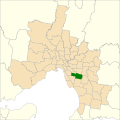
Interactive map of electoral district boundaries from the 2022 state election | |
| State | Victoria |
| Created | 1927 |
| MP | Steve Dimopoulos |
| Party | Labor Party |
| Namesake | Suburb of Oakleigh |
| Electors | 41,595 (2018) |
| Area | 32 km2 (12.4 sq mi) |
| Demographic | Metropolitan |

The electoral district of Oakleigh is an electoral district of the Victorian Legislative Assembly. [1] It covers the south-east Melbourne suburbs of Carnegie, Murrumbeena, Hughesdale, Notting Hill, Oakleigh East, Oakleigh and parts of Chadstone, Glen Waverley, Mount Waverley, Glen Huntly, Mulgrave and Ormond.
Contents
The seat is Labor Party held within the inner south-east metropolitan Melbourne.
Steve Dimopoulos is the current member of parliament for Oakleigh.