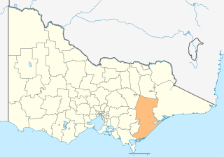
The Shire of Wellington is a local government area in Victoria, Australia, located in the eastern part of the state. It covers an area of 10,817 square kilometres (4,176 sq mi) and in June 2018 had a population of 44,019.

Maffra is a town in Victoria, Australia, 220 kilometres (140 mi) east of Melbourne. It is in the Shire of Wellington local government area. It relies mainly on dairy farming and other agriculture, and is the site of one of Murray-Goulburn Cooperative's eight processing plants in Victoria. Maffra is a detour off the Princes Highway and is near Sale, Stratford, Newry, Tinamba, Heyfield and Rosedale. At the 2016 census, Maffra had a population of 4,316.

Stratford is a town on the Avon River in Victoria, Australia, 232 kilometres (144 mi) east of Melbourne on the Princes Highway in Shire of Wellington. At the 2006 census, Stratford had a population of 1950. The town services the local regional community and travellers on the Princes Highway. Stratford's principal industries are dairying, sheep, cattle and horse breeding and vegetable crops. The town has numerous coffee shops and cafes, a cellar door for a local winery, Design Gallery, model railway shop, a pub, parks and playgrounds for car travelers to break their journey.

Allan McLean was an Australian politician who served as the 19th Premier of Victoria, in office from 1899 to 1900. He was later elected to federal parliament, where he served as a government minister under George Reid.
Tinamba is a dairy farming town in Victoria, Australia, located on Traralgon - Maffra Road between Heyfield and Maffra, in the Shire of Wellington. It has a country pub, a church, engineer works and two dilapidated tennis courts. At the 2006 census, Tinamba and the surrounding area had a population of 500. In 2007 Tinamba suffered two 1 in 100-year floods. Tinamba Railway Station Post Office opened on 1 July 1887 and was renamed Tinamba around 1895.
Newry is a town in Victoria, Australia, located on Newry - Boisdale Road, north west of Maffra, in the Shire of Wellington. The town had a population in 2016 of 427 people.
Boisdale is a town in the Central Gippsland region of Victoria, Australia, located on Briagolong Road, north of Maffra, in the Shire of Wellington. At the 2016 census, Boisdale and the surrounding area had a population of 275. It is a small town in the heart of Gippsland's dairying distinct. Boisdale includes not only the town itself, but the area surrounding the town, comprising mostly dairy and vegetable farms. It is situated approximately 9 km north of the larger town of Maffra. Boisdale is 176 km east of Australia's second largest city, Melbourne, the capital of Victoria.

Bushy Park is a town in Victoria, Australia, located on Briagolong Road, north of Maffra, in the Shire of Wellington.
Valencia Creek is a rural town in East Gippsland, Victoria, Australia on the Valencia Creek-Briagolong Road, north of Maffra in the Shire of Wellington. The junction of Valencia Creek and the Avon River are a short distance upstream. The foothills of the Great Dividing Range start immediately north of Valencia Creek, while dairy farms lie to the south along the Avon River flats to Boisdale.

Briagolong is a town in the Australian state of Victoria, located 20 kilometres north of Maffra and some 270 kilometres east of Melbourne, in the Shire of Wellington region of Gippsland. At the 2016 census, Briagolong had a population of 1,081.
Cowwarr is a town in Victoria, Australia, 27 kilometres north-east of Traralgon, 174 kilometres east of Melbourne, in the Shire of Wellington. At the 2016 census, Cowwarr and the surrounding area had a population of 368.

The Gippsland line is a railway line serving the Latrobe Valley and Gippsland regions of Victoria, Australia. It runs east from the state capital Melbourne through the cities of Moe, Morwell, Traralgon, Sale and terminating at Bairnsdale.
The Maffra railway line is a closed railway line in Victoria, Australia. The line provided an alternative route to East Gippsland than the current route to Sale. The line was closed in stages from Traralgon to Cowwarr in 1986, and from Cowwarr to Maffra in 1994. In the later years of the line, the main purpose of the line was to serve dairy industries at Maffra.

Tinamba is a closed station located 10 km (6 mi) east of Heyfield, on the Maffra railway line in Victoria, Australia. It was 204 km (127 mi) from Southern Cross station.

The Shire of Avon was a local government area about 20 kilometres (12 mi) north of Sale, the major regional centre in central Gippsland, Victoria, Australia. The shire covered an area of 2,533 square kilometres (978.0 sq mi), and existed from 1864 until 1994.

The Shire of Maffra was a local government area about 20 kilometres (12 mi) north-northwest of Sale, the major regional centre in central Gippsland, Victoria, Australia. The shire covered an area of 4,167.43 square kilometres (1,609.1 sq mi), and existed from 1875 until 1994.

Dawson is a closed station located in the locality of Dawson on the Maffra railway line in Victoria, Australia.
The Briagolong railway line is a closed railway line in Victoria, Australia, which ran from Maffra to Briagolong. It opened in 1889 as a branch of the Maffra railway line, closing in 1952.
The Lady Outlaw is a 1911 Australian silent film set in Van Diemen's Land during convict days.
The Gippsland Times is a newspaper published in Sale, Victoria, Australia since 1861. It is now part of Fairfax Media's group of regional newspapers.
