
Mont Albert is an inner eastern suburb of Melbourne, Victoria, Australia, 12 kilometres east of Melbourne's Central Business District, located within the Cities of Boroondara and Whitehorse local government areas. Mont Albert recorded a population of 4,948 at the 2021 census.
Howrah is a residential locality in the local government area (LGA) of Clarence in the south-east region of Tasmania. The locality is about 5 kilometres (3.1 mi) south-east of the town of Rosny Park. The 2021 Census recorded a population of 9,545 for the suburb of Howrah. It is a suburb of the City of Clarence. It is east of Bellerive and north of Tranmere.
Rossarden is a rural locality in the local government areas (LGA) of Northern Midlands (89%) and Break O'Day (11%) in the Central and North-east LGA regions of Tasmania. The locality is about 81 kilometres (50 mi) east of the town of Longford. The 2016 census recorded a population of 42 for the state suburb of Rossarden.
Seven Mile Beach is a rural residential locality in the local government area (LGA) of Clarence in the Hobart LGA region of Tasmania. The locality is about 17 kilometres (11 mi) east of the town of Rosny Park. The 2016 census recorded a population of 1286 for the state suburb of Seven Mile Beach.
Old Beach is a residential / rural locality in the local government area (LGA) of Brighton in the Hobart LGA region of Tasmania. The locality is about 10 kilometres (6.2 mi) south of the town of Brighton. The 2016 census recorded a population of 3779 for the state suburb of Old Beach.

Otago is a rural residential locality in the local government areas (LGA) of Brighton and Clarence in the Hobart LGA region of Tasmania. The locality is about 15 kilometres (9.3 mi) south of the town of Brighton. The 2016 census recorded a population of 554 for the state suburb of Otago. It is a suburb of Hobart, located on the shores of Otago Bay.
Roches Beach is a rural residential locality in the local government area (LGA) of Clarence in the Hobart LGA region of Tasmania. The locality is about 19 kilometres (12 mi) east of the town of Rosny Park. The 2021 Census recorded a population of 220 for the state suburb of Roches Beach. It is a suburb of Hobart, between Lauderdale and Acton Park.
Dodges Ferry is a rural / residential locality in the local government area (LGA) of Sorell in the South-east LGA region of Tasmania. The locality is about 13 kilometres (8.1 mi) south-east of the town of Sorell. The 2016 census recorded a population of 2467 for the state suburb of Dodges Ferry.

Great Mackerel Beach is a suburb about 43 kilometres north of the Sydney central business district, from 2016 in the local government area of Northern Beaches Council, Sydney, New South Wales, Australia, formerly part of Pittwater Council. It is on the western shores of Pittwater in Ku-ring-gai Chase National Park, beside Currawong Beach, and near Coasters Retreat and Palm Beach. The resident population was 50 at the 2021 census; the median age was 57, with an average of 0.3 children per family and an average of 1.7 people per household. The population was 36 at the 2016 census, 301 at the 2011 census, and 103 in 2006. As of 2021 there were 111 private dwellings, with many people not listed as residents occupying properties during school holidays and weekends. Great Mackerel Beach is frequently referred to as Mackerel Beach or [Great] Mackeral Beach, although the spelling "Mackerel" is becoming standard.

Binalong Bay is a rural locality in the local government area (LGA) of Break O'Day in the North-east LGA region of Tasmania. The locality is about 12 kilometres (7.5 mi) north-east of the town of St Helens. The 2016 census recorded a population of 290 for the state suburb of Binalong Bay.

Kumarina is a town located in the Mid West region of Western Australia along the Great Northern Highway between the towns of Meekatharra and Newman. It is the closest settlement to Collier Range National Park. It contains a roadhouse and a caravan park, as well as a small wildlife sanctuary, tavern, motel and restaurant.
Woodford is a town in the Western District of Victoria, Australia. located 9 kilometres (6 mi) north of Warrnambool. At the 2016 census, the population of the combined area was 361.
Glen Martin is a scattered rural community located within the Hunter Region of New South Wales, Australia. It is part of the Dungog local government area.

Golden Beach is a town situated on the Ninety Mile Beach in Gippsland Victoria. The beaches there offer long distances for walking and fishing, but are not patrolled. It has kangaroos on the golf course, a playground near the shops and a lookout deck near the ocean beach. There are many nearby wildlife reserves which are sanctuaries for water birds and other species. Seaspray and Loch Sport are nearby settlements which are slightly more developed with eating places and a caravan park.
Cedar Creek is a small rural locality 29 kilometres (18 mi) west of Cessnock in the Hunter Region of New South Wales, Australia. In 2016 the population was 33 people and the median age was 44.
Huntly North is a locality in the City of Greater Bendigo, in the state of Victoria, Australia.
Lockwood is a town in the City of Greater Bendigo, Victoria. Lockwood was the administrative centre of Marong shire from 1864 to 1908.

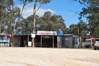
Neerim Junction is a town in West Gippsland, Victoria, Australia, located in the Shire of Baw Baw, 89 kilometres (55 mi) from Melbourne and 26 kilometres (16 mi) from Warragul. At the 2016 Census, Neerim Junction had a population of 127. Its postcode is 3832 and its Main Street hosts a general store with an Australia Post office, a small playground and a petrol station. It is one of several Neerim settlements, the others being Neerim South, Neerim North, Neerim and Neerim East.
Eppalock is a locality in the City of Greater Bendigo in the Australian state of Victoria.
Mount Camel is a locality in the City of Greater Bendigo, Victoria named for the nearby Mount Camel.


