
Mansfield is a small town in the foothills of the Victorian Alps in the Australian state of Victoria. It is approximately 180 kilometres (110 mi) north-east of Melbourne by road. The population of Mansfield was 5,541 at the 2021 census.

Bulleen is an eastern suburb in Melbourne, Australia, 13 km north-east of the Melbourne central business district, located within the City of Manningham local government area. Bulleen recorded a population of 11,219 at the 2021 census.
Montrose is a suburb in Melbourne, Victoria, Australia, 33 km east of Melbourne's central business district, located within the Shire of Yarra Ranges local government area. Montrose recorded a population of 6,900 at the 2021 census.

Seymour is a town located in the Southern end of the Goulburn Valley in the Shire of Mitchell, Victoria, Australia and is located 104 kilometres (65 mi) north of Melbourne. At the 2021 census, Seymour had a population of 6,569. The township services the surrounding agricultural industries as well as the nearby military base of Puckapunyal, which is an important training centre for the Australian Army. Other important sectors of employment in Seymour include retail, light engineering, agricultural services support, medical services, and education.
Nar Nar Goon is a town in Gippsland, Victoria, Australia, 61 km (38 mi) south-east of Melbourne's Central Business District, located within the Shire of Cardinia local government area. Nar Nar Goon recorded a population of 1,023 at the 2021 census.
Yea is a town in Victoria, Australia 112 kilometres (70 mi) north-east of the state capital Melbourne at the junction of the Goulburn Valley Highway and the Melba Highway, in the Shire of Murrindindi local government area. In an area originally inhabited by the Taungurung people, it was first visited by Europeans of the Hume and Hovell expedition in 1824, and within 15 years most of the land in the area had been taken up by graziers. Surveyed in 1855, the township grew as a service centre for grazing, gold-mining and timber-getting in the area.
Kinglake is a town in Victoria, Australia, 56 km (35 mi) north-east of Melbourne's Central Business District, located within the Shires of Murrindindi and Nillumbik local government areas. Kinglake is on the traditional lands of the Taungurung and Wurundjeri peoples.

Drouin is a town in the West Gippsland region, 90 kilometres (56 mi) east of Melbourne, in the Australian state of Victoria. Its local government area is the Shire of Baw Baw, and is home to the shire council's headquarters despite being the second-largest town in the shire, behind neighbouring Warragul. The town's name is believed to be derived from an Aboriginal word meaning "north wind". New housing developments have accelerated the town's residential growth in recent years. As at the 2016 census, Drouin had a population of 11,887 people.

Lang Lang is a town in Victoria, Australia, 73 km south-east of Melbourne's Central Business District, located within the Shires of Bass Coast, Cardinia and South Gippsland local government areas. Lang Lang recorded a population of 2,556 at the 2021 census.

Neerim is a locality in Victoria, Australia, on Main Neerim Road in the Shire of Baw Baw.

Neerim South is a town in West Gippsland, Victoria, Australia, located in the Shire of Baw Baw, 110 kilometres (68 mi) east of Melbourne and 20 kilometres (12 mi) north of Warragul. At the 2021 census, Neerim South had a population of 1,599.

Poowong is a small dairying town located in South Gippsland, in the Australian state of Victoria. At the 2016 census, Poowong had a population of 360.
The Ellinbank and District Football Netball League (EDFNL), formerly known as the Ellinbank & District Football League (EDFL), is an Australian rules football and netball league, based in the West Gippsland region of Victoria for smaller towns and villages in the regions of Baw Baw, South Gippsland and Cardinia.

Newlyn is a town in the Shire of Hepburn, in Victoria, Australia. It is situated on the Midland Highway between Creswick and Daylesford. At the 2021 census, Newlyn had a population of 136.

Longwarry is a town in Victoria, Australia, 83 kilometres (52 mi) south-east of Melbourne's Central Business District, located within the Shires of Baw Baw and Cardinia local government areas. Longwarry recorded a population of 2,436 at the 2021 census.
Nyora is a town in South Gippsland, Victoria, Australia, approximately 84 kilometres (52 mi) south-east of Melbourne's Central Business District, located within the Shires of Baw Baw, Cardinia and South Gippsland local government areas. Nyora recorded a population of 1,644 at the 2021 census.
Pimpinio is a town in the Rural City of Horsham, Victoria, Australia. It is 15 km from the City of Horsham and 317 km from the Victorian capital city Melbourne. As of the 2021 Australian census, Pimpinio had a population of 191 people.
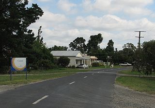
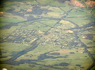
Catani is a bounded rural locality in Victoria, Australia, 72 kilometres (45 mi) south-east of Melbourne's Central Business District, located within the Shire of Cardinia local government area. Catani recorded a population of 297 at the 2021 census.

Cora Lynn is a locality in Victoria, Australia, 68 km south-east of Melbourne's Central Business District, located within the Shire of Cardinia local government area. Cora Lynn recorded a population of 220 at the 2021 census.
Bena is a town in the South Gippsland region of Victoria, Australia. It is located 100 km south-east of Melbourne and 8 km from Korumburra.

