Bushy Park in the London Borough of Richmond upon Thames is the second largest of London's Royal Parks, at 445 hectares in area, after Richmond Park. The park, most of which is open to the public, is immediately north of Hampton Court Palace and Hampton Court Park and is a few minutes' walk from the west side of Kingston Bridge. It is surrounded by Teddington, Hampton, Hampton Hill and Hampton Wick and is mainly within the post towns of Hampton and Teddington, those of East Molesey and Kingston upon Thames taking the remainder.
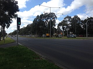
Wantirna is a suburb in Melbourne, Victoria, Australia, 24 km east of Melbourne's Central Business District, located within the City of Knox local government area. Wantirna recorded a population of 14,237 at the 2021 census.

Box Hill North is a suburb of Melbourne, Victoria, Australia, 14 km east from Melbourne's Central Business District, located within the City of Whitehorse local government area. Box Hill North recorded a population of 12,337 at the 2021 census.
Mulgrave is a suburb in Melbourne, Victoria, Australia, 21 km south-east of Melbourne's Central Business District, located within the City of Monash local government area. Mulgrave recorded a population of 19,889 at the 2021 census.

Derwent Valley Council is a local government body situated in southern-central Tasmania, west of Hobart. Derwent Valley is classified as a rural local government area and has a population of 10,290, it includes the localities of Bushy Park, Maydena and Strathgordon, with New Norfolk the major, principal town.

Hampton Wick is a Thamesside area of the London Borough of Richmond upon Thames, England, contiguous with Teddington, Kingston upon Thames and Bushy Park.

Stratford is a town on the Avon River in Victoria, Australia, 232 kilometres (144 mi) east of Melbourne on the Princes Highway in Shire of Wellington. At the 2016 census, Stratford had a population of 2617. The town services the local regional community and travellers on the Princes Highway. Stratford's principal industries are dairying, sheep, cattle and horse breeding and vegetable crops. The town has numerous coffee shops and cafes, a cellar door for a local winery, Design Gallery, model railway shop, a pub, parks and playgrounds for car travelers to break their journey.

Hampton Court Park, also known as Home Park, is a walled royal park managed by the Historic Royal Palaces. The park lies between the gardens of Hampton Court Palace and Kingston upon Thames and Surbiton in south west London, England, mostly within the post town of East Molesey, but with its eastern extremity within the post town of Kingston. In 2014, part of the park was designated a biological Site of Special Scientific Interest. It takes up most of the final (lowest) meander of the non-tidal reaches of the River Thames and is mainly divided between a golf course, meadows interspersed with trees used for deer, seasonal horse grazing and wildlife. A corner of the park is used annually for the Hampton Court Flower Show and the part nearest to the palace has the Long Water — an early set of hydro-engineered ponds or lakes, fed by water from the distant River Colne, as are the bodies of water in the neighbouring park, Bushy Park.

Roseville Chase is a suburb on the Upper North Shore of Sydney in the state of New South Wales, Australia 11 kilometres north-west of the Sydney central business district, in the local government area of Ku-ring-gai Council. Roseville is a separate suburb to the west.
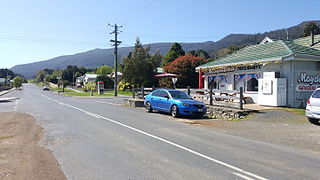
Maydena is a locality in Tasmania, Australia, alongside the River Tyenna.

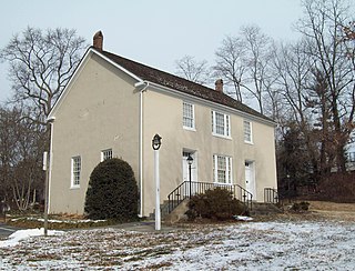
Bushy House is a Grade II* listed former residence of King William IV and Queen Adelaide in Teddington, London, which George Montagu, 1st Earl of Halifax had constructed for his own enjoyment on the site of a previous house Upper Lodge, Bushy Park, between 1714 and 1715.

Bushy Hare is a 1950 Warner Bros. Looney Tunes cartoon directed by Robert McKimson. The short was released on November 18, 1950, and stars Bugs Bunny.

Bushy Park Wetlands is a 30-hectare (74-acre) conservation park in Glen Waverley, Victoria, Australia. On the edge of suburbia, it is bounded by Dandenong Creek and houses along King Arthur Drive and Knights Drive. There is a cycling and walking path, and a bird watching hide, where egrets, pelicans, coots, dusky moorhen, ibis and occasionally spoonbill can be observed. It is accessible from the end of Highbury Road, or at the Drummies Bridge Reserve off High Street Road. It is also connected by the Dandenong Creek Trail to Shepherds Bush Park, Koomba Park and Napier Park.
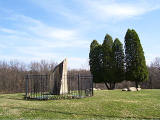
Bushy Run Battlefield Park is a historical park operated by the Pennsylvania Historical and Museum Commission (PHMC) and the Bushy Run Battlefield Heritage Society on 218 acres (88 ha) in Penn Township, Westmoreland County, Pennsylvania in the United States. It was the site of the Battle of Bushy Run fought on August 5–6, 1763 during the Pontiac's Rebellion. The battle was a major victory for the British and enabled them to secure their control of the Ohio River Valley and what was to become the Northwest Territory.

The Shire of Maffra was a local government area about 20 kilometres (12 mi) north-northwest of Sale, the major regional centre in central Gippsland, Victoria, Australia. The shire covered an area of 4,167.43 square kilometres (1,609.1 sq mi), and existed from 1875 until 1994.
Glenwood is an unincorporated community in Howard County, Maryland, United States. It is located between Baltimore and Washington, D.C., therefore attracting commuters to those employment centers. The community features acres of open space and is districted to Bushy Park Elementary, Glenwood and Folly Quarter Middle, and Glenelg High schools. Union Chapel was listed on the National Register of Historic Places in 1975 and Round About Hills was added in 2008. The population in 2020 was approximately 3,416.

Teddington is an affluent suburb of London in the London Borough of Richmond upon Thames. Historically an ancient parish in the county of Middlesex and situated close to the border with Surrey, the district became part of Greater London in 1965. In 2021, The Sunday Times named Teddington as the best place to live in London, and in 2023, the wider borough was ranked first in Rightmove's Happy at Home index, making it the "happiest place to live in Great Britain"; the first time a London borough has taken the top spot.

Camp Griffiss was a US military base in the United Kingdom during and after World War II. Constructed within the grounds of Bushy Park in Middlesex, England, it served as the European Headquarters for the United States Army Air Forces from July 1942 to December 1944. From here Dwight D. Eisenhower planned the D-Day invasion. Most of the camp's huts had been removed by the early 1960s, and a memorial tablet now stands on the site.

Bushy Park is a native forest reserve and bird sanctuary located in the Manawatū-Whanganui region of the North Island of New Zealand. The reserve is located eight kilometres (5.0 mi) inland from Kai Iwi and has an area of approximately 99 hectares, including the Bushy Park Homestead and grounds. The forest has a diverse range of native plant species, with canopy trees including northern rātā, rimu, tawa, and pukatea. In 1962, the forest was gifted to the Royal Forest and Bird Protection Society of New Zealand by the former owner G. F. Moore, along with the homestead and its surrounds. The reserve is now managed by the Bushy Park Trust, in partnership with Forest & Bird and local iwi Ngā Rauru Kītahi. The forest reserve and homestead were renamed as Bushy Park Tarapuruhi in 2019.

Bushy Park Homestead is an Edwardian-era homestead located in the Bushy Park forest sanctuary, 8 km (5.0 mi) from Kai Iwi, in the Manawatū-Whanganui region of New Zealand. The homestead is registered as a Category I historic place by Heritage New Zealand.