
Belgrave South is an area and a suburb of Greater Melbourne mainly beyond the Melbourne metropolitan area Urban Growth Boundary, 37 km south-east from Melbourne's central business district, located within the Shire of Yarra Ranges local government area. Belgrave Heights recorded a population of 1,670 at the 2021 census.
Coldstream is a locality and township within Greater Melbourne beyond the Melbourne metropolitan area Urban Growth Boundary, 36 km north-east from Melbourne's central business district, located within the Shire of Yarra Ranges local government area. Coldstream recorded a population of 2,199 at the 2021 census.

Sassafras is a locality and township within Greater Melbourne, beyond the Melbourne metropolitan area Urban Growth Boundary, 43 km east of Melbourne's Central Business District, located within the City of Knox and Shire of Yarra Ranges local government areas. Sassafras recorded a population of 970 at the 2021 census.

Clyde North is a suburb in Melbourne, Victoria, Australia, 46 km south-east of Melbourne's Central Business District, located within the City of Casey local government area. Clyde North recorded a population of 31,681 at the 2021 census.
Cranbourne North is a suburb in Melbourne, Victoria, Australia, 39 km south-east of Melbourne's Central Business District, located within the City of Casey local government area. Cranbourne North recorded a population of 24,683 at the 2021 census.
Cranbourne South is a suburb in Melbourne, Victoria, Australia, 49 km south-east of Melbourne's Central Business District, located within the City of Casey local government area. Cranbourne South recorded a population of 3,241 at the 2021 census.

Lyndhurst is a suburb in Melbourne, Victoria, Australia, 36 km south-east of Melbourne's Central Business District, located within the Cities of Casey and Greater Dandenong local government areas. Lyndhurst recorded a population of 8,926 at the 2021 census.

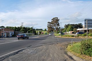
Baxter is a township and rural locality beyond the Urban Growth Boundary in Victoria, Australia, 48 km (30 mi) south-east of Melbourne's Central Business District, located within the Shire of Mornington Peninsula local government area. Baxter recorded a population of 2,166 at the 2021 census.
Capel Sound is a suburb on the Mornington Peninsula in Melbourne, Victoria, Australia, 61 km (38 mi) south of Melbourne's central business district, located within the Shire of Mornington Peninsula local government area. Capel Sound recorded a population of 5,246 at the 2021 census.

Mickleham is a suburb of Melbourne, Victoria, Australia, 29 km (18 mi) north of Melbourne's central business district, located within the City of Hume local government area and beyond the Urban Growth Boundary. Mickleham recorded a population of 17,452 at the 2021 census, compared to 3,142 at the 2016 census. In 2018, it was covered by the Australian Broadcasting Corporation as Australia's fastest-growing suburb.

Wonga Park is a locality on the edge of Greater Melbourne, beyond the Melbourne Metropolitan Urban Growth Boundary area, 28 km north-east from Melbourne's Central Business District, located within the Cities of Manningham and Maroondah and the Shire of Yarra Ranges local government areas. Wonga Park recorded a population of 3,843 at the 2021 census.
Plenty is a suburb in Melbourne, Victoria, Australia, 21 km (13 mi) north-east of Melbourne's Central Business District, located within the Shire of Nillumbik local government area. Plenty recorded a population of 2,575 at the 2021 census.

Yarrambat is a town in Victoria, Australia, 24 km north-east of Melbourne's Central Business District, located within the Shire of Nillumbik local government area. Yarrambat recorded a population of 1,602 at the 2021 census.
Warrandyte South is a locality within Greater Melbourne, beyond the Melbourne Metropolitan Area Urban Growth Boundary, 25 km north-east of Melbourne's Central Business District, located within the City of Manningham local government area. Warrandyte South recorded a population of 671 at the 2021 census.

Kalkallo is a suburb in Melbourne, Victoria, Australia, 31 km (19 mi) north of Melbourne's Central Business District, located within the City of Hume local government area. Kalkallo recorded a population of 5,548 at the 2021 census.
Yuroke is a bounded rural locality in Victoria, Australia, 26 km (16 mi) north-west of Melbourne's Central Business District, located within the City of Hume local government area. Yuroke recorded a population of 123 at the 2021 census.

Sunshine West is a suburb in Melbourne, Victoria, Australia, 13 km (8.1 mi) west of Melbourne's central business district, located within the City of Brimbank local government area. Sunshine West recorded a population of 18,552 at the 2021 census.
Cranbourne West is a suburb in Melbourne, Victoria, Australia, 40 km south-east of Melbourne's Central Business District, located within the City of Casey local government area. Cranbourne West recorded a population of 19,969 at the 2021 census.
Botanic Ridge is a suburb in Melbourne, Victoria, Australia, 45 km south-east of Melbourne's Central Business District, located within the City of Casey local government area. Botanic Ridge recorded a population of 6,739 at the 2021 census.

Fraser Rise is a suburb in Melbourne, Victoria, Australia, 24 km (15 mi) north-west of Melbourne's Central Business District, located within the City of Melton local government area. Fraser Rise recorded a population of 9,097 at the 2021 census.


