Related Research Articles
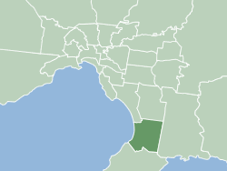
The City of Frankston is a local government area (LGA) in Victoria, Australia in the southern suburbs of Melbourne. It has an area of 130 square kilometres, and in June 2018, the City of Frankston recorded a population of 141,845.

Frankston is a suburb in Melbourne, Victoria, Australia, 41 km (25 mi) south-east of Melbourne's Central Business District, located within the City of Frankston local government area. Frankston recorded a population of 37,331 at the 2021 census.

Toorak railway station is a commuter railway station on the northern boundary of Armadale, a suburb of Melbourne, Victoria, Australia. The station is listed on the Victorian Heritage Register, and was opened on 7 May 1879. The station is named after the nearby suburb of Toorak—located north of the station. The station consists of an island platform and two side platforms all accessed by a pedestrian bridge. There are two principal station buildings located on the central platform and on platform 4, consisting of a small two and one-story brick buildings. These buildings were provided in 1914, as ticketing and staff offices. The station is only partially accessible due to a multiple steep access ramps.

Armadale railway station is a commuter railway station in Armadale, a suburb of Melbourne, Victoria, Australia. The station is listed on the Victorian Heritage Register and was opened on 7 May 1879. The station consists of an island platform and two side platforms, all accessed by a pedestrian bridge. There are two principal station buildings located on the central platform and on platform 4, consisting of a small two and one-story brick buildings. These buildings were provided in 1914 as ticketing and staff offices. The station is only partially accessible due to a multiple steep access ramps.

Caulfield railway station is a commuter railway station on the northern boundary of Caulfield East, a suburb of Melbourne, Victoria, Australia. Opened in 1879 and rebuilt from 1913 to 1914, the station complex is listed on the Victorian Heritage Register and is noted as an example of Federation Free Style architecture. It is named after the nearby suburb of Caulfield, located southwest of the station.

Mentone railway station is located on the Frankston line in Victoria, Australia. It serves the south-eastern Melbourne suburb of Mentone, and it opened on 19 December 1881 as Balcombe Road. It was renamed Balcombe on 1 September 1882, and was renamed Mentone on 7 January 1884.

The City of Frankston was a local government area about 40 kilometres (25 mi) south of Melbourne, the state capital of Victoria, Australia. The city covered an area of 70.96 square kilometres (27.4 sq mi) in and around Frankston, and existed from 1860 until 1994.
The Bunurong Land Council Aboriginal Corporation is a Registered Aboriginal Party and incorporated association representing the Bunurong community in the state of Victoria, Australia, particularly in matters relating to the Victorian Aboriginal Heritage Act 2006.
References
- ↑ "Frankston City". Victorian Heritage Database. Heritage Council of Victoria. Retrieved 12 April 2020.