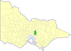
This is a list of places on the Victorian Heritage Register in the Shire of Murrindindi in Victoria, Australia. The Victorian Heritage Register is maintained by the Heritage Council of Victoria.
The Victorian Heritage Register, as of 2021, lists the following seven state-registered places within the Shire of Murrindindi: [1]
Place name | Place # | Location | Suburb or Town | Co-ordinates | Built | Stateregistered | Photo |
---|---|---|---|---|---|---|---|
Alexandra Court House and Former Shire Offices | H1654 | 38A Downey Street | Alexandra | 37°11′29″S145°42′42″E / 37.191444°S 145.711611°E | 1877 | 20 August 1982 | |
Former Yea Railway Station | H0771 | 14 Station Street | Yea | 37°12′50″S145°25′41″E / 37.213889°S 145.428000°E | 1889 | 20 August 1982 | |
Murrindindi Station | H0371 | 5620 Melba Highway | Yea | 37°17′14″S145°28′06″E / 37.287278°S 145.468389°E | 1848 | 12 May 1976 | |
Purcell's General Store | H0740 | 20-22 High Street | Yea | 37°12′39″S145°25′32″E / 37.210902°S 145.425436°E | 1887 | 13 December 1989 | |
Robbies Mill | H1823 | Robbie Road | Murrindindi | 37°27′44″S145°38′49″E / 37.462222°S 145.646861°E | 1934 | 17 June 1999 | |
Rubicon Hydro-Electric Scheme | H1187 | 580 Rubicon Road | Rubicon | 37°19′38″S145°51′39″E / 37.327124°S 145.860699°E | 1928 | 18 April 1996 | |
The Hermitage | H0303 | 161 Maroondah Highway | Narbethong | 37°34′33″S145°38′05″E / 37.575972°S 145.634831°E | 1894 | 9 October 1974 |
The Shire of Murrindindi is a local government area in the Hume region of Victoria, Australia, located in the north-east part of the state. It covers an area of 3,880 square kilometres (1,500 sq mi) and, in June 2018, had a population of 14,478. It includes the towns of Alexandra, Buxton, Eildon, Flowerdale, Kinglake, Marysville, Molesworth, Strath Creek, Taggerty, Yarck and Yea. It was formed in 1994 from the amalgamation of the Shire of Alexandra, Shire of Yea, and parts of the Shire of Broadford, Shire of Eltham, Shire of Euroa, Shire of Healesville and City of Whittlesea.
The Shire of Mansfield is a local government area in the Hume region of Victoria, Australia, located in the north-east part of the state. It covers an area of 3,844 square kilometres (1,484 sq mi) and in June 2018, had a population of 8,979.
The Alpine Shire is a local government area in the Hume region of Victoria, Australia, located in the north-east part of the state. It covers an area of 4,788 square kilometres (1,849 sq mi) and in June 2018 had a population of 12,730.
The Victorian Heritage Register (VHR) lists places deemed to be of cultural heritage significance to the State of Victoria, Australia. It has statutory weight under the Heritage Act 2017. The Minister for Planning is the responsible Minister. Heritage Victoria was established as the State Government listing and permit authority in 1995, replacing the original authority, the Historic Buildings Preservation Council, established in 1974. Listing on the Victorian Heritage Register is separate from listing by a local Council or Shire, known as a Heritage Overlay. Heritage Victoria is currently part of the Department of Environment, Land, Water and Planning of the Government of Victoria, Australia. Heritage Victoria reports to the Heritage Council who approve recommendations to the Register and hear appeals when a registration is disputed. The council also hears appeals by an owner to a permit issued by Heritage Victoria. As of 2021, there are over 2,400 places and objects listed on the VHR.
The Shire of Yea was a local government area about 110 kilometres (68 mi) northeast of Melbourne, the state capital of Victoria, Australia. The shire covered an area of 1,392.32 square kilometres (537.6 sq mi), and existed from 1869 until 1994. The shire's population was dominated by the town of Yea.
Rubicon is a locality in Victoria, Australia, located in the Shire of Murrindindi. It is situated on the Rubicon River. In the 2016 census, Rubicon had a population of 56.