List of places on the Victorian Heritage Register in the Shire of Mansfield

Last updated

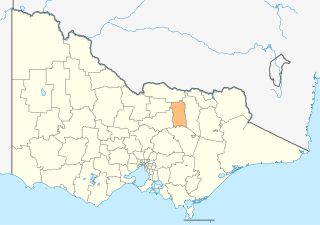
This is a list of places on the Victorian Heritage Register in the Shire of Mansfield in Victoria, Australia. The Victorian Heritage Register is maintained by the Heritage Council of Victoria.

The Victorian Heritage Register, as of 2021, lists the following eight state-registered places within the Shire of Mansfield: [1]

Place namePlace #LocationSuburb or TownCo-ordinatesBuiltState
registered
Photo
Howqua United Gold Treatment Works H1279 Howqua Hills Track Howqua Hills 37°11′55″S146°20′14″E / 37.198583°S 146.337361°E / -37.198583; 146.337361 1890's19 December 1996
Leichardt Gold Crushing Battery H1914 Abbot Creek Track Woods Point 37°33′41″S146°18′57″E / 37.561250°S 146.315944°E / -37.561250; 146.315944 188613 November 2003
Mansfield Court House H1474 88 High Street Mansfield 37°03′09″S146°05′15″E / 37.052437°S 146.087602°E / -37.052437; 146.087602 187920 August 1982 Mansfield Court House 001.JPG
Police Memorial H1538 High Street and Highett Street Mansfield 37°03′08″S146°05′17″E / 37.052111°S 146.088083°E / -37.052111; 146.088083 188020 August 1982 Mansfield Police Memorial 002.JPG
Police Stables H1540 5 Curia Street Mansfield 37°03′10″S146°05′12″E / 37.052889°S 146.086722°E / -37.052889; 146.086722 188910 February 1988
Royal Standard Gold Battery Site H1270 Royal Standard Spur Track Woods Point 37°34′49″S146°21′50″E / 37.580222°S 146.363750°E / -37.580222; 146.363750 unknown19 December 1996
Spring Creek Sawmill and Seasoning Works H1824 Mount Samaria State Park Bridge Creek 36°52′01″S146°05′40″E / 36.867000°S 146.094528°E / -36.867000; 146.094528 192317 June 1999
Stockyard Creek Gold Mining Diversion Sluice H1255 Howqua Track Howqua Hills 37°11′04″S146°18′48″E / 37.184472°S 146.313444°E / -37.184472; 146.313444 unknown19 December 1996

Related Research Articles

Rural City of Benalla Local government area in Victoria, Australia

The Rural City of Benalla is a local government area in the Hume region of Victoria, Australia, located in the north-east part of the state. It covers an area of 2,353 square kilometres (908 sq mi) and, in June 2018, had a population of 14,024.

Shire of Mansfield Local government area in Victoria, Australia

The Shire of Mansfield is a local government area in the Hume region of Victoria, Australia, located in the north-east part of the state. It covers an area of 3,844 square kilometres (1,484 sq mi) and in June 2018, had a population of 8,979.

Victorian Heritage Register Heritage register of places in Victoria, Australia

The Victorian Heritage Register (VHR) lists places deemed to be of cultural heritage significance to the State of Victoria, Australia. It has statutory weight under the Heritage Act 2017. The Minister for Planning is the responsible Minister. Heritage Victoria was established as the State Government listing and permit authority in 1995, replacing the original authority, the Historic Buildings Preservation Council, established in 1974. Listing on the Victorian Heritage Register is separate from listing by a local Council or Shire, known as a Heritage Overlay. Heritage Victoria is currently part of the Department of Environment, Land, Water and Planning of the Government of Victoria, Australia. Heritage Victoria reports to the Heritage Council who approve recommendations to the Register and hear appeals when a registration is disputed. The council also hears appeals by an owner to a permit issued by Heritage Victoria. As of 2021, there are over 2,400 places and objects listed on the VHR.

References

  1. "Mansfield Shire". Victorian Heritage Database. Heritage Council of Victoria. Retrieved 30 November 2021.