Related Research Articles
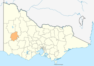
The Rural City of Horsham is a local government area in Victoria, Australia, located in the western part of the state. It covers an area of 4,267 square kilometres (1,647 sq mi) and in June 2018, had a population of 19,875. It includes the towns of Brimpaen, Dadswells Bridge, Dooen, Haven, Horsham, Laharum, Natimuk, Noradjuha and Pimpinio. It was formed in 1995 by the amalgamation of the City of Horsham, most of the Shire of Wimmera and Shire of Arapiles, and part of the Shire of Kowree.
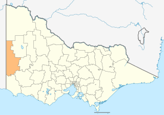
The Shire of West Wimmera is a local government area in the western part of the Wimmera region of Victoria, Australia, located in the western part of the state. It covers an area of 9,108 square kilometres (3,517 sq mi) and in June 2018 had a population of 3,862. It includes the towns of Apsley, Edenhope, Goroke, Gymbowen, Harrow, Kaniva, Minimay, Nurcoung and Serviceton. It was formed in 1995 from the amalgamation of the Shire of Kaniva and parts of the Shire of Kowree, Shire of Arapiles and Shire of Glenelg.
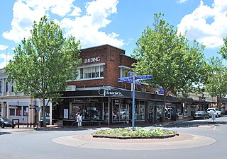
Hamilton is a city in south-western Victoria, Australia, at the intersection of the Glenelg Highway and the Henty Highway. The Hamilton Highway connects it to Geelong.

Horsham is a regional city in the Wimmera region of western Victoria, Australia. Located on a bend in the Wimmera River, Horsham is approximately 300 kilometres (190 mi) northwest of the state capital Melbourne. As of the 2021 census, Horsham had a population of 20,429. It is the most populous city in Wimmera, and the main administrative centre for the Rural City of Horsham local government area. It is the eleventh largest city in Victoria after Melbourne, Geelong, Ballarat, Bendigo, Wodonga, Mildura, Shepparton, Warrnambool, Traralgon, and Wangaratta.

The City of Horsham was a local government area about 290 kilometres (180 mi) west-northwest of Melbourne, the state capital of Victoria, Australia. The munincipality covered an area of 23.31 square kilometres (9.0 sq mi), and existed from 1882 until 1994.

The Shire of Arapiles was a local government area in the Wimmera region of western Victoria, Australia. The shire covered an area of 2,342.62 square kilometres (904.5 sq mi), and existed from 1888 until 1995.

The Shire of Wimmera was a local government area in the Wimmera region of western Victoria, Australia. The municipality covered an area of 2,611 square kilometres (1,008.1 sq mi), and existed from 1862 until 1995. Although its shire offices were located in Horsham, Horsham itself was governed by a separate council after it succeeded in 1882.
References
- ↑ "Horsham Rural City". Victorian Heritage Database. Heritage Council of Victoria. Retrieved 10 April 2020.