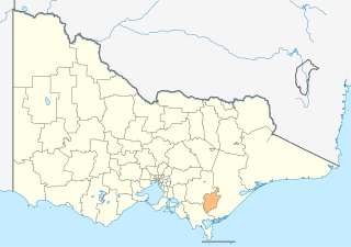
List of places on the Victorian Heritage Register in the Shire of Baw Baw

Last updated

This is a list of places on the Victorian Heritage Register in the Shire of Baw Baw in Victoria, Australia. The Victorian Heritage Register is maintained by the Heritage Council of Victoria.

The Victorian Heritage Register, as of 2021, lists the following sixteen state-registered places within the Shire of Baw Baw: [1]

Place namePlace #LocationSuburb or TownCo-ordinatesBuiltState
registered
Photo
Brunton's Bridge H1450 Bruntons Bridge Road Walhalla 37°59′56″S146°28′22″E / 37.998778°S 146.472694°E / -37.998778; 146.472694 188720 August 1982
Former Walhalla Post Office and Residence H0583 Main Road Walhalla 37°56′36″S146°27′02″E / 37.943222°S 146.450694°E / -37.943222; 146.450694 188529 August 1984
Lower Goodwood Kilns H1819 Goodwood Mill Track Gentle Annie 37°53′21″S145°51′59″E / 37.889111°S 145.866278°E / -37.889111; 145.866278 193117 June 1999
New Ada Mill H1820 Walk Into History Track Ada 37°49′07″S145°50′32″E / 37.818583°S 145.842361°E / -37.818583; 145.842361 193117 June 1999
New Federal Mill H1821 Upper Yarra Walking Track Ada 37°49′15″S145°50′08″E / 37.820833°S 145.835583°E / -37.820833; 145.835583 193517 June 1999
Primary School No. 1924 H1627 153-161 Princes Way Drouin 38°07′56″S145°51′17″E / 38.132306°S 145.854694°E / -38.132306; 145.854694 193620 August 1982
Rail Bridge H1443 Thomson River Walhalla 37°57′34″S146°25′13″E / 37.959333°S 146.420389°E / -37.959333; 146.420389 191020 August 1982 Walhalla 1910 Railway.jpg
Rail Bridge H1435 Noojee Trestle Bridge Rail Trail Noojee 37°53′58″S145°59′09″E / 37.899583°S 145.985778°E / -37.899583; 145.985778 19199 October 1974 Noojee trestle.jpg
Thomson River Diversion Tunnel Site H1990 Thomson River Walhalla 37°58′20″S146°25′28″E / 37.972222°S 146.424472°E / -37.972222; 146.424472 191211 July 2002
Timber Bridge H1995 Bloomfield Rd Crossover 38°03′12″S145°57′58″E / 38.053222°S 145.966000°E / -38.053222; 145.966000 189222 August 2002
Tramway Bridge H1444 Australian Alps Walking Track Walhalla 37°55′55″S146°24′53″E / 37.931806°S 146.414806°E / -37.931806; 146.414806 190020 August 1982
Walhalla Bandstand H1315 Main Road Walhalla 37°56′29″S146°27′06″E / 37.941472°S 146.451778°E / -37.941472; 146.451778 18968 May 1997
Walhalla Cemetery H1976 Main Road Walhalla 37°56′55″S146°27′05″E / 37.948500°S 146.451417°E / -37.948500; 146.451417 14 February 2002
Warragul Drill Hall H0600 40 Alfred Street Warragul 38°09′59″S145°56′02″E / 38.166500°S 145.934000°E / -38.166500; 145.934000 1912-191313 September 2007
Warragul Railway Station H1598 122 Queen Street Warragul 38°09′54″S145°55′59″E / 38.165028°S 145.933083°E / -38.165028; 145.933083 191520 August 1982 Warragul station July18.JPG
Windsor House H0326 Right Hand Branch Road Walhalla 37°56′31″S146°27′11″E / 37.941944°S 146.453111°E / -37.941944; 146.453111 18909 October 1974

Related Research Articles

City of Latrobe Local government area in Victoria, Australia

The City of Latrobe is a local government area in the Gippsland region in eastern Victoria, Australia, located in the eastern part of the state. It covers an area of 1,426 square kilometres (551 sq mi) and in June 2018 had a population of 75,211. It is primarily urban with the vast majority of its population living within the four major urban areas of Moe, Morwell, Traralgon, and Churchill, and other significant settlements in the LGA include Boolarra, Callignee, Glengarry, Jeeralang, Newborough, Toongabbie, Tyers, Yallourn North and Yinnar. It was formed in 1994 from the amalgamation of the City of Moe, City of Morwell, City of Traralgon, Shire of Traralgon, and parts of the Shire of Narracan and Shire of Rosedale. The Yallourn Works Area was added in 1996. When formed, the municipality was called the Shire of La Trobe, but on 6 April 2000, it adopted its current name.

Shire of Mansfield Local government area in Victoria, Australia

The Shire of Mansfield is a local government area in the Hume region of Victoria, Australia, located in the north-east part of the state. It covers an area of 3,844 square kilometres (1,484 sq mi) and in June 2018, had a population of 8,979.

Victorian Heritage Register Heritage register of places in Victoria, Australia

The Victorian Heritage Register (VHR) lists places deemed to be of cultural heritage significance to the State of Victoria, Australia. It has statutory weight under the Heritage Act 2017. The Minister for Planning is the responsible Minister. Heritage Victoria was established as the State Government listing and permit authority in 1995, replacing the original authority, the Historic Buildings Preservation Council, established in 1974. Listing on the Victorian Heritage Register is separate from listing by a local Council or Shire, known as a Heritage Overlay. Heritage Victoria is currently part of the Department of Environment, Land, Water and Planning of the Government of Victoria, Australia. Heritage Victoria reports to the Heritage Council who approve recommendations to the Register and hear appeals when a registration is disputed. The council also hears appeals by an owner to a permit issued by Heritage Victoria. As of 2021, there are over 2,400 places and objects listed on the VHR.

Former Fire Station (Walhalla, Victoria)

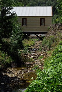
The Former Fire Station in Walhalla, Baw Baw Shire, Victoria spans over Stringer's Creek. It is listed on the Victorian Heritage Register.

References

  1. "Baw Baw Shire". Victorian Heritage Database. Heritage Council of Victoria. Retrieved 15 November 2021.