List of places on the Victorian Heritage Register in the Rural City of Benalla

Last updated

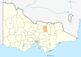
This is a list of places on the Victorian Heritage Register in the Rural City of Benalla in Victoria, Australia. The Victorian Heritage Register is maintained by the Heritage Council of Victoria.

The Victorian Heritage Register, as of 2021, lists the following seventeen state-registered places within the Rural City of Benalla: [1]

Place namePlace #LocationSuburb or TownCo-ordinatesBuiltState
registered
Photo
Benalla Botanical Gardens and Art Gallery H2260 Bridge Street West Benalla 36°33′20″S145°58′27″E / 36.555611°S 145.974111°E / -36.555611; 145.974111 18749 December 2010 BenallaArtGallery.JPG
Benalla Water Supply Depot H1048 1-3 Riverview Road Benalla 36°33′26″S145°59′25″E / 36.557111°S 145.990250°E / -36.557111; 145.990250 187910 November 1994
Broken River Bridge H1043 Bridge Street Benalla 36°33′09″S145°58′51″E / 36.552500°S 145.980972°E / -36.552500; 145.980972 190918 August 1994
Ellen Kelly Homestead Site H2410 Greta Road Glenrowan West 36°31′22″S146°10′21″E / 36.522889°S 146.172417°E / -36.522889; 146.172417 21 October 2021
Former Benalla Court House H1070 69 Arundel Street Benalla 36°33′19″S145°58′40″E / 36.555222°S 145.977778°E / -36.555222; 145.977778 187927 April 1995
Former Benalla Migrant Camp H2358 1 & 57 Samaria Road Benalla 36°33′18″S145°59′57″E / 36.554944°S 145.999194°E / -36.554944; 145.999194 194119 May 2016 Hut 11.jpg
Former Lands Office H1069 71 Arundel Street Benalla 36°33′19″S145°58′41″E / 36.555333°S 145.978000°E / -36.555333; 145.978000 186120 April 1995
Former Shire Offices H2189 13 Mair Street Benalla 36°33′05″S145°58′55″E / 36.551278°S 145.982056°E / -36.551278; 145.982056 195811 June 2009
Former Thoona Dairy and Butter Factory H1330 38 Sargeant Street Thoona 36°20′30″S146°04′43″E / 36.341528°S 146.078500°E / -36.341528; 146.078500 188914 August 1997
Grandstand H0976 Benalla Showgrounds, Bridge Street West Benalla 36°33′16″S145°58′45″E / 36.554583°S 145.979222°E / -36.554583; 145.979222 191822 July 1993
Holy Trinity Church H1073 73 Arundel Street Benalla 36°33′20″S145°58′42″E / 36.555444°S 145.978250°E / -36.555444; 145.978250 186520 April 1995
Kelly Gang Camp Site H2123 Old Tolmie Road Archerton 36°51′35″S146°11′03″E / 36.859694°S 146.184250°E / -36.859694; 146.184250 187610 September 2009
National Bank H1056 75-79 Nunn Street Benalla 36°33′03″S145°59′01″E / 36.550944°S 145.983528°E / -36.550944; 145.983528 189110 November 1994
Rail Bridge H1061 Over Broken River Benalla 36°32′49″S145°58′39″E / 36.547083°S 145.977389°E / -36.547083; 145.977389 18792 February 1995
Spring Creek Sawmill and Seasoning Works H1824 Mount Samaria State Park Bridge Creek 36°52′01″S146°05′40″E / 36.867000°S 146.094528°E / -36.867000; 146.094528 192317 June 1999
St Joseph's Catholic Church H0845 42 Arundel Street Benalla 36°33′13″S145°58′32″E / 36.553722°S 145.975556°E / -36.553722; 145.975556 18666 February 1991
Stringybark Creek site H2205 Stringybark Creek Road and Tatong-Tolmie Road Archerton 36°52′08″S146°13′06″E / 36.868944°S 146.218444°E / -36.868944; 146.218444 187810 September 2009

Related Research Articles

Benalla Town in Victoria, Australia

Benalla is a small city located on the Broken River gateway to the High Country north-eastern region of Victoria, Australia, about 212 kilometres (130 mi) north east of the state capital Melbourne. At the 2016 census the population was 9,298.

Rural City of Wangaratta Local government area in Victoria, Australia

The Rural City of Wangaratta is a local government area in the Hume region of Victoria, Australia, located in the north-east part of the state. It covers an area of 3,645 square kilometres (1,407 sq mi) and, in June 2018, had a population of 29,087. It includes the towns of Cheshunt, Eldorado, Everton, Glenrowan, Greta, Greta West, Milawa, Moyhu, Oxley, Tarrawingee, Wangaratta and Whitfield. It was formed in 1994 from the amalgamation of the City of Wangaratta, Shire of Wangaratta, Shire of Oxley, and parts of the United Shire of Beechworth, Shire of Benalla and Shire of Yarrawonga. When formed the municipality was originally called the Shire of Milawa, but a few months later, was renamed to its current name.

The Shire of Delatite was a local government area in Victoria, Australia, located in the north-east part of the state. It covered an area of 6,218 square kilometres (2,401 sq mi) and, at the 2001 census, had a population of 21,553. It included the towns of Benalla and Mansfield, and was formed in 1994 from the amalgamation of the City of Benalla, Shire of Benalla, the then Shire of Mansfield and part of the Shire of Violet Town. In 2002 the shire was split into the Rural City of Benalla and Shire of Mansfield. This process has been cited as an example of successful de-amalgamation by residents of other councils who are unhappy with the forced mergers that affected almost all Victorian local government areas in 1994.

Rural City of Benalla Local government area in Victoria, Australia

The Rural City of Benalla is a local government area in the Hume region of Victoria, Australia, located in the north-east part of the state. It covers an area of 2,353 square kilometres (908 sq mi) and, in June 2018, had a population of 14,024.

Shire of Mansfield Local government area in Victoria, Australia

The Shire of Mansfield is a local government area in the Hume region of Victoria, Australia, located in the north-east part of the state. It covers an area of 3,844 square kilometres (1,484 sq mi) and in June 2018, had a population of 8,979.

Victorian Heritage Register Heritage register of places in Victoria, Australia

The Victorian Heritage Register (VHR) lists places deemed to be of cultural heritage significance to the State of Victoria, Australia. It has statutory weight under the Heritage Act 2017. The Minister for Planning is the responsible Minister. Heritage Victoria was established as the State Government listing and permit authority in 1995, replacing the original authority, the Historic Buildings Preservation Council, established in 1974. Listing on the Victorian Heritage Register is separate from listing by a local Council or Shire, known as a Heritage Overlay. Heritage Victoria is currently part of the Department of Environment, Land, Water and Planning of the Government of Victoria, Australia. Heritage Victoria reports to the Heritage Council who approve recommendations to the Register and hear appeals when a registration is disputed. The council also hears appeals by an owner to a permit issued by Heritage Victoria. As of 2021, there are over 2,400 places and objects listed on the VHR.

City of Benalla Local government area in Victoria, Australia

The City of Benalla was a local government area about 188 kilometres (117 mi) northeast of Melbourne, the state capital of Victoria, Australia. The city, which was surrounded by the Shire of Benalla, covered an area of 17.76 square kilometres (6.9 sq mi), and existed from 1948 until 1994.

Benalla Migrant Camp

The Benalla Migrant Camp, formally known as the Benalla Holding Centre and the Benalla Migrant Accommodation Centre, was one of 23 similar camps established by the Australian government to provide temporary housing for non-British new arrivals in post-World War II Australia. The Camp occupied the former Royal Australian Air Force (RAAF) No.11 Elementary Flying Training School (1941-1944), adjacent to a small aerodrome on the outskirts of Benalla in north east Victoria. Opening in 1949, the Benalla Migrant Camp was a modest-sized holding centre, accommodating 200 – 400 people. It survived national reviews of migrant accommodation needs in 1953 and 1959, but by 1967, the number of residents had diminished sufficiently for the Camp to close. By that time, over 60,000 people — mainly of Polish, Latvian, Lithuanian, German and Estonian origins, as well as other nationalities — had been accommodated there.

References

  1. "Benalla Rural City". Victorian Heritage Database. Heritage Council of Victoria. Retrieved 28 November 2021.