The City of Whitehorse is a local government area in Victoria, Australia in the eastern suburbs of Melbourne. It has an area of 64.3 km2 (25 sq mi) and an estimated residential population of 171,167 as of June 2021.

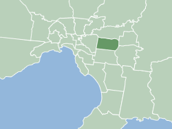
The City of Maroondah is a local government area in Victoria, Australia in the eastern suburbs of Melbourne. Maroondah had a population of 115,043 in August 2021.

Ringwood is an eastern suburb of Melbourne, Victoria, Australia, 29 km (18 mi) east of Melbourne's Central Business District, located within the City of Maroondah local government area. Ringwood recorded a population of 19,144 at the 2021 census.
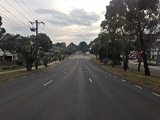
Maroondah Highway is a major east–west thoroughfare in the eastern suburbs of Melbourne, and a highway connecting the north-eastern fringes of Melbourne to the lower alpine region of Victoria, Australia.

Kilsyth is a suburb of Melbourne, Victoria, Australia, 36 km east from Melbourne's central business district (CBD), located within the City of Maroondah and the Shire of Yarra Ranges local government areas. Kilsyth recorded a population of 11,699 at the 2021 census.
Park Orchards is a suburb of Melbourne, Victoria, Australia, 23 km north-east of Melbourne's Central Business District, located within the Cities of Manningham and Maroondah local government areas. At the 2021 census, Park Orchards recorded a population of 3,835.
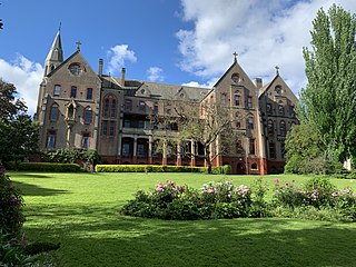
The Victorian Heritage Register (VHR) lists places deemed to be of cultural heritage significance to the State of Victoria, Australia. It has statutory weight under the Heritage Act 2017. The Minister for Planning is the responsible Minister. Heritage Victoria was established as the State Government listing and permit authority in 1995, replacing the original authority, the Historic Buildings Preservation Council, established in 1974. Listing on the Victorian Heritage Register is separate from listing by a local Council or Shire, known as a Heritage Overlay. Heritage Victoria is currently part of the Department of Environment, Land, Water and Planning of the Government of Victoria, Australia. Heritage Victoria reports to the Heritage Council who approve recommendations to the Register and hear appeals when a registration is disputed. The council also hears appeals by an owner to a permit issued by Heritage Victoria. As of 2021, there are over 2,400 places and objects listed on the VHR.
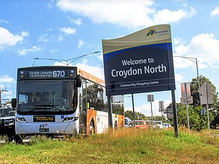
Croydon North is a suburb of Melbourne, Victoria, Australia, 36 km east of Melbourne's Central Business District, located within the City of Maroondah local government area. Croydon North recorded a population of 8,092 at the 2021 census.

The City of Ringwood was a local government area about 25 kilometres (16 mi) east of Melbourne, the state capital of Victoria, Australia. The city covered an area of 22.76 square kilometres (8.79 sq mi), and existed from 1924 until 1994.

The City of Croydon was a local government area about 30 kilometres (19 mi) east of Melbourne, the state capital of Victoria, Australia. The city covered an area of 34.32 square kilometres (13.25 sq mi), and existed from 1961 until 1994.
The Victorian Heritage Inventory, commonly known as the Heritage Inventory, is a list of all known historical archaeology sites in Victoria, Australia. It is maintained by Heritage Victoria , the Victorian State Government’s principal cultural (non-Indigenous) heritage agency.
