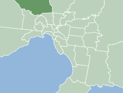
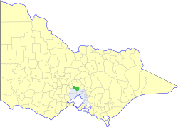
This is a list of places on the Victorian Heritage Register in the City of Whittlesea in Victoria, Australia. The Victorian Heritage Register is maintained by the Heritage Council of Victoria.
The Victorian Heritage Register, as of 2020, lists the following 14 state-registered places within the City of Whittlesea: [1]
Place name | Place # | Location | Suburb or Town | Co-ordinates | Built | Stateregistered | Photo |
---|---|---|---|---|---|---|---|
Bear's Castle | H1420 | Yan Yean Water Supply Catchment Reserve, Cades Lane | Yan Yean | 37°32′18″S145°08′07″E / 37.538400°S 145.135190°E | c. 1846 | 9 October 1974 | |
Fashoda Homestead | H2312 | 330 Bridge Inn Rd | Mernda | 37°35′54″S145°04′12″E / 37.598240°S 145.070010°E | c. 1855 | 11 October 2012 | |
Graff's Farm | H0915 | 1 Thomas St | Thomastown | 37°40′39″S145°00′31″E / 37.677540°S 145.008520°E | 1873 | 3 June 1992 | |
Horse-Drawn Stone-Carrying Sled | H2237 | 275 Oherns Rd | Epping | 37°38′05″S144°59′39″E / 37.634720°S 144.994190°E | c. 1858 | 8 April 2010 | |
Old Bundoora Primary School | H1344 | 222 Plenty Rd | Bundoora | 37°41′09″S145°04′07″E / 37.685760°S 145.068720°E | 1877 | 18 September 1997 | |
Old South Morang Primary School | H1398 | 879 Plenty Rd | South Morang | 37°38′50″S145°05′28″E / 37.647350°S 145.091210°E | 1877 | 11 December 1997 | |
Maroondah Water Supply System (Upper and Central Sections) | H2381 | through Bundoora | 1891 | 24 May 2018 | |||
Siebel's Farmhouse | H1212 | 77 Mount View Rd | Thomastown | 37°40′22″S145°00′37″E / 37.672870°S 145.010180°E | 1860 | 24 October 1996 | |
Summerhill | H0958 | 585 Summerhill Rd | Wollert | 37°34′59″S144°57′52″E / 37.583010°S 144.964510°E | 1850s | 8 November 2007 | |
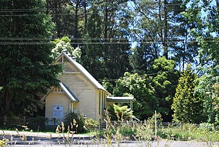
Thomastown Lutheran Church and Cemetery | H0899 | 104-112 Gardenia Rd | Lalor | 37°40′18″S145°00′30″E / 37.671560°S 145.008340°E | 1856 | 13 May 1992 | |
Whittlesea Primary School | H1717 | 2425-2435 Plenty Rd | Whittlesea | 37°30′52″S145°06′49″E / 37.514390°S 145.113710°E | 1878 | 20 August 1982 | |
Wuchatsch's Farm | H0950 | 74 Robert St | Lalor | 37°40′02″S145°00′24″E / 37.667350°S 145.006680°E | 1850s | 16 December 1992 | |
Yan Yean Water Supply System | H2333 | through Whittlesea, Humevale, Yan Yean, Doreen, Mernda, South Morang, Mill Park and Bundoora | 36°00′39″S146°00′08″E / 36.010763°S 146.002088°E | 1853-57 | 12 December 2013 | ||
Ziebell's Farm | H0979 | 100-102 Gardenia Rd | Thomastown | 37°40′20″S145°00′25″E / 37.672230°S 145.007070°E | 1850s | 19 August 1993 | |
The City of Whittlesea is a local government area located in the outer northern suburbs of Melbourne, the state capital of Victoria, Australia. The city covers an area of 490 square kilometres (189.2 sq mi), and in June 2018, it had a population of 223,322.
The City of Hume is a local government area located within the metropolitan area of Melbourne, Victoria, Australia. It includes the outer north-western suburbs and a number of rural localities between 13 and 40 kilometres from the Melbourne city centre.
The Shire of Murrindindi is a local government area in the Hume region of Victoria, Australia, located in the north-east part of the state. It covers an area of 3,880 square kilometres (1,500 sq mi) and, in August 2021, had a population of 15,197. It includes the towns of Alexandra, Buxton, Eildon, Flowerdale, Kinglake, Marysville, Molesworth, Strath Creek, Taggerty, Yarck and Yea. It was formed in 1994 from the amalgamation of the Shire of Alexandra, Shire of Yea, and parts of the Shire of Broadford, Shire of Eltham, Shire of Euroa, Shire of Healesville and City of Whittlesea.
Yarra Plenty Regional Library (YPRL) provides a public library service to the local government municipalities of the City of Banyule, Shire of Nillumbik and City of Whittlesea in the northeast of Melbourne Australia and located on the lands of the Woiworung. It is an independent legal entity with an executive management team which is responsible for day-to-day operations of the organisation. It is managed by the Yarra Plenty Regional Library Board made of two representatives (councillors) of the three municipalities that constitute the service. Its role is to set the policy and direction for the regional library service. The library service covers an area of 988.4 km² including metropolitan, urban fringe and rural populations. The organisation is administered from its Library Support Services (LSS) located at Daniher Drive, Sth Morang.
The City of Preston was a local government area about 11 kilometres (7 mi) north-northeast of Melbourne, the state capital of Victoria, Australia. The city covered an area of 37.05 square kilometres (14.31 sq mi), and existed from 1871 until 1994.
The Shire of Bulla was a local government area about 40 kilometres (25 mi) northwest of Melbourne, the state capital of Victoria, Australia. The shire covered an area of 422.17 square kilometres (163.0 sq mi), and existed from 1862 until 1994.
The Shire of Eltham was a local government area about 25 kilometres (16 mi) northeast of Melbourne, the state capital of Victoria, Australia. The shire covered an area of 277.13 square kilometres (107.0 sq mi), and existed from 1856 until 1994.
Kinglake West is a town in Victoria, Australia, 45 km (28 mi) north-east of Melbourne's Central Business District, located within the City of Whittlesea and the Shires of Murrindindi and Nillumbik local government areas. Kinglake West recorded a population of 1,305 at the 2021 census.
Westgarthtown is a heritage registered precinct located within the Melbourne suburbs of Thomastown and Lalor, in Victoria, Australia.