List of places on the Victorian Heritage Register in the Shire of Towong

Last updated

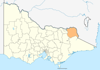
This is a list of places on the Victorian Heritage Register in the Shire of Towong in Victoria, Australia. The Victorian Heritage Register is maintained by the Heritage Council of Victoria.

The Victorian Heritage Register, as of 2021, lists the following thirty-four state-registered places within the Shire of Towong: [1]

Place namePlace #LocationSuburb or TownCo-ordinatesBuiltState
registered
Photo
Bethanga Bridge H0989 Riverina Highway Bellbridge 36°05′24″S147°03′30″E / 36.090111°S 147.058306°E / -36.090111; 147.058306 192714 July 2005 Bethanga Bridge (Lake Hume) 2015.jpg
Dart River Gold Battery Site H1267 Sipthorpe Track Nariel Valley,
Dartmouth
36°31′18″S147°46′19″E / 36.521611°S 147.771889°E / -36.521611; 147.771889 185119 December 1996
Glengarry Gold Battery and Chlorination Works H1278 Corryong-Benambra Road Dartmouth 36°31′44″S147°47′15″E / 36.528861°S 147.787528°E / -36.528861; 147.787528 193719 December 1996
Greens Creek Battery Site H1266 Alpine National Park Dartmouth 36°34′43″S147°38′26″E / 36.578639°S 147.640611°E / -36.578639; 147.640611 188419 December 1996
La Mascotte Gold Battery Site and Chlorination Works H1276 Sipthorpe Track Nariel Valley 36°31′09″S147°46′31″E / 36.519139°S 147.775361°E / -36.519139; 147.775361 189719 December 1996
Mount Merrimac Gold Battery Site H1304 Lightning Creek Mitta Mitta 36°39′04″S147°21′22″E / 36.651111°S 147.356139°E / -36.651111; 147.356139 189027 March 1997
Pioneer and Union Hydraulic Gold Sluicing Site H1229 Omeo Highway Mitta Mitta 36°32′31″S147°22′26″E / 36.542000°S 147.373750°E / -36.542000; 147.373750 185928 November 1996
Thologolong Homestead H1832 4770 Murray River Road
(Stockyard Creek Track)
Thologolong 35°59′24″S147°23′35″E / 35.990111°S 147.393083°E / -35.990111; 147.393083 19279 September 1999
Tintaldra General Store and Former Bakery H0777 3 Main Street Tintaldra 36°02′49″S147°55′54″E / 36.047056°S 147.931778°E / -36.047056; 147.931778 186430 November 1990 Tintaldra tearooms Stevage.jpeg
Young Australian Battery and Gold Cyaniding Works H1761 Glendart Track Dartmouth 36°32′34″S147°47′12″E / 36.542722°S 147.786611°E / -36.542722; 147.786611 188326 November 1998

Related Research Articles

Shire of Towong Local government area in Victoria, Australia

The Shire of Towong is a local government area in the Hume region of Victoria, Australia, located in the north-east part of the state. It covers an area of 6,675 square kilometres (2,577 sq mi) and in June 2018 had a population of 6,054.

Alpine Shire Local government area in Victoria, Australia

The Alpine Shire is a local government area in the Hume region of Victoria, Australia, located in the north-east part of the state. It covers an area of 4,788 square kilometres (1,849 sq mi) and in June 2018 had a population of 12,730.

Victorian Heritage Register Heritage register of places in Victoria, Australia

The Victorian Heritage Register (VHR) lists places deemed to be of cultural heritage significance to the State of Victoria, Australia. It has statutory weight under the Heritage Act 2017. The Minister for Planning is the responsible Minister. Heritage Victoria was established as the State Government listing and permit authority in 1995, replacing the original authority, the Historic Buildings Preservation Council, established in 1974. Listing on the Victorian Heritage Register is separate from listing by a local Council or Shire, known as a Heritage Overlay. Heritage Victoria is currently part of the Department of Environment, Land, Water and Planning of the Government of Victoria, Australia. Heritage Victoria reports to the Heritage Council who approve recommendations to the Register and hear appeals when a registration is disputed. The council also hears appeals by an owner to a permit issued by Heritage Victoria. As of 2021, there are over 2,400 places and objects listed on the VHR.

Shire of Tallangatta Local government area in Victoria, Australia

The Shire of Tallangatta was a local government area about 340 kilometres (211 mi) northeast of Melbourne, the state capital of Victoria, Australia. The shire covered an area of 4,090.72 square kilometres (1,579.4 sq mi), and existed from 1869 until 1994.

References

  1. "Towong Shire". Victorian Heritage Database. Heritage Council of Victoria. Retrieved 30 November 2021.