Prince Regent National Park

Last updated

Prince Regent National Park
Western Australia
ISS015-E-17358 - View of Western Australia.jpg
Satellite image of the Prince Regent National Park, Prince Regent River and Saint George Basin taken by ISS Expedition 15
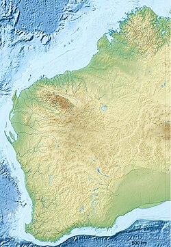
Australia Western Australia relief location map.png
Red pog.svg
Prince Regent National Park
Coordinates 15°34′03″S125°28′07″E / 15.5674°S 125.4685°E / -15.5674; 125.4685 Coordinates: 15°34′03″S125°28′07″E / 15.5674°S 125.4685°E / -15.5674; 125.4685
Established1964 [1]
Area5,764.0 km2 (2,225.5 sq mi) [1]
Website Prince Regent National Park
FootnotesCoordinates [1]

Prince Regent National Park, formerly the Prince Regent Nature Reserve, is a protected area in the Kimberley region of Western Australia. In 1978 the area was nominated as a UNESCO World Biosphere Reserve.

Contents

Land

The national park covers a total area of 5,764 square kilometres (2,225 sq mi) [1] and was created in 1964 to protect the catchment area of the Prince Regent River. The northern boundary of the national park abuts the southern boundary of the Mitchell River National Park creating a protected area of over 7,500 square kilometres (2,900 sq mi). [2] The landscape of the reserve ranges from lush rainforest to sandstone plains. The area contains gorges, waterfalls, cliffs and mountain ranges.

Careening Bay, on Coronation Island, site of "The Mermaid Tree" (after HMS Mermaid, Philip Parker King's ship) is within the park. The boab tree was inscribed by the ship's carpenter when the vessel was deliberately careened (beached) in order to undertake repairs. [3]

Traditional Owners

The Traditional Owners of the area round the river are the Worrorra peoples, [4] [5] but the park lies mainly in Wunambal land. [6]

As part of the same native title claim lodged in 1998 by Wanjina Wunggurr RNTBC known as the Dambimangari claim, [7] which included claims for the three peoples in the Wanjina Wunggurr cultural bloc, referred to as Dambimangari (Worrorra), Uunguu (Wunambal) and Wilinggin (Ngarinyin), the Uunguu parts of the claims were determined on 23 May 2011. This gave native title to the Wunambal people over 25,909 km2 (10,004 sq mi), [8] [9] stretching along the coastal waters from the Anjo Peninsula in the north, including the waters of Admiralty Gulf and York Sound, down to Coronation Island. Inland, it includes parts of the Mitchell River National Park and the Prince Regent National Park. [10]

Wildlife

More than half of the bird and mammal species found in the Kimberley region are found within the national park. [11] It is home to the monjon, the smallest of the rock-wallabies, [12] and the golden bandicoot - listed as a vulnerable species. [13] The Prince Regent and Mitchell River Important Bird Area which overlaps part of the national park, is an area identified as an Important Bird Area by BirdLife International, an international non-government organisation, because of its importance for a range of bird species, especially those restricted to tropical savanna habitats. [14]

Access

The area remains one of Australia's most remote wilderness areas with no roads and formidable tide-races and whirlpools restricting seaward access. The area is mostly accessed by air or by boat and has remained virtually unchanged since European settlement of Western Australia. A permit is required to enter the national park and can be obtained from the Parks and Wildlife Service.

See also

Related Research Articles

Wandjina Spirit beings of north-western Australian Aboriginal mythology

The Wandjina, also written Wanjina and Wondjina and also known as Gulingi, are cloud and rain spirits from Australian Aboriginal mythology that are depicted prominently in rock art in Australia. Some of the artwork in the Kimberley region of Western Australia dates back to approximately 4,000 years ago. Another closely related spirit entity is the creator being Wunngurr, a being analogous to the Rainbow Serpent in other Aboriginal peoples' belief systems, but with a different interpretation.

Gibb River Road Track in Western Australia

The Gibb River Road is a road in the Kimberley region of Western Australia.

Horizontal Falls Natural phenomenon in Western Australia where spring tides create a waterfall

The Horizontal Falls, or Horizontal Waterfalls, nicknamed the "Horries" and known as Garaanngaddim by the local Indigenous people, are an unusual natural phenomenon on the coast of the Kimberley region in Western Australia, where tidal flows cause waterfalls on the ebb and flow of each tide. The Lalang-garram / Horizontal Falls Marine Park is a protected area covering the falls and wider area.

Wunambal language Aboriginal Australian language of Western Australia

The Wunambal language, also known as Northern Worrorran, Gambera or Gaambera, is a moribund Australian Aboriginal language of Western Australia. It has several dialects, including Yiiji, Gunin, Miwa, and Wilawila. It is spoken by the Wunambal people.

Golden bandicoot Species of marsupial

The golden bandicoot is a short-nosed bandicoot found in northern Australia. It is the smallest of its genus.

Bush Heritage Australia

Bush Heritage Australia is a non-profit organisation based in Melbourne, Australia, that operates throughout Australia. It was previously known as the Australian Bush Heritage Fund, which is still its legal name. It purchases land, assessed as being of outstanding conservation value, from private owners, to manage as wildlife reserves in perpetuity. It also partners with existing land owners, including Aboriginal groups, to help plan and manage conservation work of important landscapes. It does so to protect endangered species and preserve Australia's biodiversity. By 2020 the organisation was contributing to the protection of 11.3 million hectares on its reserves and partnership lands. There were 6,700 Australian species recorded on its reserves and partnership properties, including 226 threatened species.

Kimberley Land Council Aboriginal Corporation, known as Kimberley Land Council, (KLC) is an association of Aboriginal people in the Kimberley region of Western Australia. The land council was formed at a meeting at Noonkanbah Station in May 1978. The corporation is registered with the Office of the Registrar of Indigenous Corporations as ICN 21.

Mitchell River National Park (Western Australia) Protected area in Western Australia

Mitchell River National Park is a national park in the Kimberley region of Western Australia, 2,140 kilometres (1,330 mi) northeast of Perth. The park adjoins the northern boundary of the Prince Regent National Park. The nearest towns are Derby, 350 kilometres (217 mi) to the southwest, as well as Wyndham, 270 km (168 mi) to the southeast. Created in 2000, the park covers an area of over 1,150 km2 (440 sq mi) on the Mitchell Plateau (Ngauwudu).

Camden Sound Coastal feature in Western Australia

Camden Sound is a relatively wide body of water in the Indian Ocean located in the Kimberley region of Western Australia. The Sound is bounded by the Bonaparte Archipelago to the north-east, the Buccaneer Archipelago to the south-west, and Montgomery Reef to the south.

Augustus Island, is an uninhabited island off the Kimberley coast of Western Australia, within the Shire of Wyndham-East Kimberley.

Prince Regent River River in Kimberley region of Western Australia

The Prince Regent River is a river in the Kimberley region of Western Australia.

Kimberley tropical savanna Terrestrial ecoregion in Western Australia

The Kimberley tropical savanna is a tropical and subtropical grasslands, savannas, and shrublands ecoregion in northwestern Australia, covering portions of Western Australia and the Northern Territory south of the Timor Sea.

There are over 2,500 islands lying off the coast of the Kimberley region of Western Australia.

Coronation Island, also known as Garlinju, is located off the Kimberley coast of Western Australia. It encompasses an area of 3,817 hectares. It is located off Port Nelson in the Bonaparte Archipelago, as a part of the group of islands known as the Coronation Islands, which were named by Philip Parker King, the first European to visit the islands in 1820, after the anniversary of the coronation of George III, who had died in January of that year.

Storr Island, also known as Yudawala or Yeewadan Ganjal, is an uninhabited island located in the Kimberley region of Western Australia.

Worrorra Indigenous people in Western Australia

The Worrorra, also written Worora, are an Aboriginal Australian people of the Kimberley area of north-western Australia.

The Ngarinyin or Ngarinjin are an Aboriginal Australian people of the Kimberley region of Western Australia. Their language, Ngarinyin, is also known as Ungarinyin. When referring to their traditional lands, they refer to themselves as Wilinggin people.

Wunambal Aboriginal Australian people of the Kimberley region in Western Australia

The Wunambal (Unambal), also known as Wunambal Gaambera, Uunguu, and other names, are an Aboriginal Australian people of the northern Kimberley region of Western Australia.

The Ngardi, also spelled Ngarti, are an Aboriginal Australian people of the Northern Territory and Western Australia.

The North Kimberley Marine Park is the largest state-managed marine park in Western Australia and second largest in Australia. covering 1,845,000 ha or 18,450 km2 (7,120 sq mi) about 270 km (170 mi) north-east of Derby. It is located in the Indian Ocean and the Timor Sea, extending from York Sound north-eastwards to the WA border with the Northern Territory.

References

  1. 1 2 3 4 "Collaborative Australian Protected Area Database (CAPAD) - Terrestrial Protected Areas by Reserve Type in Western Australia (2014) (refer "DETAIL' tab)". Australian Government, Department of the Environment (DoE). Retrieved 30 October 2016.
  2. "Department of Environment - Park Finder - Ngauwudu Management Area (Mitchell Plateau)". 2009. Retrieved 15 October 2010.
  3. "Careening Bay". Parks WA . Parks and Wildlife Service.
  4. "AusAnthrop Australian Aboriginal tribal database". 2012. Archived from the original on 27 September 2015. Retrieved 12 May 2012.
  5. Clendon, Mark (2014). Worrorra: a language of the north-west Kimberley coast (See map, page i.). University of Adelaide. p. i. ISBN   978-1-922064-59-2 . Retrieved 10 November 2020. CC-BY icon.svg Text may be copied from this source, which is available under a Attribution 4.0 International (CC BY 4.0) licence.
  6. Rumsey, Alan (2018). "The sociocultural dynamics of indigenous multilingualism in northwestern Australia". Language & Communication . 62 (B): 91–101. doi:10.1016/j.langcom.2018.04.011. ISSN   0271-5309. S2CID   150007441 . Retrieved 10 November 2020. See also Worrorran languages map.
  7. "About". Dambimangari Aboriginal Corporation. Includes map. Retrieved 10 November 2020.{{cite web}}: CS1 maint: others (link)
  8. "Copy of Native Title Map". Kimberley Land Council. 8 August 2013. Retrieved 10 November 2020.
  9. "Native Title Determination Details: WCD2011/002 - Dambimangari". National Native Title Tribunal . Retrieved 10 November 2020.
  10. "Wunambal Gaambera People". Wunambal Gaambera Country. Includes map. Retrieved 10 November 2020.{{cite web}}: CS1 maint: others (link)
  11. "About Australia - Prince Regent National Park". 2008. Retrieved 10 March 2009.[ permanent dead link ]
  12. "The Kangaroo Trail - Factsheet". 2009. Retrieved 10 March 2009.
  13. "Department of environment - Isoodon auratus auratus — Golden Bandicoot (mainland)". 2009. Retrieved 10 March 2009.
  14. "IBA: Prince Regent and Mitchell River". Birdata. Birds Australia. Retrieved 22 September 2011.