
The Blue Mountains National Park is a protected national park that is located in the Blue Mountains region of New South Wales, in eastern Australia. The 267,954-hectare (662,130-acre) national park is situated approximately 80 kilometres (50 mi) west of Sydney, and the park boundary is quite irregular as it is broken up by roads, urban areas and inholdings. Despite the name mountains, the area is an uplifted plateau, dissected by a number of larger rivers. The highest point in the park is Mount Werong at 1,215 metres (3,986 ft) above sea level; while the low point is on the Nepean River at 20 metres (66 ft) above sea level as it leaves the park.
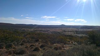
Gawler Ranges National Park is a 1,633 km2 (631 sq mi) protected area lying 350 km (217 mi) north-west of Adelaide in the northern Eyre Peninsula of South Australia. It is known for its spectacular rock formations.
Murray River National Park is a protected area in South Australia located between 180 kilometres (110 mi) and 240 km (150 mi) north east of the Adelaide city centre, lying along the Murray River. The national park is classified as an IUCN Category VI protected area. As of 2022 the national park comprises more than 14,879 ha, and includes a vast network of Murray River wetlands and floodplains.
Hassell National Park is a national park in the Great Southern region of Western Australia, 367 kilometres (228 mi) southeast of Perth and 57 km (35 mi) north east of Albany.

Mount Frankland National Park is a national park in the South West region of Western Australia, 327 km (203 mi) south of Perth. The park is part of the larger Walpole Wilderness Area that was established in 2004, an international biodiversity hotspot.
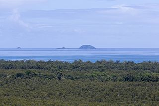
Frankland Group is a national park in Queensland, Australia, 1353 km northwest of Brisbane. The five continental islands of the Frankland Group are High Island, Normanby Island, Mabel Island, Round Island and Russell Island, which lie about 10 km offshore, and are about 45 km south east of Cairns. They are the traditional home of the Mandingalbay Yidinji, and the Gungandji Aboriginal peoples. On 9 June 1770, on the First voyage of James Cook, Cook named the island group after Admiral Sir Thomas Frankland, 5th Baronet.
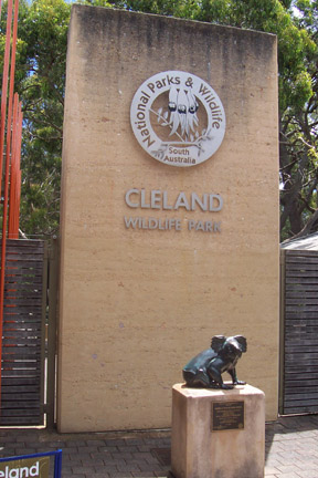
Cleland National Park, formerly Cleland Conservation Park, is a protected area located in the Adelaide Hills, South Australia about 22 kilometres (14 mi) south-east of the Adelaide city centre. It conserves a significant area of natural bushland on the Adelaide Hills face, including Mount Lofty Summit and Waterfall Gully.

Totness Recreation Park is a protected area in the Australian state of South Australia located within the localities of Mount Barker and Totness in the central Mount Lofty Ranges. Covering 41 hectares of land, the park is divided by the South Eastern Freeway and features a large dam. It was declared as a reserve in 1970 and re-designated as a recreation park in 1972. The park has no visitor facilities except for access tracks. It is the only park in the district, managed by the Department of Environment and Water, that is solely designated for recreation.

Warren, also known as Karri Forest Region and the Jarrah-Karri forest and shrublands ecoregion, is a biogeographic region in southern Western Australia. Located in the southwest corner of Western Australia between Cape Naturaliste and Albany, it is bordered to the north and east by the Jarrah Forest region. Its defining characteristic is an extensive tall forest of Eucalyptus diversicolor (karri). This occurs on dissected, hilly ground, with a moderately wet climate. Karri is a valuable timber and much of the karri forest has been logged over, but less than a third has been cleared for agriculture. Recognised as a region under the Interim Biogeographic Regionalisation for Australia (IBRA), and as a terrestrial ecoregion by the World Wide Fund for Nature, it was first defined by Ludwig Diels in 1906.

Mount Magnificent Conservation Park is a protected area in the Australian state of South Australia located in the Mount Lofty Ranges about 58 kilometres south of the state capital of Adelaide. It is located within the gazetted locality of Mount Magnificent.

Mount Anne is a mountain located in the Southwest National Park in south-west region of Tasmania, Australia. The mountain lies within the UNESCO World Heritage-listed Tasmanian Wilderness.
Mount Scott Conservation Park is a protected area in the Australian state of South Australia located in the gazetted locality of Blackford about 23 kilometres (14 mi) east of Kingston SE in the state's Limestone Coast region.
Wiljani Conservation Park is a protected area in the Australian state of South Australia in the gazetted locality of Mount Pleasant located about 3.5 kilometres (2.2 mi) north-west of the town centre in Mount Pleasant.
Lake Muir National Park is a national park in Western Australia, located 290 kilometres (180 mi) south east of Perth to the south of Muirs Highway in the Shire of Manjimup.

Mount Lindesay National Park is a national park in the Great Southern Region of Western Australia. It was designated in 2004, and covers an area of 395.73 km2. It is part of the larger Walpole Wilderness Area that was established in the same year.
Mount Roe National Park is a national park in the Great Southern Region of Western Australia. It was designated in 2004, and covers an area of 1278 km2.

Mount Frankland South National Park is a national park in Western Australia. It lies mostly in the South West region, with the eastern portion in Great Southern Region. It was designated in 2004, and covers an area of 422.99 km2. It is part of the larger Walpole Wilderness Area that was established in the same year.
Boyndaminup National Park is a national park in Western Australia. It is located in the Shire of Manjimup in the South West region. It was designated in 2004, and covers an area of 54.43 km2.
Blackwood River National Park is a national park in Western Australia. It extends along the middle reach of the Blackwood River, the largest river in South West Australia. It is located in the shires of Augusta–Margaret River and Nannup in the South West region. It was designated in 2004, and covers an area of 204.75 km2.
