Whicher National Park

Last updated

Whicher National Park
Western Australia
Cane brake pool gnangarra 01.JPG
Cane Brake Pool
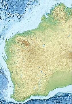
Australia Western Australia relief location map.png
Red pog.svg
Whicher National Park
Nearest town or city Nannup
Coordinates 33°45′S115°41′E / 33.750°S 115.683°E / -33.750; 115.683
Established2019
Areaunbeknownst
Managing authorities Department of Parks and Wildlife (Western Australia)
Website Whicher National Park
See also List of protected areas of
Western Australia

Whicher National Park is a National Park in the Whicher Range of the South West region of Western Australia. [1] The park is home to the protected Petrophile shrub and the source of the Margaret River.

It is located in the Jarrah Forest and Warren bioregions. [2]
Related Research Articles

<span class="mw-page-title-main">Fitzgerald River National Park</span> Protected area in Western Australia

Fitzgerald River National Park is a national park in the Shires of Ravensthorpe and the Jerramungup in Western Australia, 419 kilometres (260 mi) southeast of Perth. The park is recognised on Australia's National Heritage List for its outstanding diversity of native plant species, including many plants which are unique to the local area.

<span class="mw-page-title-main">Karijini National Park</span> Protected area in Western Australia

Karijini National Park is an Australian national park centred in the Hamersley Ranges of the Pilbara region in the northwestern section of Western Australia. The park is located north of the Tropic of Capricorn, 1,055 kilometres (656 mi) from the state's capital city, Perth. Formerly known as Hamersley Range National Park, the park was officially renamed in 1991.

<span class="mw-page-title-main">Tuart Forest National Park</span> Protected area in Western Australia

Tuart Forest National Park is a national park in the South West region of Western Australia, 183 kilometres (114 mi) south of Perth. It contains the largest remaining section of pure tuart forest in the world. Traditionally the state forest associated with this stand of trees has been known as the Ludlow State Forest, named for Frederick Ludlow.

<span class="mw-page-title-main">Yanchep National Park</span> Protected area in Western Australia

Yanchep is a national park in Western Australia, 42 kilometres (26 mi) north of Perth adjacent to the locality of the same name Yanchep.

<span class="mw-page-title-main">Town of Victoria Park</span> Local government area in Western Australia

The Town of Victoria Park is a local government area of Western Australia. It covers an area of 17.62 km² in metropolitan Perth, the capital of Western Australia. It had a population of approximately 35,000 as at the 2016 Census.

<span class="mw-page-title-main">Shire of Augusta–Margaret River</span> Local government area in Western Australia

The Shire of Augusta Margaret River is a local government area in the south-west corner of the South West region of Western Australia, approximately 270 kilometres (168 mi) south of Perth. The shire covers an area of 2,243 square kilometres (866 sq mi) and had a population of over 14,000 at the 2016 Census, about half of whom live in the towns of Margaret River and Augusta.

<span class="mw-page-title-main">Kings Park, Western Australia</span> Park in Perth, Western Australia

Kings Park, is a 399.9-hectare (988-acre) park overlooking Perth Water and the central business district of Perth, Western Australia.

<span class="mw-page-title-main">Shire of Wyndham–East Kimberley</span> Local government area in Western Australia

The Shire of Wyndham East Kimberley is one of the four local government areas in the Kimberley region of northern Western Australia, covering an area of 117,514 square kilometres (45,372 sq mi) at Western Australia's northeastern corner. The Shire's seat of government was originally in Wyndham but now in the town of Kununurra, which is home to over half of the Shire's permanent population of around 7,000, while a council office is located at Wyndham.

<span class="mw-page-title-main">Shire of Halls Creek</span> Shire in the Kimberley region of Western Australia

The Shire of Halls Creek is one of the four local government areas in the Kimberley region of northern Western Australia, covering an area of 143,030 square kilometres (55,224 sq mi), most of which is sparsely populated. The Shire's seat of government is the town of Halls Creek. Many Aboriginal communities are located within the shire.

<span class="mw-page-title-main">Shire of Mundaring</span> Local government area in Perth, Western Australia

The Shire of Mundaring is a local government area in eastern metropolitan Perth, the capital of Western Australia. The Shire covers an area of 645 square kilometres (249 sq mi) and had a population of approximately 38,000 as at the 2016 Census.

<span class="mw-page-title-main">Nuytsland Nature Reserve</span> Nature reserve in Western Australia

Nuytsland Nature Reserve is a protected area of Western Australia in the south-eastern part of the state, on the south coast.

<span class="mw-page-title-main">Shire of Cranbrook</span> Local government area in Western Australia

The Shire of Cranbrook is a local government area in the Great Southern region of Western Australia, about 92 kilometres (57 mi) north of Albany and about 320 kilometres (200 mi) south-southeast of the state capital, Perth. The Shire covers an area of 3,277 square kilometres (1,265 sq mi), and its seat of government is the town of Cranbrook.

<span class="mw-page-title-main">Shire of Exmouth</span> Local government area in Western Australia

The Shire of Exmouth is a local government area in the Gascoyne region of Western Australia, about 1,000 kilometres (600 mi) north of the state capital, Perth. The Shire covers an area of 6,503 square kilometres (2,511 sq mi), and its seat of government is the town of Exmouth.

<span class="mw-page-title-main">Shire of Jerramungup</span> Local government area in the Great Southern region of Western Australia

The Shire of Jerramungup is a local government area in the Great Southern region of Western Australia, about 180 kilometres (112 mi) northeast of Albany and about 440 kilometres (273 mi) southeast of the state capital, Perth. The Shire covers an area of 6,507 square kilometres (2,512 sq mi) with Bremer Bay its largest town. The seat of government is the town of Jerramungup.

<span class="mw-page-title-main">Mitchell River National Park (Western Australia)</span> Protected area in Western Australia

Mitchell River National Park is a national park in the Kimberley region of Western Australia, 2,140 kilometres (1,330 mi) northeast of Perth. The park adjoins the northern boundary of the Prince Regent National Park. The nearest towns are Derby, 350 kilometres (217 mi) to the southwest, as well as Wyndham, 270 km (168 mi) to the southeast. Created in 2000, the park covers an area of over 1,150 km2 (440 sq mi) on the Mitchell Plateau (Ngauwudu).

The Department of Parks and Wildlife (DPaW) was the department of the Government of Western Australia responsible for managing lands described in the Conservation and Land Management Act 1984 and implementing the state's conservation and environment legislation and regulations. The minister responsible for the department was the Minister for the Environment.

<span class="mw-page-title-main">Department of Biodiversity, Conservation and Attractions (Western Australia)</span> Government department in Western Australia

The Department of Biodiversity, Conservation and Attractions (DBCA) is the Western Australian government department responsible for managing lands and waters described in the Conservation and Land Management Act 1984, the Rottnest Island Authority Act 1987, the Swan and Canning Rivers Management Act 2006, the Botanic Gardens and Parks Authority Act 1998, and the Zoological Parks Authority Act 2001, and implementing the state's conservation and environment legislation and regulations. The Department reports to the Minister for Environment and the Minister for Tourism.

References

  1. "Whicher | Explore Parks WA | Parks and Wildlife Service". parks.dpaw.wa.gov.au.
  2. "Terrestrial CAPAD 2022 WA summary". www.dcceew.gov.au/. Department of Climate Change, Energy, the Environment and Water . Retrieved 30 August 2023.

See also