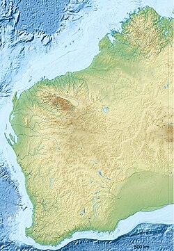
Beelu National Park Western Australia | |
---|---|
Nearest town or city | Mundaring |
Coordinates | 31°57′16″S116°08′59″E / 31.95444°S 116.14972°E Coordinates: 31°57′16″S116°08′59″E / 31.95444°S 116.14972°E |
Established | 1995 |
Area | 46.17 km2 (17.8 sq mi) [1] |
Managing authorities | Department of Environment and Conservation |
Website | Beelu National Park |
See also | List of protected areas of Western Australia |
Beelu National Park is a national park east of Perth, Western Australia. Lying south of Mundaring, Western Australia, and west of the Mundaring Weir Road, it is part of the group of parks known as the Parks of the Darling Range. The park was formerly named Mundaring National Park.
Mundaring National Park was established and gazetted in 1995 as part of the Protecting Our Old Growth Forests policy of the State Government. [2] The park was renamed in 2008 as an acknowledgement of the traditional owners of the area. The word Beelu is derived from the Noongar word for river or stream. The Beelu were the original people of the area, whose district was bounded by the Helena, Swan and Canning Rivers. [3]
The park contains an abundance of native flora including jarrah, marri, Zamia, bull Banksia, sheoak and grass tree.
The park contains toilets, wood barbecues, picnic tables and a variety of hiking and mountain biking trails. An information centre, the Perth Hills National Parks Centre, is located within the park. A lookout is located South Ledge with a view over Mundaring Weir and Lake CY O'Connor. The largest oak tree in Western Australia is found in Fred Jacoby Park. Two campsites are available for use within the park.
The Swan River is a river in the south west of Western Australia. The river runs through the metropolitan area of Perth, Western Australia's capital and largest city.
Gooseberry Hill National Park is a national park in Western Australia, in the locality of Gooseberry Hill, 21 km east of Perth. It is at the southern side of the mouth of the Helena Valley on the Darling Scarp. Statham's Quarry is located within the park boundary.
Greenmount National Park is a national park in the locality of Greenmount, Western Australia, 22 km east of Perth.
John Forrest National Park is a national park in the Darling Scarp, 24 km (15 mi) east of Perth, Western Australia. Proclaimed as a national park in November 1900, it was the first national park in Western Australia and the second in Australia after Royal National Park.
Kalamunda National Park is a national park in Western Australia, 23 kilometres (14 mi) east of Perth, near the town of Kalamunda.
The Mundy Regional Park is a regional park located on the western edge of the Darling Scarp, approximately 22 kilometres (14 mi) east of Perth in Western Australia. The 56-hectare (140-acre) park has commanding views of the Swan Coastal Plain, the city of Perth and surrounding suburbs. The park is managed by the Department of Biodiversity, Conservation and Attractions.
Walyunga National Park is a national park in Western Australia, 35 km northeast of Perth along the Great Northern Highway.
The Darling Scarp, also referred to as the Darling Range or Darling Ranges, is a low escarpment running north–south to the east of the Swan Coastal Plain and Perth, Western Australia. The escarpment extends generally north of Bindoon, to the south of Pemberton. The adjacent Darling Plateau goes easterly to include Mount Bakewell near York and Mount Saddleback near Boddington. It was named after the Governor of New South Wales, Lieutenant-General Ralph Darling.
Kalamunda is a town and eastern suburb of Perth, Western Australia, located in the Darling Scarp at the eastern limits of the Perth metropolitan area.
Greenmount is a locality and a geographical feature in the Shire of Mundaring, Western Australia, on the edge of the Darling Scarp. It is a vital point in the transport routes from the Swan Coastal Plain into the hinterland of Western Australia.
The Helena River is a tributary of the Swan River in Western Australia. The river rises in country east of Mount Dale and flows north-west to Mundaring Weir, where it is dammed. It then flows west until it reaches the Darling Scarp.
The Railway Reserves Heritage Trail – also on some maps as Rail Reserve Heritage Trail or Rail Reserves Historical Trail, and frequently referred to locally as the Bridle Trail or Bridle Track – is within the Shire of Mundaring in Western Australia.
The Mundaring Branch Railway is a historical section of the original Eastern Railway main line across the Darling Scarp in the Western Australian Government Railways (WAGR) system.
Mundaring Weir is a dam located 39 kilometres (24 mi) from Perth, Western Australia in the Darling Scarp. The dam and reservoir form the boundary between the suburbs of Reservoir and Sawyers Valley. The dam impounds the Helena River.
Helena Valley is the name of a river valley and a locality in the foothills of the Darling Scarp in Perth, Western Australia.
Perth Hills is a term used primarily for marketing purposes to identify the part of the Darling Scarp and hinterland east of the scarp that lies within the Shire of Mundaring, City of Swan, and the City of Kalamunda and as part of the constituent bodies belonging to the Eastern Metropolitan Regional Council of Perth, Western Australia.
The Shire of Mundaring is a local government area in eastern metropolitan Perth, the capital of Western Australia. The Shire covers an area of 645 square kilometres (249 sq mi) and had a population of approximately 38,000 as at the 2016 Census.
Mundaring Weir Road is a road in the outer eastern suburbs of Perth, Western Australia that links Mundaring and Kalamunda.
Tourism in Perth, the capital city of Western Australia, is an important part of the Australian state's economy, contributing to the prosperity of businesses in the city, as well as other regions of the state.